Arts (125)
    Asian & African (8)
    Books (560)
    Boxes & Tea Caddies (85)
    Clocks (36)
    Decorative (398)
    Dolls & Bears (122)
    Figurines (530)
    Furniture (24)
    Glass (1736)
  ...
View All


Search our
Dealer/Mall
Stores!


Poodle, Spaghetti Trim, Ucagco


Collector Books

The Journal of Antiques and Collectibles


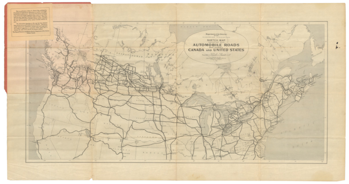
1925 Map of Automobile Routes between the U.S. and Canada, Early Highways For Sale


1925 Map of Automobile Routes between the U.S. and Canada, Early Highways
When you click on links to various merchants on this site and make a purchase, this can result in this site earning a commission. Affiliate programs and affiliations include, but are not limited to, the eBay Partner Network.


Buy Now

1925 Map of Automobile Routes between the U.S. and Canada, Early Highways:
$250.00

94.5 x 49 cm (37 x 19 in.)
Sketch map indicating main automobile roads between Canada and United States.
This 1925 map showcases the main automobile roads connecting Canada and the United States, indicative of the era’s burgeoning car culture and the development of international road infrastructure. The map features a network of lines representing the major routes used by motorists, with thicker lines indicating primary roads and thinner lines secondary routes.
The map extends across the breadth of both countries, displaying roads that traverse diverse landscapes—from the populated corridors along the coasts to the less dense interior regions. Cities and towns along these routes are marked, providing motorists with essential waypoints during their travels.
Given its time, the map captures a moment just before the widespread construction of the U.S. interstate highway system, which would begin a few decades later. The map serves an important role in promoting automobile travel and tourism between the two nations, encouraging cross-border exploration and cultural exchange.

Buy Now


Related Items:

1925 Map of Automobile Routes between the U.S. and Canada, Early Highways picture

1925 Map of Automobile Routes between the U.S. and Canada, Early Highways

$250.00


Vintage Antique 1925 Standard Oil Ohio Road Map Gas Stations Polarine Motor Oil picture

Vintage Antique 1925 Standard Oil Ohio Road Map Gas Stations Polarine Motor Oil

$43.95


ANTIQUE MARYLAND, DELAWARE AND DISTRICT OF COLUMBIA MAP 1925 National Geographic picture

ANTIQUE MARYLAND, DELAWARE AND DISTRICT OF COLUMBIA MAP 1925 National Geographic

$5.95


  Shopping Cart 
(Your shopping cart is empty)
Subtotal: $0.00
View Cart | Checkout


  Recently Viewed

1.  Lacquered Cedar Wood Box
2.  The White Horse Established 1742 Sign Signed
3.  Pewter Framed Tile, Plate. Ship, Sailing


  Latest Items

1.  Basket, Handpainted,
2.  Apricot Wildflower Pattern Bell
3.  Jade, Jadeite Glass Bell, Westmoreland
4.  Green Glass Strawberry Ptn. Bell
5.  Aladdin Lamp, Rose and White Moonstone


  Facebook


Secure Websites

Online Payments


| Search Items | Member Profile | My Favorites | Auto Notify | FAQ | Links | Sitemap |
Terms of Use | Privacy Policy | Tell Your Friends | Newsletters/Articles/Press Releases |


Antiques, collectibles, estate items, reproductions & art from dealers & collectors world wide at JosephMarc.
Copyright © 2004-2011 JosephMarc, Inc. All rights reserved.