When you click on links to various merchants on this site and make a purchase, this can result in this site earning a commission. Affiliate programs and affiliations include, but are not limited to, the eBay Partner Network.
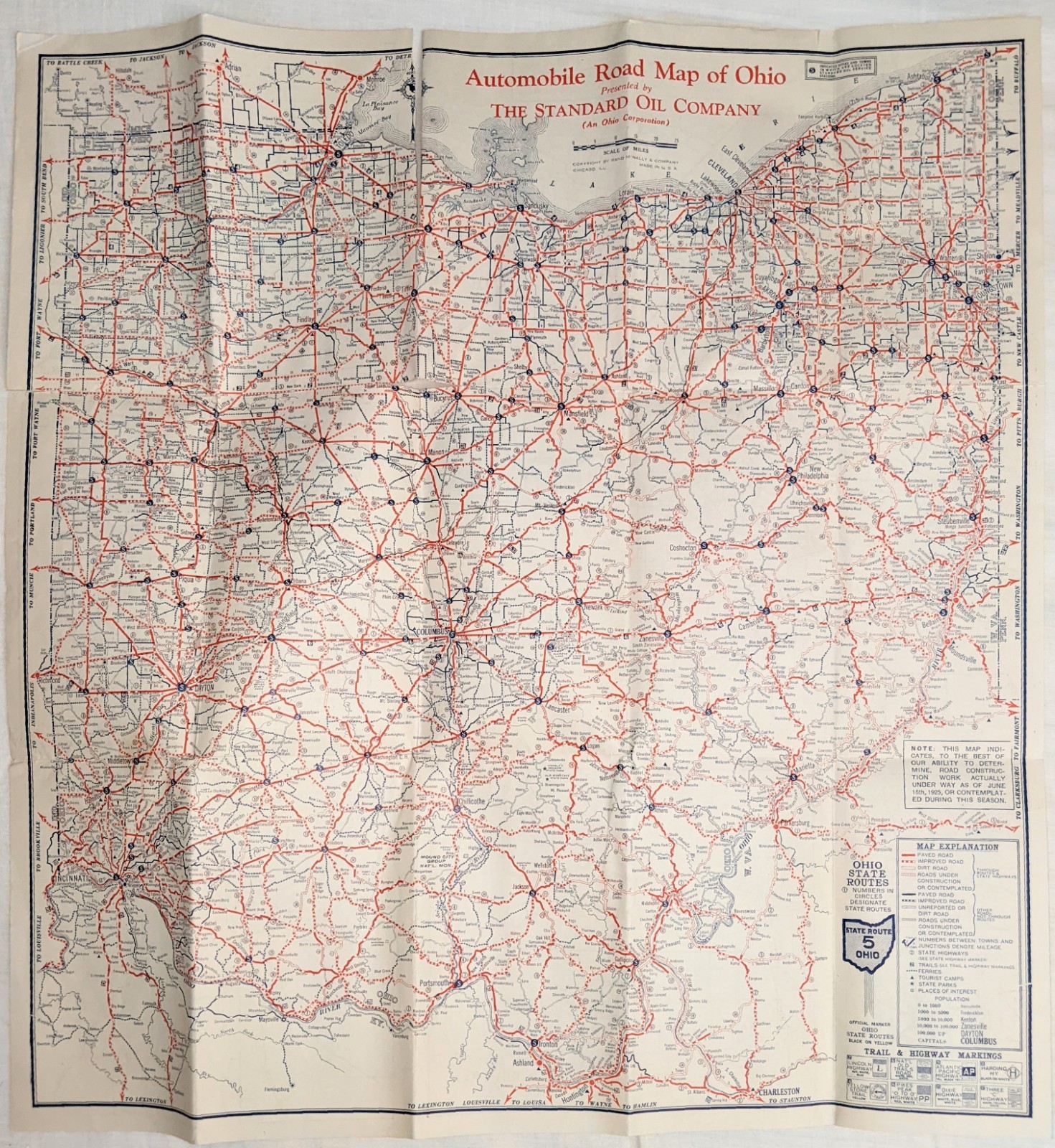
Original 1925 Automobile Road Map of Ohio presented by The Standard Oil Company, an Ohio corporation, and produced by Rand McNally. Large folding statewide map with detailed city maps for Cleveland, Cincinnati, Columbus, Toledo, Dayton, Akron, Canton, Youngstown, Springfield, and other areas. Red squares identify Standard Oil service-station locations. Also includes Polarine Motor Oils advertising, Red Crown gasoline imagery, tourist camps, state parks, road classifications, and construction information dated June 15, 1925.
Used antique condition with age toning, original fold creases, handling wear, scattered spotting, minor edge and corner wear, small tears, localized fold weakness, and a period handwritten “1925 Ohio Map” notation. Appears complete and opens fully. Please review all photographs carefully. Original period item, not a reproduction.
This large folding map documents Ohio’s road system during the early automobile-travel era. The statewide map identifies paved, improved, graded, and dirt roads; state routes; tourist camps; state parks; places of interest; and historic trail and highway markings.
A printed notice states that road-construction information was current to the best of the publisher’s ability as of June 15, 1925.
The reverse contains detailed street and route maps for major Ohio cities. Red squares identify Standard Oil service-station locations, giving the map particular appeal to collectors of gas-station and petroleum advertising.
Period advertising includes Polarine Motor Oils, Red Crown gasoline imagery, a Standard Oil filling station, and early automobile illustrations.
Featured city maps
- Cleveland
- Cincinnati
- Columbus
- Toledo
- Dayton
- Akron
- Canton
- Youngstown
- Springfield
- Additional regional route information
Map features
- Original 1925 Standard Oil promotional road map
- Large statewide automobile highway map
- Standard Oil service stations marked by red squares
- Road-construction information dated June 15, 1925
- Ohio state-route numbers
- Paved, improved, graded, and dirt-road classifications
- Tourist camps and state parks
- Places of interest
- Historic trail and highway markers
- Polarine Motor Oils advertising
- Red Crown gasoline graphics
- Standard Oil filling-station artwork
- Rand McNally cartography and printing
- Original period issue, not a reproduction
Issued before the nationwide U.S. numbered-highway system was fully established, this map preserves an especially interesting transitional moment in American road and automobile history.
It should appeal to collectors of:
- Standard Oil and SOHIO memorabilia
- Gasoline and motor-oil advertising
- Antique road maps
- Service-station ephemera
- Ohio history
- Automobilia
- Early automobile travel
- Rand McNally maps
Publisher information
Presented by: The Standard Oil Company, an Ohio corporation
Cartography and printing: Rand McNally & Company
Year: 1925
Road information current through: June 15, 1925
Condition
The map appears complete and opens fully. It shows expected evidence of approximately a century of use and storage, including:
- General age toning
- Original fold creases
- Fold and handling wear
- Scattered spots and discoloration
- Minor edge and corner wear
- Small tears and nicks
- Localized weakness or separation at some fold intersections
- Period handwritten “1925 Ohio Map” notation on the cover panel
The red-and-blue printing remains strong, and the Standard Oil, Red Crown, and Polarine advertising graphics display attractively.
Please examine all photographs carefully. The photos are part of the description and show the exact map included.