When you click on links to various merchants on this site and make a purchase, this can result in this site earning a commission. Affiliate programs and affiliations include, but are not limited to, the eBay Partner Network.
"An Authentic Original Map Not A Reproduction"
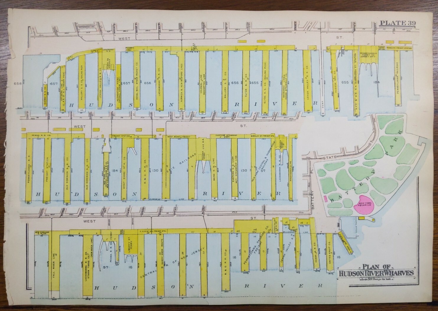
Offered for your consideration is a beautiful antique original map showing the Hudson River wharves and a portion of the Battery Park of Manhattan New York City NY. This map is bounded by Battery Park to the south and on the reverse is a map showing the East River wharves as shown in the last two pictures. This 16 1/2" x 11 1/2" map printed on heavy paper is in GOOD condition with light tone, soil, and edge wear, from the Atlas of New York City, Borough of Manhattan ©1916 by G.W. Bromley.
FREE SHIPPING: Your map will be shipped in a plastic sleeve and waterproof tube with USPS tracking.
Please view our happy customer response and buy with complete confidence.
Please view the other 1,000 plus maps for sale in our store.
We sell antique and vintage original maps only, no reproductions.
Thank you
*There are numerous companies out there selling modern reprints of this map. Don't be fooled by their use of the word "old".THIS IS AN AUTHENTIC, ORIGINAL, ANTIQUE MAP!