

|
Site Categories |
|
Featured Items |

Poodle, Spaghetti Trim, Ucagco


|
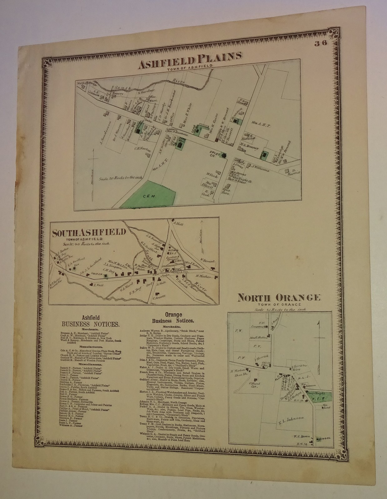
1871 map of Ashfield and Orange MA taken from F.W. Beers & Co Franklin Co. Atlas For Sale

When you click on links to various merchants on this site and make a purchase, this can result in this site earning a commission. Affiliate programs and affiliations include, but are not limited to, the eBay Partner Network.

1871 map of Ashfield and Orange MA taken from F.W. Beers & Co Franklin Co. Atlas:
$27.00
This is a page from the 1871 Atlas of Franklin County, Massachusetts, published by F.W. Beers & Co. It features detailed cadastral maps of villages within the towns of Ashfield and Orange. Includes Ashfield Plains (Town of Ashfield): The largest map at the top, showing the village center, including the \"Epis. Ch.\" (Episcopal Church), a cemetery, and various residences labeled with owners\' names. South Ashfield (Town of Ashfield): Located in the middle-left, showing the layout of that specific village. North Orange (Town of Orange): Located in the bottom-right corner. 12.75 x 15.5\" ... may be slightly rolled for shipping ... Code JSB 334
|
|
Related Items:
1871 Hand Colored Map Of The State Of Maine 16x25 $23.00
1871 map Whately, Massachusetts taken from Franklin Co. Atlas $27.00
1871 map of Ashfield and Orange MA taken from F.W. Beers & Co Franklin Co. Atlas $27.00
|
|
|
Shopping Cart  |

|
Recently Viewed |
|
Latest Items |
|
Facebook |
Secure Websites

|
