

|
Site Categories |
|
Featured Items |

Poodle, Spaghetti Trim, Ucagco


|
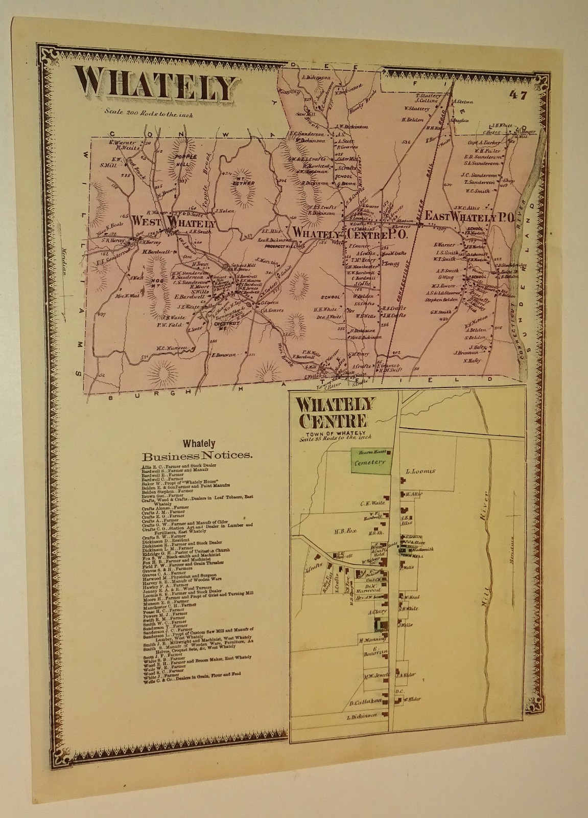
1871 map Whately, Massachusetts taken from Franklin Co. Atlas For Sale

When you click on links to various merchants on this site and make a purchase, this can result in this site earning a commission. Affiliate programs and affiliations include, but are not limited to, the eBay Partner Network.

1871 map Whately, Massachusetts taken from Franklin Co. Atlas:
$27.00
This is a page from the 1871 Atlas of Franklin County, Massachusetts, published by F.W. Beers & Co. ... Depicts the entire township of Whately, illustrating geographic boundaries, topography (such as Popple Hill and Mt. Esther), and roadways. It functions as a cadastral map, explicitly identifying specific properties by their landowners' last names. The Inset at Bottom focusing specifically on Whately Centre, providing an expanded look at the town center's grid, the local cemetery, the Mill River, and individual households. A Business Directory text block on the bottom left lists Whately Business Notices, which serves as a historical census of the town's prominent merchants, farmers, and tradesmen during the post-Civil War era... about 12 x 15.25" ... may be slightly rolled for shipping ... Code JSB 334
|
|
Related Items:
1871 Hand Colored Map Of The State Of Maine 16x25 $23.00
1871 map Whately, Massachusetts taken from Franklin Co. Atlas $27.00
1871 map of Ashfield and Orange MA taken from F.W. Beers & Co Franklin Co. Atlas $27.00
|
|
|
Shopping Cart  |

|
Recently Viewed |
|
Latest Items |
|
Facebook |
Secure Websites

|
