When you click on links to various merchants on this site and make a purchase, this can result in this site earning a commission. Affiliate programs and affiliations include, but are not limited to, the eBay Partner Network.
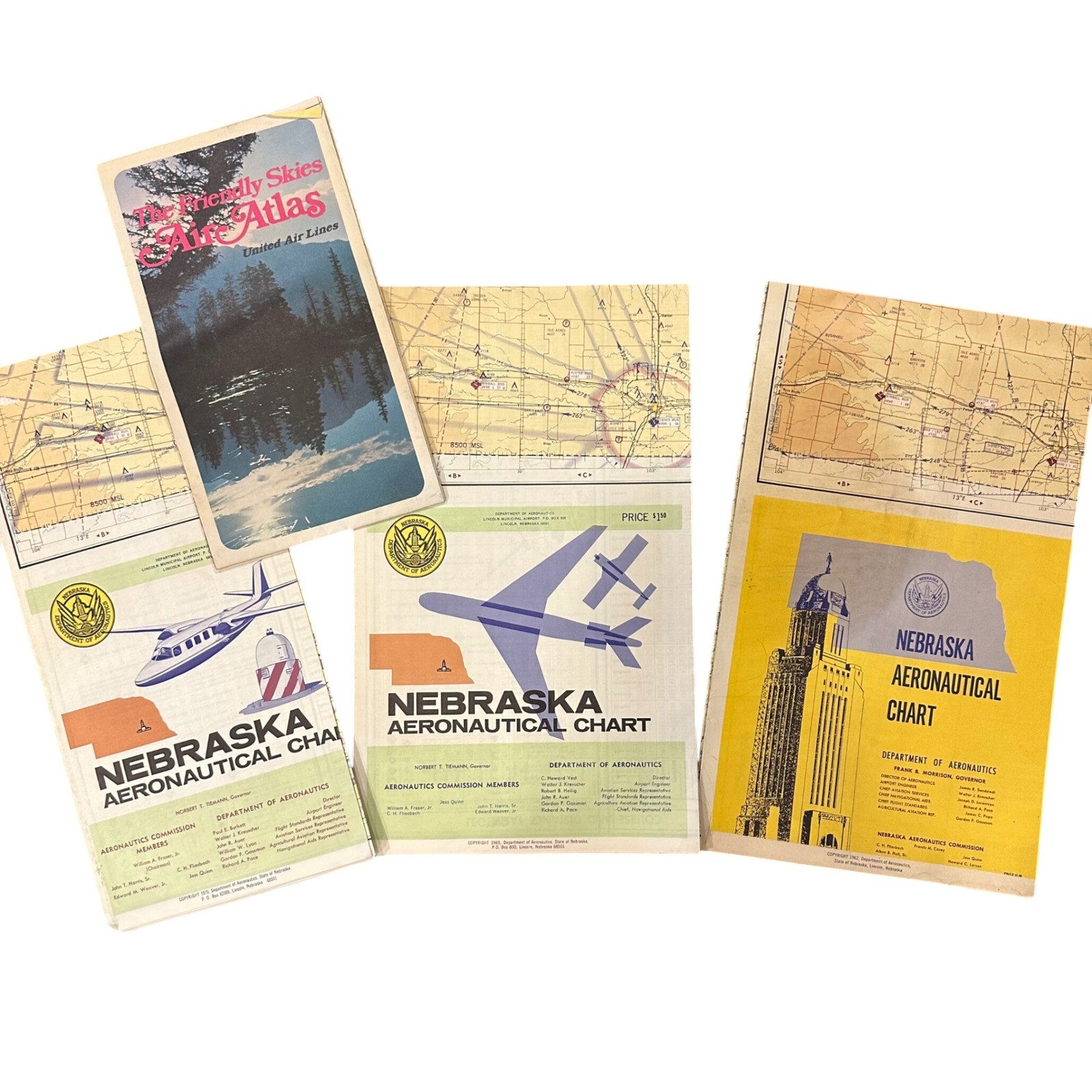
Vintage collection of aviation maps and charts includes three Nebraska Aeronautical Charts dated 1962, 1969, and 1970, alongside a 1974 United Air Lines "The Friendly Skies Air Atlas." These fold-out documents offer a detailed historical perspective on mid-century flight paths, regional topography, and airport data for the Nebraska area and broader domestic routes. The charts feature intricate topographical details, radio facility data, and airport directories characteristic of the era's navigational tools. This set is in good vintage condition with expected wear from use and storage.
Type: Aviation Charts & Atlas
State: Nebraska
Years: 1962, 1969, 1970, 1974
Publisher: Nebraska Department of Aeronautics / United Air Lines
Material: Paper
Theme: Aviation History
Features: Fold-out maps, Topographical data, Airport directories
Origin: USA
Quantity: 4 Pieces
Subject: Air Navigation
Keywords: Vintage Aviation, Nebraska History, Pilot Memorabilia, Mid Century Modern, Flight Navigation, Antique Maps, United Airlines, Ephemera, Aeronautical Chart, 1960s, 1970s, Air Travel Decor, Cartography
Thanks for looking.