When you click on links to various merchants on this site and make a purchase, this can result in this site earning a commission. Affiliate programs and affiliations include, but are not limited to, the eBay Partner Network.
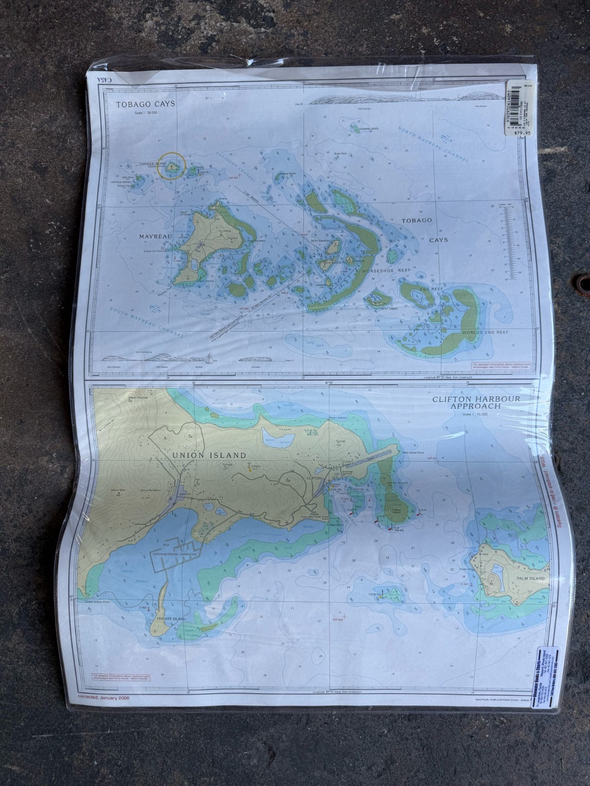
Up for sale is an authentic set of Caribbean Yachting Charts (CYC) published by Nautical Publications GmbH (Arnis, Germany).
Publisher: Nautical Publications GmbHSeries: Caribbean Yachting ChartsDatum & Systems: WGS 84 Datum | Maritime Buoyage System B | Soundings in Metres (LAT)ISBN-13: 978-3-932414-05-3 | Barcode: 9783932414053Retail Distribution Label: Bluewater Books & Charts (Ft. Lauderdale, FL)Packaging: Protected inside a durable clear vinyl marine chart sleeve
Charts Included:1. Chart C13 - Tortola to Virgin Gorda (Scale 1:60,000) - Coverage: British Virgin Islands (BVI) including Road Town, Tortola, Sir Francis Drake Channel, Virgin Gorda, Guana Island, Beef Island, Peter Island, and Salt Island. - Edition/Correction: Corrected to January 2006.
2. Chart C45A - Tobago Cays & Clifton Harbour Approach (Scale 1:15,000 Inset) - Coverage: The Grenadines (St. Vincent and the Grenadines) covering Mayreau, Tobago Cays Marine Park, Horseshoe Reef, Worlds End Reef, Union Island, Ashton Harbour, and Palm Island. - Cross-referenced with Chris Doyle\'s authoritative Sailors Guides. - Edition/Correction: Corrected to January 2006.
Condition Details (Please review all photos):- Very Good pre-owned condition.- Stored safely inside a clear vinyl protective sleeve.- Paper is clean and bright with crisp sounding depths, contour lines, and waypoint markings.- Chart C13 features a small, faint navigator pencil waypoint note (\"Rock hole wpb\" with an X) near Peter Island.- No rips, water staining, or missing edges.
Shipping & Packaging:- Packaged securely between rigid cardboard stiffeners inside a weatherproof mailer to ensure the maps and vinyl sleeve arrive flat and uncreased.- Prompt dispatch with online tracking uploaded directly to .(43)