

|
Site Categories |
|
Featured Items |

Poodle, Spaghetti Trim, Ucagco


|
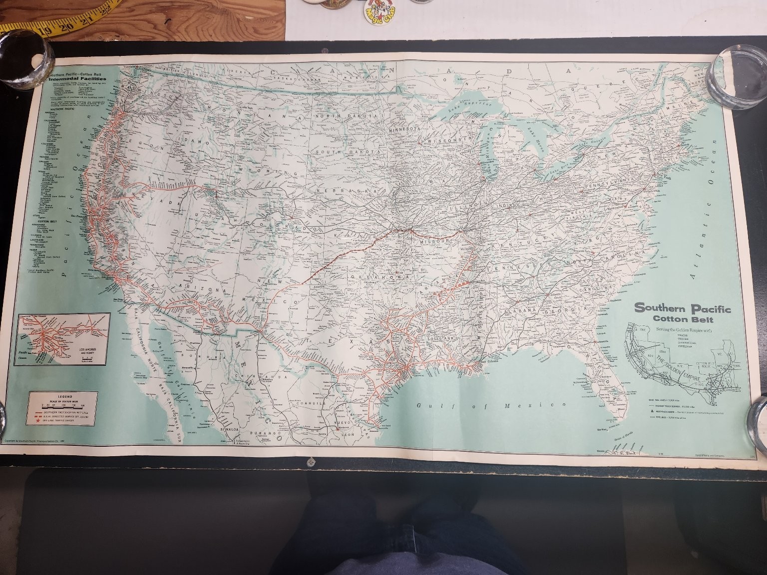
1980 Southern Pacific Cotton Belt Railroad Map Rand McNally USA Intermodal Map For Sale

When you click on links to various merchants on this site and make a purchase, this can result in this site earning a commission. Affiliate programs and affiliations include, but are not limited to, the eBay Partner Network.

1980 Southern Pacific Cotton Belt Railroad Map Rand McNally USA Intermodal Map:
$29.75
Explore the extensive network of the Southern Pacific Cotton Belt with this detailed 1980 railroad map. This vintage piece of ephemera, produced by Rand McNally and Company, showcases the comprehensive intermodal facilities and routes across the United States, highlighting key rail lines, highway truck service, piggyback ramps, and pipelines. The map provides a fascinating glimpse into the logistics and transportation infrastructure of a bygone era, illustrating the reach of "The Golden Empire" served by these iconic railroads.This collectible map features an inset detailing the Los Angeles and Vicinity area, along with a legend clarifying the various transportation lines. It is a unique historical document for collectors of railroad memorabilia, vintage maps, or those interested in American transportation history. The map's large format allows for a clear view of the intricate details, making it an excellent display piece or research tool for understanding the vast operations of the Southern Pacific and Cotton Belt railway systems.
|
|
Related Items:
1980 Southern Methodist University Yearbook Rotunda Dallas Texas SMU $77.11
1980 Southern Pacific Cotton Belt Railroad Map Rand McNally USA Intermodal Map $29.75

vintage 1980 Southern Bell Telephone Communications Employee Award Patch $19.98
|
|
|
Shopping Cart  |

|
Recently Viewed |
|
Latest Items |
|
Facebook |
Secure Websites

|
