When you click on links to various merchants on this site and make a purchase, this can result in this site earning a commission. Affiliate programs and affiliations include, but are not limited to, the eBay Partner Network.
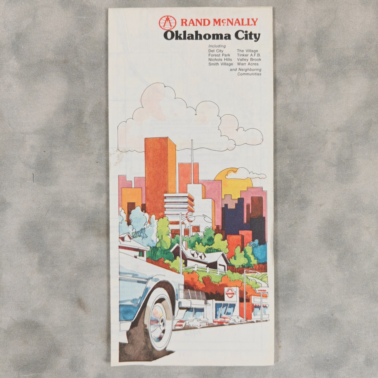
The detailed map shows Oklahoma City streets, highways, Route 66-era transportation routes, parks, neighborhoods, landmarks, and surrounding communities, making it a great piece of Oklahoma history as well as a practical reference for seeing how the metropolitan area developed.
Period attractions listed include the Myriad, National Cowboy Hall of Fame and Western Heritage Center, Oklahoma City Zoo, State Capitol, Oklahoma Art Center, Frontier City, and National Softball Hall of Fame.
The map displays beautifully with its distinctive vintage Rand McNally artwork and would make an excellent addition to an Oklahoma City, Route 66, travel ephemera, automobilia, or vintage map collection.
Item Specifics
- 🗺️ Type: Folding Street / Road Map
- 🏙️ City: Oklahoma City
- 📍 State: Oklahoma
- 📅 Year: Circa 1978
- 🏭 Publisher: Rand McNally & Co.
- 🇺🇸 Country/Region: United States
- 🛣️ Theme: Roads, Highways, Route 66, Travel
- 📏 Scale: 1 inch approximately 0.84 mile
- 📄 Material: Printed Paper
- 🎨 Format: Full-color fold-out map with illustrated cover
- 🏘️ Coverage: Oklahoma City and neighboring communities
- ✈️ Included Area: Tinker A.F.B.
- 🧭 Features: Streets, highways, parks, landmarks and points of interest
- 📚 Collectible Interest: Oklahoma History, Cartography, Travel Ephemera, Route 66
- ✅ Completeness: Appears complete and intact from supplied photographs
- 🕰️ Vintage: Yes
- 🏷️ Original/Reproduction: Original period map
Condition
Good vintage condition with normal fold creases and light age/handling wear. Map graphics remain bright and readable with no obvious major tears or missing sections visible in the photographs.
Additional Details
The photographed item is the actual vintage map being offered. Please review the images closely for fold lines, edge wear, toning, and other normal signs of age associated with vintage paper maps.
Seller’s Note: Please review all photos carefully as they are considered part of the condition description. Vintage and pre-owned items may show age-related wear, storage marks, creasing, toning, or other minor imperfections. Only the item or items shown in the photographs are included.
Keywords
1978 Rand McNally Oklahoma City map, vintage Oklahoma map, Oklahoma City street map, OKC map, Route 66 map, vintage road map, folding travel map, Oklahoma ephemera, historic Oklahoma City, Rand McNally map, vintage cartography, Oklahoma collectible, Route 66 memorabilia, Oklahoma travel, Tinker AFB map, vintage city map