1970 Map WEST INDIES Cuba Jamaica Bermuda Aruba Bahamas Central America Trinidad For Sale


When you click on links to various merchants on this site and make a purchase, this can result in this site earning a commission. Affiliate programs and affiliations include, but are not limited to, the eBay Partner Network.

1970 Map WEST INDIES Cuba Jamaica Bermuda Aruba Bahamas Central America Trinidad:
$6.99
Handsomelarge-format richly-detailed fold-out map of the West Indies andCentral America. - This map opens up to agenerous 67 x 96.5 cm [26¼\" x 38\"] and isdrawn on a scale of 1:4,815,360, or 76 miles to the inch.
- The coverage area includes Anguilla, Antiqua & Barbuda. Aruba,Bahamas, Barbados, Bermuda, British Virgin Islands, Cayman Islands,Cuba, Dominica, Dominican Republic, Grenada, Guadeloupe, Haiti,Jamaica, Martinque, Montserrat, Netherlands Antilles, Puerto Rico,Saint Kitts-Nevis, Saint Lucia, Saint Vincent & the Grenadines,Trinidad & Tobago, Turks & Caicos Islands, U.S. VirginIslands, Guatemala, Honduras, Nicaragua, Costa Rica, El Salvador, andPanama.
- Numerous insets provide detail of individual islands andcities.
- In addition to the geographical data there are dozens of historicalannotations on events of note, from the discoveries of early explorersto splashdown sites of Gemini, Apollo, and Frienship spacecraft in theU.S. manned space program.
- Condition: This map is in very good condition,bright and clean, with no marks, rips, or tears. Itis blank on the back, with no printing on the reverse side. Please seethe scansand feel free to askany questions.
- It was published by the National Geographic Society, Washington, D.C.,as a supplement to the January 1970 issue of NationalGeographic Magazine.
- It is an original National Geographic Society map, nota reproduction or modern reprint.
- Buy with confidence! We are always happy to combine shipping on thepurchase of multiple items — just make sure to pay for everythingat one time, not individually.
Powered by SixBit\'s eCommerce Solution
|
|
Related Items: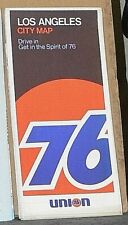
1970 Union 76 Street Map of Los Angeles, California "NEW OLD STOCK" $2.99
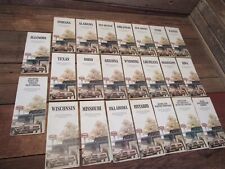
Vintage LOT 1970's Road Maps TEXACO Gas Oil Station Indiana Ohio & Others $89.99
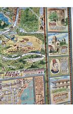
1970 Dick Bibler Pictorial Historical Map Of The Monterey Peninsula Vintage $475.00
|


