When you click on links to various merchants on this site and make a purchase, this can result in this site earning a commission. Affiliate programs and affiliations include, but are not limited to, the eBay Partner Network.
Antique 1911 Nebraska Railroad Pocket Map – Rand McNally & Co.
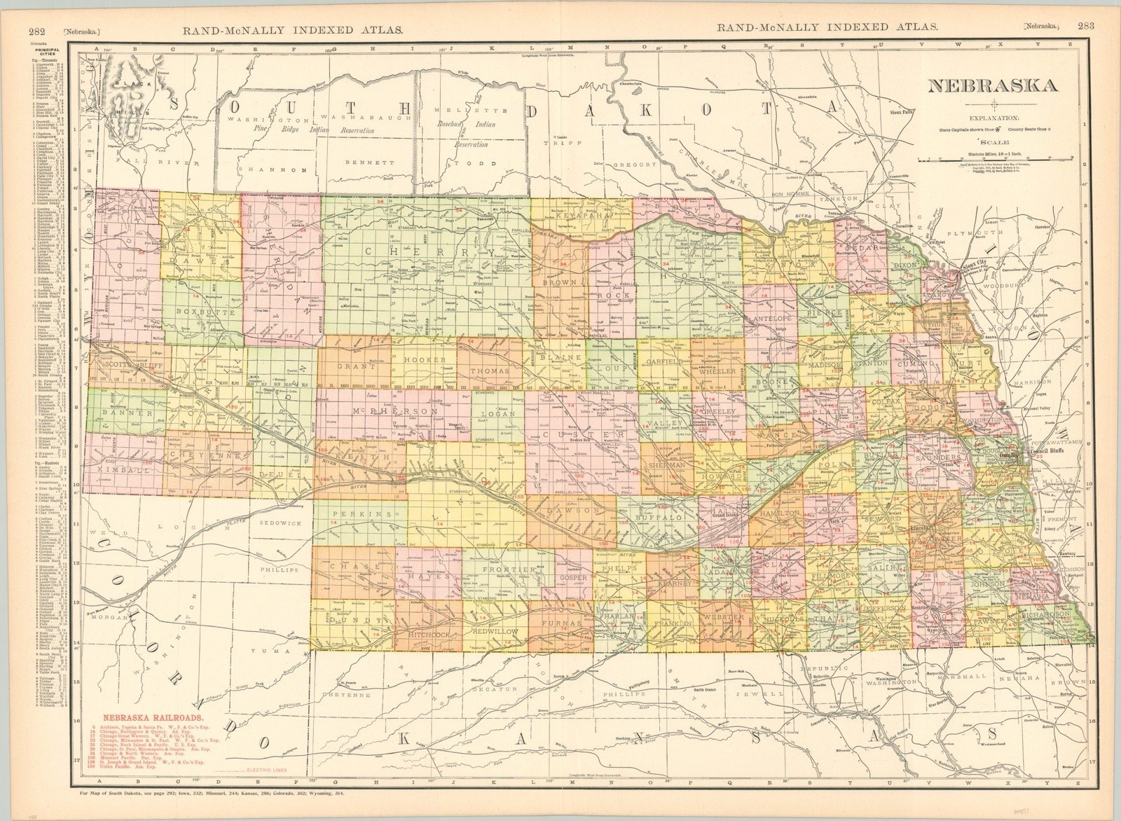
Offered here is an original 1911 fold-out map of Nebraska, published by Rand McNally & Co., showing detailed railroad lines, county boundaries, and principal cities with populations from the early 20th century.
This is a genuine antique, not a reproduction — perfect for collectors of railroadiana, cartography, or Nebraska state history.
2nd to last photo is a stock image to show map details
• Publisher: Rand McNally & Co., Chicago
• Year: 1911 (dated)
• Map Size: Approx. 21” x 26” unfolded
• Printing: Lithographed color on lightweight paper
Features:
• Detailed railway and electric lines
• All counties labeled and color-coded
• City population index at margins
• Folds into pocket size
Condition:
• Fair to good condition for age
• Tears along fold lines, some beginning to separate
• Staining and toning, especially on the reverse side
• Edges have small splits and minor corner loss
Map remains complete, colorful, and highly legible
This is being sold as is and as photographed.
😻😻
Your purchase helps me continue to fund my artistic work as a photographer in Hollywood California. It also helps me to feed my increasingly finicky cat who now only wants the most expensive cat food
😻😻