

|
Site Categories |
|
Featured Items |

Poodle, Spaghetti Trim, Ucagco


|
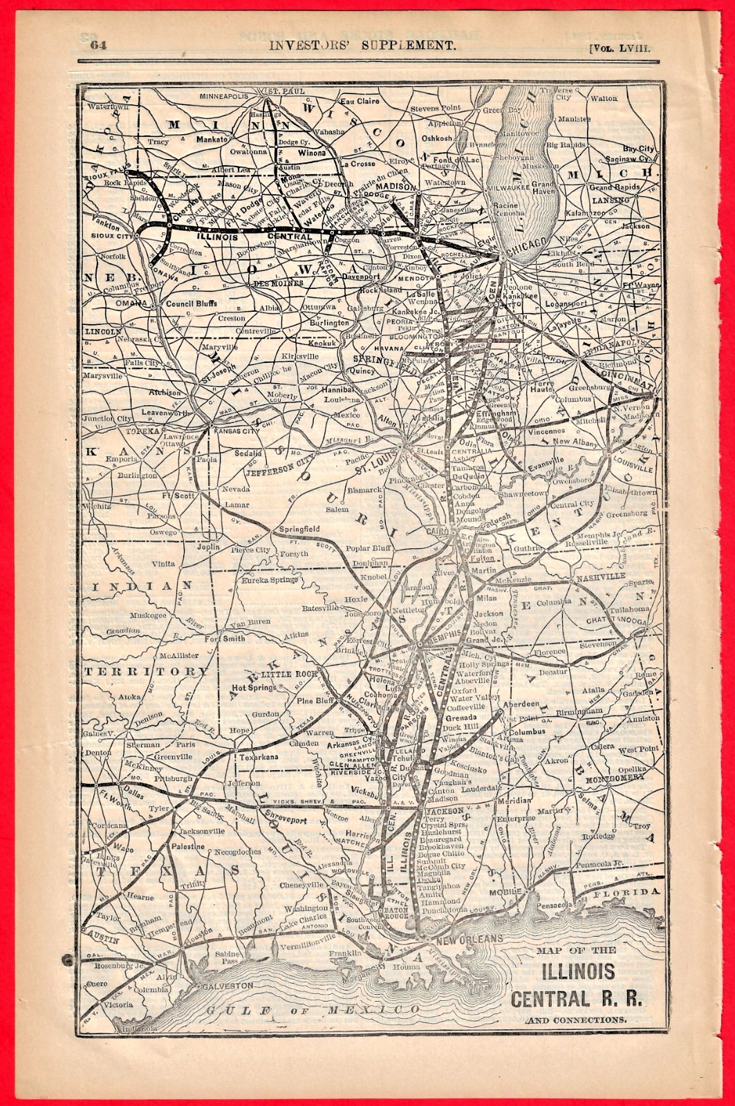
1894 ILLINOIS CENTRAL RAILROAD MAP For Sale

When you click on links to various merchants on this site and make a purchase, this can result in this site earning a commission. Affiliate programs and affiliations include, but are not limited to, the eBay Partner Network.

1894 ILLINOIS CENTRAL RAILROAD MAP:
$24.95
Original 1894 Illinois Central Railroad System Map. Originally published by William B. Dana & Co. for the "Investors' Supplement" of the "Commercial and Financial Chronicle." This is a genuine 19th-century lithographed R.R. map; not a modern reproduction. Perfect for framing. Measures 8 x 12-1/2 inches; very nice frameable condition. It is January, 1894 on reverse side. These maps were specifically designed for Wall Street investors, bankers, and bondholders to track the expanding infrastructure, main trunk lines, and leased properties of the Illinois Central during the Gilded Age. It beautifully details the expansive north-south network connecting Chicago and the Great Lakes all the way down to New Orleans and the Gulf of Mexico, including vital Midwestern and Southern branch lines. 440 Our 27th year on
|
|
Related Items:
1894 ILLINOIS CENTRAL RAILROAD MAP $24.95
1894 Illinois YMCA 22nd Convention Program Springfield Christian Young Men Assoc $39.77
1894 Chicago Varnish Co Receipt Chicago Illinois Arthur B Brooks Ithaca NY $24.97
|
|
|
Shopping Cart  |

|
Recently Viewed |
|
Latest Items |
|
Facebook |
Secure Websites

|
