When you click on links to various merchants on this site and make a purchase, this can result in this site earning a commission. Affiliate programs and affiliations include, but are not limited to, the eBay Partner Network.
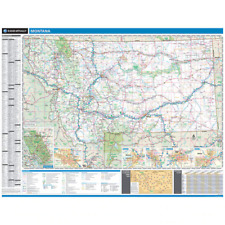
PROSERIES WALL MAP: SOUTH CAROLINA STATE (R)
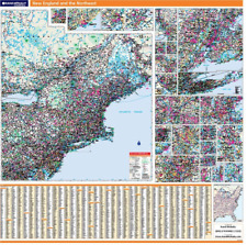
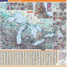
DESCRIPTIONRand McNally\'s regional wall map of South Carolina is ideal for anyone needing a comprehensive representation of the area for planning, routing, or reference. It\'s a great choice for business and sales strategy, urban development, social work outreach, education, and marketing. South Carolina residents, businesses, and government offices are sure to find this wonderful reference tool irreplaceable.Note: This map is not available for gift wrapping. Please allow 7-10 days for shipping. Copyright 2012.
Laminated wall map printed with UV-resistant ink to help prevent color fadingMap details include state highways, federal highways, county highways, county boundaries, city shading, cities and towns, major waterways, state/national parks, campsites, exit numbers, rest areas, military installations, airports, golf courses, universities, and moreIncludes a hanging kit with rails for easy mountingCOVERAGE AREAInset maps include: Aiken; Augusta, GA; Charleston; Charlotte, NC; Columbia; Greenville; Hilton Head Island; Myrtle Beach & the Grand Strand; Rock Hill; Savanah, GA; and Spartanburg.
PRODUCT DETAILSDimensions: 46\" x 60\"Scale: 1\" = approximately 6.4 miles


")