When you click on links to various merchants on this site and make a purchase, this can result in this site earning a commission. Affiliate programs and affiliations include, but are not limited to, the eBay Partner Network.
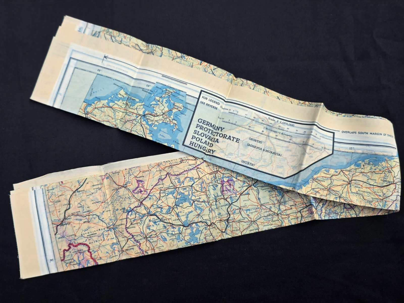
World War II Era Silk 2 Sided Escape & Evasion Map 43/E & F. Sheets E & F.
Sheet E shows escape routes through Germany, Protectorate, Slovakia, Poland, and Hungary. Sheet F Croatia (west & Central), Montenegri (west), Hungary (west), Slovakia (south), Germany (south), Italy (north & central, Switzerland (east). These where used by the British Royal Air Force and U.S. Air Forces to help downed pilots or escaped prisoners of war navigate behind enemy lines.
It measures 34" wide by 30" tall.
Condition: I marked as used but the map shows no signs of use, mint condition!