When you click on links to various merchants on this site and make a purchase, this can result in this site earning a commission. Affiliate programs and affiliations include, but are not limited to, the eBay Partner Network.
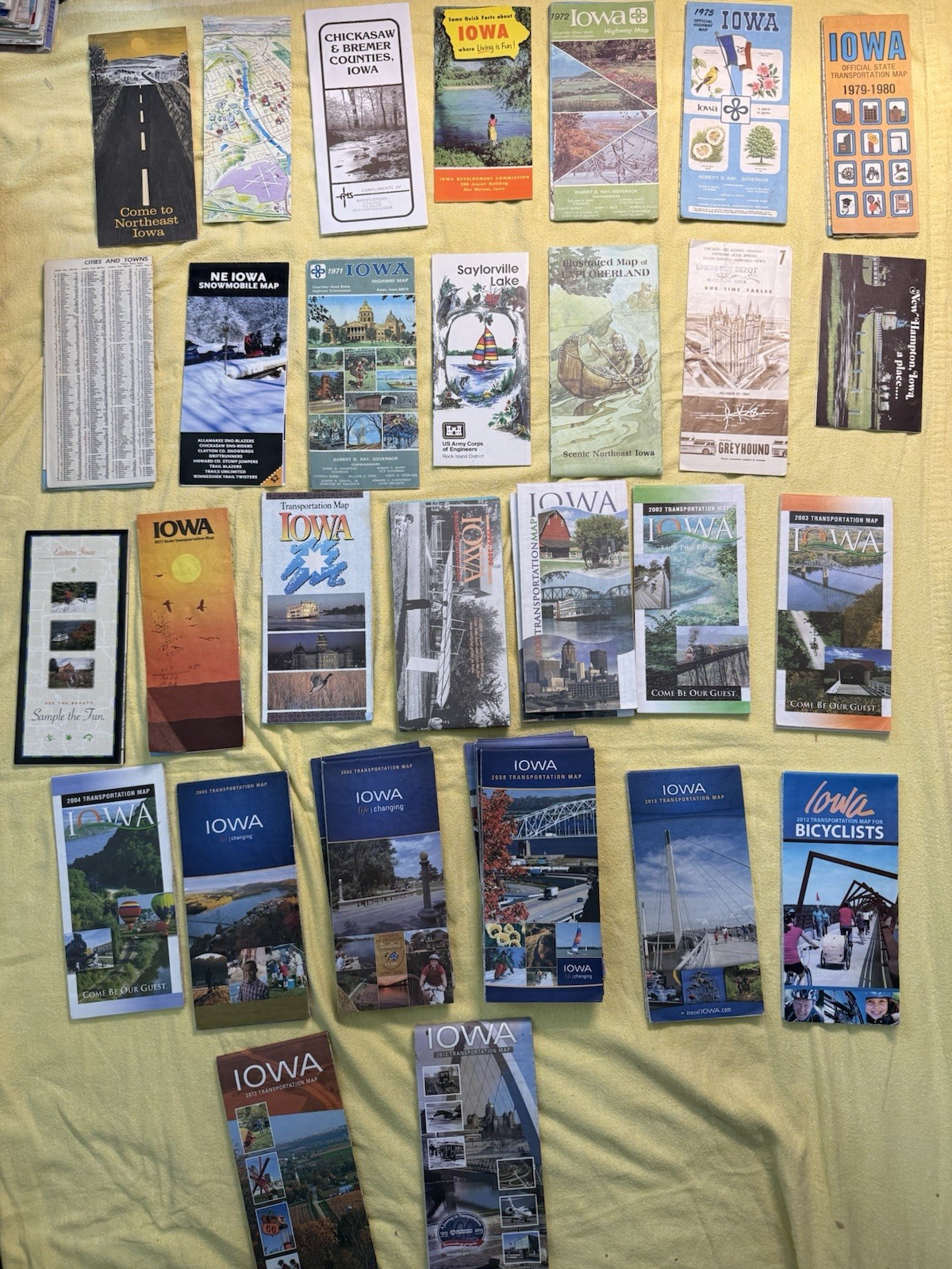
For sale is a large collection of approximately 35 Iowa maps and tourist brochures, mostly official state highway/transportation maps plus regional scenic guides.
Highlights include:
• Vintage 1970s: 1971, 1972, 1975 Iowa Highway Maps (Governor Robert D. Ray era), NE Iowa Snowmobile Map, Chickasaw & Bremer Counties, Saylorville Lake, Explorerland illustrated map, and more.
• 1977-1980s: 1977 Transportation Map, 1979-1980 Official State Transportation Map.
• 2000s-2010s: Multiple Transportation Maps (2002 Large Print, 2003, 2004, 2005, 2006, 2008, 2010, 2012, 2013), Iowa for Bicyclists map, Eastern Iowa, and others.
• Regional items: Northeast Iowa, “Come to Northeast Iowa,” Greyhound bus schedules, state symbols (bird/flower) brochure, and more.
These are great for Iowa history/road trip collectors, ephemera enthusiasts, or anyone interested in vintage travel memorabilia and Midwest tourism. Many feature beautiful period photography of Iowa landscapes, state parks, rivers, and attractions.
Condition: Good to very good overall for their age — some light wear, creases, or storage marks typical of folded maps/brochures (see photos). Most are complete and intact. No major tears or missing pages noted.
Lot of 35+ pieces — perfect for resale, display, or research. Great value for a comprehensive Iowa map collection spanning 40+ years!