When you click on links to various merchants on this site and make a purchase, this can result in this site earning a commission. Affiliate programs and affiliations include, but are not limited to, the eBay Partner Network.
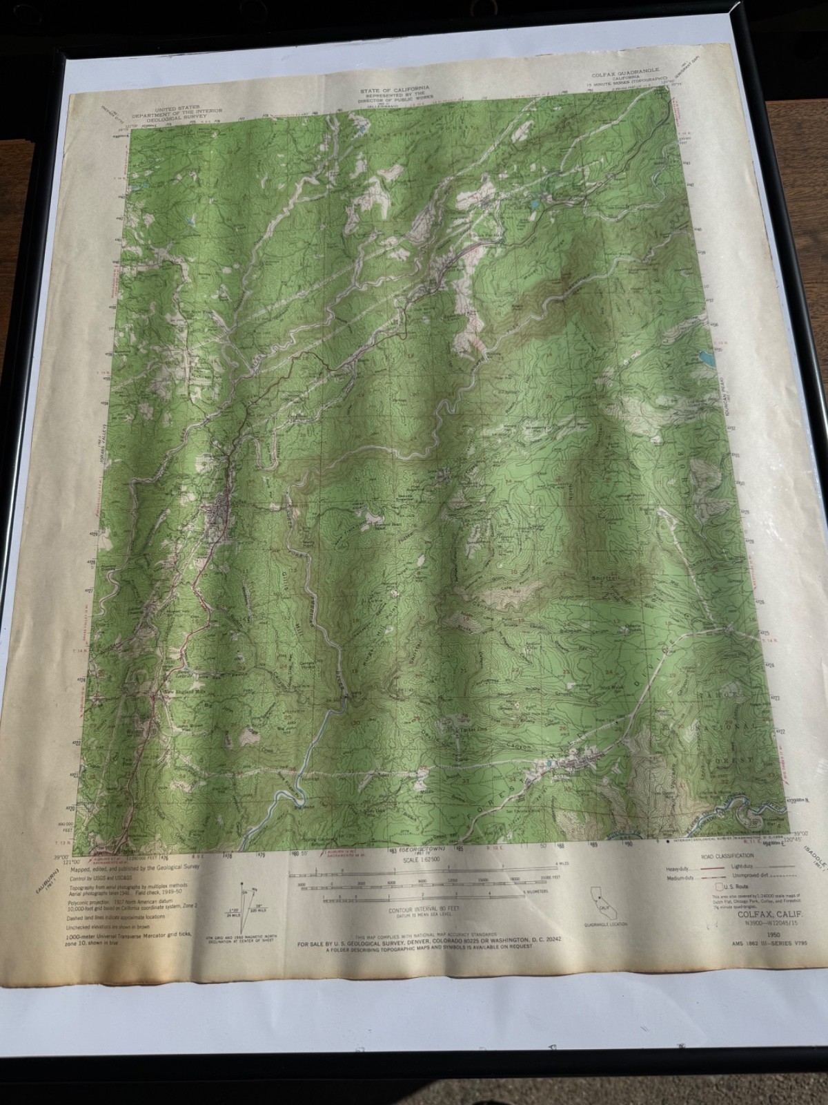
Vintage 1966 USGS Colfax CA Gold Country 1950 15-Min Topographic Map.
Condition:
Original vintage USGS map in good displayable condition. Age toning, surface waviness, vertical creasing, edge wear, scattered marks, and small margin tears are present. Colors and printed details remain clear. Please review all photographs.
Description:
Original vintage United States Geological Survey map covering historic California Gold Country in Placer and El Dorado counties.
This is the 1950 Colfax Quadrangle edition with a 1966 USGS printing code along the lower margin. It is an authentic period government-issued map—not a modern decorative reproduction.
Coverage includes Colfax, Dutch Flat, Iowa Hill, Foresthill, the American River, Tahoe National Forest, portions of El Dorado National Forest, historic mining areas, railroad corridors, mountain roads, trails, waterways, and former settlements.
Produced from 1946 aerial photography with field checks completed during 1949–1950. It preserves the area’s mid-century landscape before later highway construction and modern development.
Although not printed during the 1800s Gold Rush, the map documents the historic mining communities, river canyons, transportation routes, and rugged terrain at the center of California Gold Country.
Map Details:
- Scale: 1:62,500
- Series: 15-Minute Topographic
- Edition date: 1950
- Printing code: 1966
- Contour interval: 80 feet
- Publisher: United States Geological Survey
Frame:
This listing is for the unframed map. The black frame shown is for presentation and is not included. A separately priced framed listing can be created upon request.
Buyer Protection:
The buyer will receive the exact vintage map photographed. It will be carefully protected, securely packed, photographed before shipment, and shipped with tracking. Any insured shipping claim requires retention of the item and all original packaging.
California Proposition 65:
WARNING: Vintage inks, paper treatments, adhesives, and framing materials may contain chemicals known to the State of California to cause cancer, birth defects, or other reproductive harm. Sold as a collectible display item.
Keywords:
Colfax California map, California Gold Country, vintage USGS map, 1950 topographic map, 1966 USGS printing, Placer County, El Dorado County, Dutch Flat, Iowa Hill, Foresthill, American River, Tahoe National Forest, mining history, railroad history, historic California map, 15-minute quadrangle