When you click on links to various merchants on this site and make a purchase, this can result in this site earning a commission. Affiliate programs and affiliations include, but are not limited to, the eBay Partner Network.
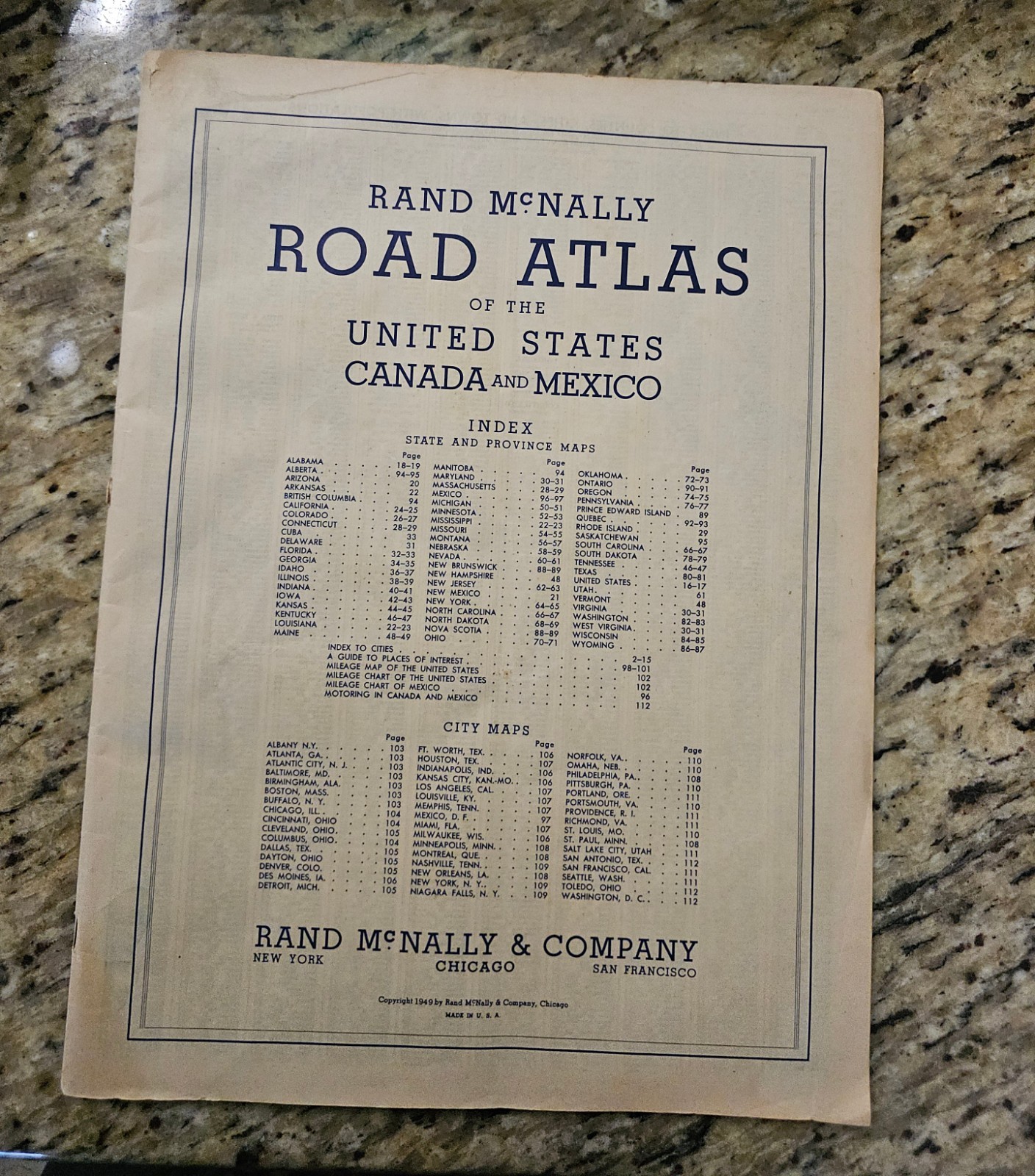
Vintage 1949 Rand McNally Road Atlas (United States, Canada, and Mexico)
Item Details & Condition: This is an authentic, original 1949 printing of the classic Rand McNally Road Atlas. *
CRITICAL CONDITION NOTE: This atlas is MISSING ITS ORIGINAL OUTER COVER. The binding starts directly at the internal title/index page as shown in the photos. *
Interior Pages: The internal pages, map sheets, and indexes remain entirely intact, legible, and firmly attached via the original staples. Expect standard vintage paper aging, light toning/browning at the edges, and minor creasing from historical handling, but no heavy moisture destruction or missing map chunks.
Featured Maps: Includes all standard state-by-state road maps, Canadian provinces, Mexican regions, and a specialized vintage "City Maps" index page (featuring historical layouts of Washington D.C., San Antonio, Toledo, and others) as well as post-WWII motoring advice for international travel.
Why Buy This Copy?
Despite lacking its cardstock cover, this piece is an excellent, budget-friendly resource for historical research, ancestry projects, route charting, or for repurposing/crafting. Many collectors and artisans specifically use coverless atlases to carefully extract individual state maps for custom framing, upcycled art, scrapbooking, or decorative gifts. Please review all provided close-up photos carefully to assess the precise edge condition, staple integrity, and page layout before purchasing. Sold as-is.
Shipping & Handling:
Ships flat and secure in a protective sleeve with rigid backing cardboard to prevent any bending or folding during transit.