When you click on links to various merchants on this site and make a purchase, this can result in this site earning a commission. Affiliate programs and affiliations include, but are not limited to, the eBay Partner Network.
## Item Overview
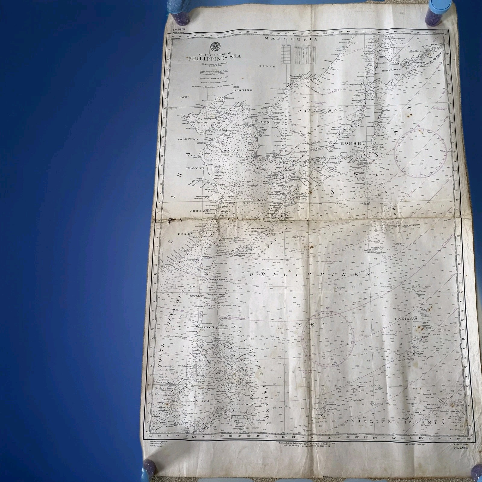
Up for sale is an authentic, original World War II maritime navigational chart issued by the United States Navy Hydrographic Office in December 1944. Chart No. 5805 provides exceptionally detailed hydrographic coverage of the North Pacific Ocean, specifically detailing the high-stakes theater of the Philippines Sea and the Japanese Mainland (Honshu).
This is a genuine vintage military artifact from the height of the Pacific War—not a modern reproduction.
## Historical Significance
Dated 1944, this map serves as an active historical record of the maritime landscape during crucial naval campaigns. It features extensive depth soundings (measured in fathoms) alongside period-accurate geographic nomenclature used by the Allied forces, including "Chosen" (Korea), "Hwang Hai" (Yellow Sea), and "Tong Hai" (East China Sea).
## Item Condition & Features
* **Publisher:** U.S. Navy Department Hydrographic Office (Washington, D.C.)
* **Chart Number:** 5805
* **Edition Date:** Dec 1944 (First Edition)
* **Condition:** Good/Fair Vintage Condition. The map displays authentic signs of age and service, including handling creases, original fold lines, and light surface staining/foxing consistent with military paper artifacts of this era. Edges are fully intact with no major material loss. Please review the high-resolution photos carefully to assess condition details.