When you click on links to various merchants on this site and make a purchase, this can result in this site earning a commission. Affiliate programs and affiliations include, but are not limited to, the eBay Partner Network.
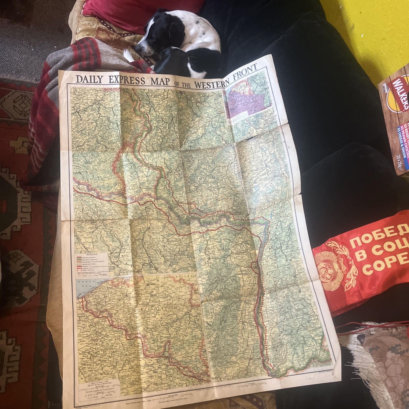
Rare Original 1939 Daily Express Western Front Military Map Maginot Siegfried Line WWII
Description:
Original vintage Daily Express Map of the Western Front, printed in Great Britain by George Philip & Son Ltd, London.
A fascinating historical military map dating from the early Second World War period, circa 1939–1940.
The large, detailed, full-colour folding map shows the Western Front across France, Belgium, Luxembourg, Germany and surrounding regions.
Features:
* Original British Daily Express publication.
* Publisher: George Philip & Son Ltd, London.
* Period: Early WWII, circa 1939–1940.
* Detailed Western Front military geography.
* French Maginot Line and German Siegfried Line.
* Approximate positions of military defences.
* National borders and neutral territories.
* German Reichsautobahnen, including proposed routes.
* Railways, roads, canals, towns and forests.
* Detailed inset maps and distance scales.
* Original colour printing.
Historical Background:
The Maginot Line was a major French defensive fortification system constructed during the interwar period to protect France against German invasion.
The Siegfried Line, also known as the Westwall, was Germany’s defensive fortification system along its western frontier.
This map illustrates the strategic geography of Western Europe during the tense opening period of the Second World War, when these defensive systems played an important role in military planning.
Condition:
Original vintage condition with visible age-related wear, discolouration, staining and fold creases.
Some wear and small areas of damage along the folds and edges.
The map has been folded and stored for many years.
Please carefully examine all photographs as they form an important part of the description.
An interesting and increasingly difficult-to-find piece of British wartime cartography, ideal for WWII collectors, military historians, map collectors or historical display.
Combined Postage:
I am happy to combine postage for multiple purchases. Please contact me before payment or request a combined invoice. Any excess postage paid will be refunded where possible.
Suggested Price: £39.99