When you click on links to various merchants on this site and make a purchase, this can result in this site earning a commission. Affiliate programs and affiliations include, but are not limited to, the eBay Partner Network.
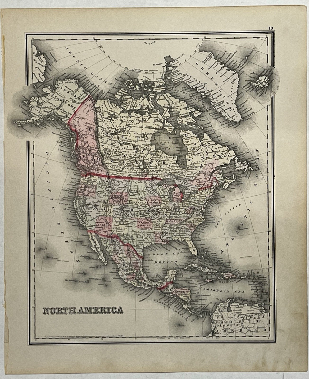
Original an 1855 Colton Map of North America showing :United States, Canada (British Possession), Mexico, Greenland, Iceland and the Caribean islands. It shows Canada as British Possessions with Canadian Confederation occurring in 1867.
Shows Oklahoma as Indian Territory.
This is. 2 Sided map with the backside showing statistics from 1880 such as: population and growth
Details:
- Printing Lithograph with hand coloring
- Condition Excellent with no major rips or tears
- Size 14” x 17”
The map is an original and not a repro.
It’s will be shipped flat to prevent creasing due to rolling.