When you click on links to various merchants on this site and make a purchase, this can result in this site earning a commission. Affiliate programs and affiliations include, but are not limited to, the eBay Partner Network.
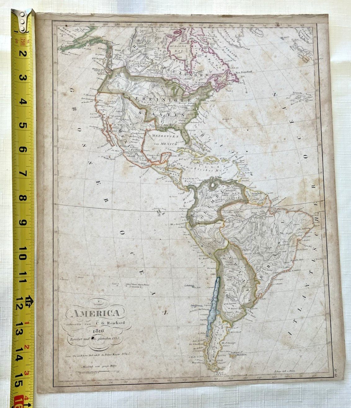
Original 1823 Printed Map of the American Continents as of 1816on Parchment Paper
In The German Language
Updated Printing Completed 1923
C.G. Reichard
Color Outlining of Boundaries
Includes Islands in the Caribbean Sea
15" x 12"
This is an antique detailed map not a reproduction.
Condition: Light Foxing on Front and Back.One Black Pen Mark on Signature Inset
Non-Smoking and Pet-Free Storage
Fast Careful Shipping from Santa Barbara, CA.JB-26-283xtopjb20