When you click on links to various merchants on this site and make a purchase, this can result in this site earning a commission. Affiliate programs and affiliations include, but are not limited to, the eBay Partner Network.
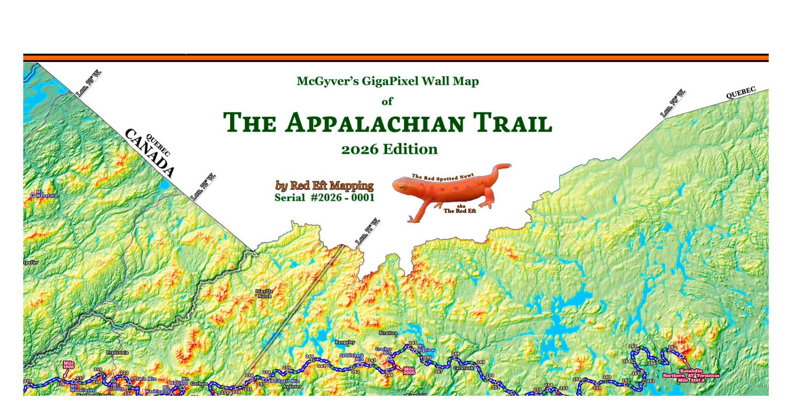
Note: This is the 2026 edition of this map. Read below to find other editions of this map.This gorgeous map from Red Eft Mapping is the largest and most detailed topographic map of the Appalachian Trail available. It is built to last a lifetime on professional canvas using archival pigmented inks. This is not a cheap paper map - you will likely hand this map down to the next generation.It is appropriate for those who dream of hiking the whole of the Appalachian Trail, have already done so, or desire a beautiful mural-sized map for a den, cabin, man-cave, or she-shed. It is also the perfect map of sufficient scale to track a loved one who is hiking the Trail, or for a large commercial space such as an outfitter, hotel, lodge, or trail hostel.This map was produced by an engineer, land surveyor, cartographer, and Appalachian Trail thru-hiker who meticulously crafted this map with heart over a two year period from scratch. It contains a complete elevation profile of the Trail, the location of all shelters, and hundreds of marked geographic locations, as well as selected "trail towns".This map is updated yearly with the latest trail mileage and re-routes, and has the current A.T. shelters in use for that year. This map is the 2026 year edition, showing the 2026 route and the official Appalachian Trail Conference 2026 mileage of 2197.9 miles.
The map is 10' wide (120") x 2' (24") tall, edge-to-edge. It was designed to be mounted horizontally so that its owner can walk its length at close-up eye level to see the incredible detail. No more stooping or standing on a ladder is necessary to view this map, unlike the ridiculous vertically-mounted Appalachian Trail maps. (The A.T. runs approximately southwest to northeast, not north to south, so a horizontal mount is just as appropriate as a vertical mount).The color scheme on this version of the map is a hypsometric background, meaning that the background terrain coloring varies with elevation. A more traditional version of the map with the states having different colors (and still showing incredible terrain detail with hill-shading) is available on another listing, item # 389644830366.
A 2025 edition of this map (same hypsometric coloring) is available on the listing #388951303850A 2025 edition of this map in "state colored" coloring is available on the listing #388951303849.
Each map is individually serial numbered for the owner. Designed and printed in the USA. Foreign content is limited to the greatest extent possible. Local is good.Shipping is free by UPS Ground, with tracking. You are going to love owning this map.