

|
Site Categories |
|
Featured Items |

Poodle, Spaghetti Trim, Ucagco


|
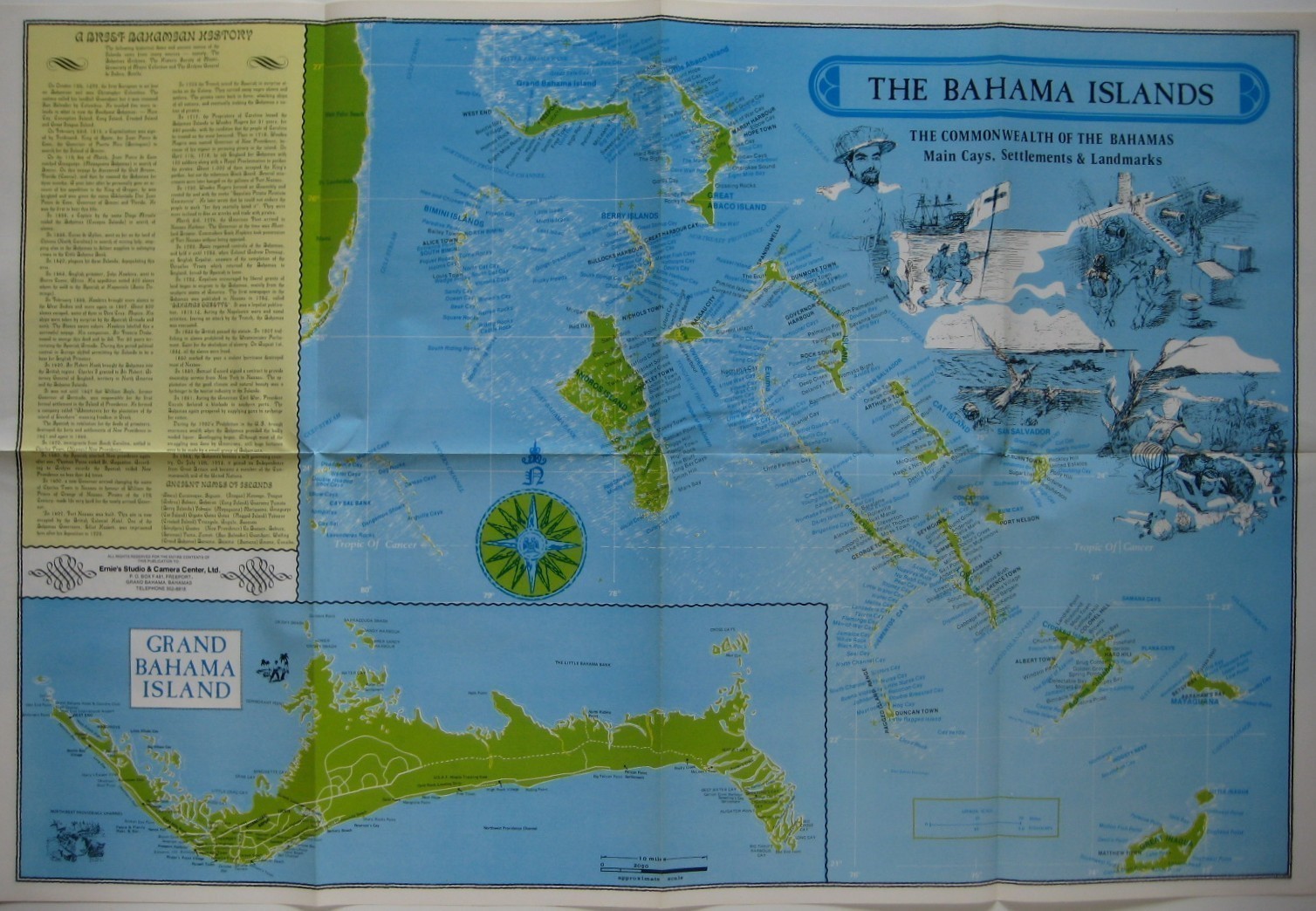
1988 Map BAHAMAS West Indies Freeport Lucaya Bimini Andros Fortune Beach Airport For Sale

When you click on links to various merchants on this site and make a purchase, this can result in this site earning a commission. Affiliate programs and affiliations include, but are not limited to, the eBay Partner Network.

1988 Map BAHAMAS West Indies Freeport Lucaya Bimini Andros Fortune Beach Airport:
$9.99
Colorful, large-format fold-out map of the Bahama Islands, printed in Freeport. - This map opens to a very generous 23\" x 35\" and is printed on two sides.
- One side depicts the main cays, settlements, and landmarks of the Bahamas, along with an inset of Grand Bahama Island and a capsule history of the islands\' colorful history.
- The other side is a detailed street plan of Freeport and Lucaya, on Grand Bahama Island, including a road and street index and key to advertisers.
- Among the named places and features are Fortune Beach, Garden of the Groves, Bahama Reef Yacht & Country Club, Bahamia, Queen\'s Highway, Hawksbill Creek, Cruise Ship Dock, Grand Lucayan Water Way, Xandu Beach, and the island\'s International Airport, one of the largest privately-owned airports in the world, with an 11,000-foot-long runway that accommodates international jet aircraft 24 hours daily.
- This map was published by Ernie\'s Studio & Camera Center, Ltd., Freeport, circa 1988.
- Condition: This map is in excellentcondition, bright and clean, with nomarks, rips, or tears, folded, as issued. Please see the scans and feel free to ask any questions.
- Buy with confidence! We are always happy to combineshipping on thepurchase of multiple items — just make sure to pay for everythingat one time, not individually.
Powered by SixBit\'s eCommerce Solution
|
|
Related Items:
MOUNT EVEREST MAP National Geographic November 1988 $1.95

Vintage 1988 Champion Map Corporation of united states 71 inches by 54 inches $44.00
THE WORLD HUGE MAP+ENDANGERED EARTH National Geographic Dec. 1988 HEAVY DURABLE $1.00
|
|
|
Shopping Cart  |

|
Recently Viewed |
|
Latest Items |
|
Facebook |
Secure Websites

|
