

|
Site Categories |
|
Featured Items |

Poodle, Spaghetti Trim, Ucagco


|
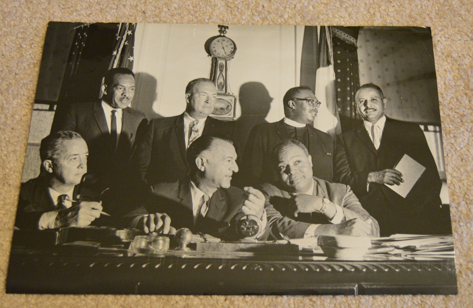
1964 Harlem Riots City Hall Meeting Photo James Farmer CORE NAACP Urban League For Sale

When you click on links to various merchants on this site and make a purchase, this can result in this site earning a commission. Affiliate programs and affiliations include, but are not limited to, the eBay Partner Network.

1964 Harlem Riots City Hall Meeting Photo James Farmer CORE NAACP Urban League:
$400.00
This powerful and historic 8 1/2 x 12 inch black and white photograph captures a pivotal moment in American civil rights history. Taken on July 21, 1964, it shows City Hall members and prominent civil rights leaders meeting in the cool of a conference room to discuss the escalating Harlem Riots. The image features key figures who played significant roles during this turbulent period. Standing (left to right): Alexander J. Allen: A representative of the Urban League, a historic civil rights organization dedicated to economic empowerment, equality, and social justice. The Urban League was instrumental in advocating for the rights of African Americans during the Civil Rights Movement. Police Commissioner Michael J. Murphy: As the head of the New York City Police Department during a time of intense social unrest, Commissioner Murphy faced the challenging task of maintaining order amidst the protests and riots. NAACP Vice President R.V. Eugens Callender: The NAACP (National Association for the Advancement of Colored People) was and remains a leading organization fighting for civil rights and racial justice. Its vice presidents like Callender were crucial in strategizing and leading the movement. CORE Attorney Percy Sutton: Percy Sutton was a prominent attorney, civil rights activist, and later a distinguished politician in New York City. He served as Manhattan Borough President and was a co-founder of the Inner City Broadcasting Corporation. CORE (Congress of Racial Equality) was a significant civil rights organization that played a key role in the Freedom Rides and other direct action protests against racial (left to right): (Unidentified individual) Deputy Mayor Edward F. Cavanagh Jr.: As Deputy Mayor of New York City, Cavanagh would have been directly involved in addressing the crisis and engaging with community leaders during the Harlem Riots. Paul Screvane: President of the New York City Council, Screvane was a prominent political figure in New York City during the 1960s. James Farmer, of CORE: A giant of the Civil Rights Movement, James Farmer was one of the \"Big Four\" civil rights leaders, alongside Martin Luther King Jr., Whitney M. Young Jr., and Roy Wilkins. He was a co-founder of CORE and a key organizer of the Freedom Rides, which challenged segregation on interstate busing in the South. Farmer advocated for nonviolent direct action to achieve racial of the 1964 Harlem Riots: The 1964 Harlem Riots erupted on July 18, 1964, following the fatal shooting of 15-year-old James Powell by a white New York City police lieutenant. The incident ignited long-simmering frustrations within the Black community over racial discrimination, police brutality, inadequate housing, and lack of economic opportunity. The riots lasted for several days, involving clashes between residents and police, looting, and property damage. These events highlighted the deep-seated racial tensions in Northern cities and became a significant moment in the broader Civil Rights Movement, demonstrating that racial injustice was not confined to the American South. The meeting captured in this photo represents an attempt by city officials and civil rights leaders to de-escalate the situation and address the underlying causes of the unrest. This photograph is a rare and compelling artifact, offering a direct glimpse into the efforts made to confront racial injustice during a tumultuous period in American history. It would be a significant addition to any collection of civil rights memorabilia, New York City history, or political history. Text on back of photo: \"In the cool of the conference rooms - At City Hall members of both races meet to discuss Harlem riots. discuss standing - left to right-Alexander J. Allen of the Urban League, Police Comn Michael J. Murphy, NAACP Vice Pres. R.V. Eugens Callender and CORE attorney Percy Sutton. sitting - left to right - [scratched out name] Dep. Mayor Edw. Cavanagh, Paul Screvane, and James Farmer, of CORE. JUL 21 1964\"
______________________The Harlem riot of 1964 occurred between July 16 and 22, 1964. It began after James Powell, a 15-year-old African American, was shot and killed by police Lieutenant Thomas Gilligan in front of Powell\'s friends and about a dozen other witnesses. Immediately after the shooting, about 300 students from Powell\'s school who were informed by the principal rallied. The shooting set off six consecutive nights of rioting that affected the New York City neighborhoods of Harlem and Bedford-Stuyvesant. In total, 4,000 New Yorkers participated in the riots which led to attacks on the New York City Police Department, vandalism, and looting in stores. Several protesters were severely beaten by NYPD officers. At the end of the conflict, reports counted one dead rioter, 118 injured, and 465 arrested.Contents1 Background2 Killing of James Powell2.1 Lieutenant Gilligan\'s version of the events2.2 Witnesses\' version of the events2.3 People2.3.1 Lieutenant Thomas Gilligan2.3.2 James Powell3 Rioting3.1 Day 1: Thursday, July 16, 19643.2 Day 2: Friday, July 17, 19643.3 Day 3: Saturday, July 18, through early morning Sunday, July 19, 19643.4 CORE rally3.5 Day 4: Sunday, July 19, through Monday, July 20, 19643.6 Day 5: Monday, July 20, through Tuesday Evening, July 213.7 Day 6: Tuesday night, July 21, through Wednesday, July 224 Aftermath4.1 Project Uplift (1965)5 See also6 References7 Bibliography8 Further reading9 External linksBackgroundIn the early 1900s appeared the first signs of resurgence in the north of Manhattan. After the construction of new subway routes that go as far as 145th street, speculators and real estate agencies took advantage of this opportunity and invested large sums of money in what is now called Harlem. Houses were bought and then sold over and over to a much higher price, upbringing the neighborhood for high-income households. By the year 1905, too many habitations had been constructed and many stayed uninhabited which led landlords to compete with each other lowering rents. To avoid the upcoming total financial destruction of the area, many housing buildings opened up to Black Americans.[citation needed] The next step to the creation of a black neighborhood was strengthened by the ever-increasing migration of blacks from southern states which resulted in the founding of the Afro-American Realty Company opening more and more homes for the black community. The \"Negro\" churches took over Harlem\'s development after the fall of the Afro-American Realty, being the most stable and prosperous black institutions of the now segregated area. They made their profit by selling properties at high price while relocating the neighborhood uptown. Consequently, the Church is the reason why Harlem was so prolific in the 20th century. In the early 1920s, many black American institution such as NAACP, Odd Fellows, and The United Order of True Reformers started moving their headquarters to Harlem which, with the continuous migration of blacks, received the name of \"Greater Harlem\".[1]
The cultural aspect of Harlem was predominated by jazz music and a very envious nightlife reserved for whites. Duke Ellington and Louis Armstrong were part of \"Greater Harlem\"[1] at the time. With its saturated concentration of Afro-American, public figures like Father Divine, Daddy Grace and Marcus Garvey started spreading their ideas of salvation for the negro community. After World War II, the rich portion of the \"Harlem Negroes\" moved to the suburbs. Tension within the neighborhood raised year after year between residents, welfare workers and policemen. In daylight, the neighborhood was quite charming, the architecture added a high-class cachet and children looked joyful playing in the streets. At night, it was quite the opposite. Homicides were six times more frequent than the average of New York City. Prostitution, junkies and muggers were part of Harlem\'s nightlife.[2][page needed]
Killing of James PowellThe events of the Harlem riot of 1964 were recorded in the writings of two newspaper reporters, Fred C. Shapiro and James W. Sullivan. They assembled testimonies from other reporters and from residents of each of the boroughs, and gave testimony of their presence at the riots.[3][page needed][4][page needed]
Consistently annoyed by the presence of young students on his stoops, Patrick Lynch, the superintendent of three apartment houses in Yorkville, at the time a predominately working-class white area on the Upper East Side of Manhattan, voluntarily hosed down the black students while insulting them according to them: “Dirty niggers, I\'ll wash you clean”;[5] this statement had been denied by Lynch. The angry wet black students started to pick up bottles and garbage-can lids and threw them at the superintendent. This immediately drew the attention of three Bronx boys, including James Powell. Lynch then retreated to the inside of the building pursued by Powell, who according to a witness, \"didn\'t stay two minutes.\"[6] As Powell exited the vestibule, off-duty police Lieutenant Thomas Gilligan, who witnessed the scene from a nearby shop, ran to the scene and shot at the 15-year-old James Powell three times. The first round, said to be the warning shot, hit the apartment\'s window. The next shot hit Powell in the right forearm reaching the main artery just above the heart. The bullet lodged in his lungs. Finally, the last one went through his abdomen and out his back. The autopsy concluded on the fatality of the chest wound in almost any circumstance. However, the pathologist said that Powell could have been saved suffering only the abdominal perforation with a fast response of the ambulance. The sequence of events is still unclear on many aspects such as the spacing of the shots and, crucially, Powell\'s possession of a knife.[3][page needed][4][page needed]
Lieutenant Gilligan\'s version of the eventsTo the sound of broken glass, Gilligan ran to the apartment building holding his badge and gun. He first yelled, \"I\'m a police lieutenant. Come out and drop it.\"[7] He then fired the warning shot as he saw Powell raising the knife. With his gun, Gilligan blocked Powell\'s second attack deflecting the knife to his arm. The apparent attack led Gilligan to fire a third round that killed the young Powell.[3][page needed][4][page needed]
Witnesses\' version of the eventsIn opposition, witnesses saw Powell ran into the building not carrying any knife. As he exited the vestibule, some said he was laughing until the lieutenant shot him. From the point of view of the French class which according to New York Times reporter, Theodore Jones, \"have had the best view of the ensuing tragedy\";[8] when Gilligan pulled his gun, the young Powell threw up his right arm, not holding a knife but as a defensive gesture.[3][page needed][4][page needed]
The most controversial episode remains the testimony of Cliff Harris, Powell\'s Bronx friend, interviewed the day following the death of James Powell. On that morning, they, James Powell, Cliff Harris and Carl Dudley, left the Bronx around 7:30 A.M. Powell carried two knives on that day which he gave to each of his friends to be held for him. On the scene he asked for the knives back. Upon Dudley\'s refusal he asked Cliff who asked him why he wanted it back? and then handed it over.[3][page needed][4][page needed]
The knife, which was not seen on the crime scene at the moment of the incident, was later found by a teacher, according to school principal Francke. The knife was situated in the gutter about eight feet from the body.[3][page needed][4][page needed]
PeopleLieutenant Thomas GilliganLieutenant Thomas Gilligan served seventeen years in the Police Department and had a few notable entries to his record. Before the Powell incident, he had shot two other men. One of those men was trying to push him off a roof and the other much younger was looting cars in front of his apartment. Citations in the New York Daily News reported that Gilligan had disarmed suspects in the past. In addition, he rescued women and children from a fire, stopped a man from a suicidal jump as well as used mouth-to-mouth resuscitation to revive a woman who had attempted suicide. Physically Gilligan was a man of six feet tall.[3][page needed][4][page needed]
James PowellJames Powell was a ninth grader in the Bronx attending summer school at the Robert F. Wagner, Sr., Junior High School on East 76th Street. After his father\'s death, neighbors said the young boy had become \"a little wild\".[9] He had four minor altercations with the law: twice attempted to board a subway or bus without paying, broke a car window and attempted robbery from which he was cleared. Physically he was five feet, six inches and weighed 122 pounds.[3][page needed][4][page needed]
RiotingDay 1: Thursday, July 16, 1964Day 1 of the riot had been contained by 75 police officers. Briefly, it happened right after the shooting of James Powell and the Police Department were securing the crime scene from approximately 300 people, the majority of whom were students. The confrontations between students and policemen foreshadowed on the next morning protest.[3][page needed][4][page needed]
Day 2: Friday, July 17, 1964On the morning after the shooting, the Congress of Racial Equality (CORE) showed up at the school nearby the scene. They demanded a civilian review board to discipline the police, but they were greeted by 50 officers holding nightsticks. 200 pickets, mainly whites and Puerto Ricans, were situated in front of the school by noon, chanting “Stop killer cops!”, “We want legal protection” and “End police brutality.”[3][page needed][4][page needed][10]
Day 3: Saturday, July 18, through early morning Sunday, July 19, 1964On July 18, the temperature went up to 92 °F (33 °C) in Central Park and much higher on the pavement. 250 persons attended James Powell\'s funeral under strict supervision of barricaded policemen. At the same time, another patrol was watching over a demonstration on the rising crime rate in Harlem. Both events ended peacefully with no incident. The CORE rally happened rather peacefully until the majority of the press corps had left. Paul L. Montgomery stayed behind; except for a UPI summer intern on his first field assignment, Montgomery worked alone for most of the evening and became the source of information for what is to follow. Reverend Nelson C. Dukes then called for action leading the march to the 28th precinct supported by Black Nationalist Edward Mills Davis and James Lawson. After meeting with Inspector Pendergast, the committee addressed the crowd, but it was already too late. The crowd began to throw bottles and debris at the police line. Soon the community took over rooftops and police shifted their goals to target those on the roofs. Easily accessible, rooftops were in bad shape and bricks, tiles and mortar were used as weapons. The policemen rapidly secured the rooftops arresting CORE members. A group of rioters threw bottles and one hit Michael Doris in the face; the first police officer to be injured during the Harlem riot of 1964. Subsequently, Inspector Pandergast instructed the force to clear the street after declaring that the crowd had become a disorderly gathering. By 10 P.M., a thousand people had assembled at the intersection of the Seventh Avenue and 125th Street. \"Go home, go home\"[11] shouted an officer in a way to disperse the crowd, but the crowd answered: \"We are home, Baby.\"[12]
The Tactical Patrol Force arrived on site and were attacked by bricks flying from rooftops. They started to break the crowd into smaller groups which created chaos. One group went down to 123rd Street and the aftermath could be seen the next morning by its destruction path. Around 10:30 P.M. (22:30 ET), a group of rioters stopped in front of the Theresa hotel where a Molotov cocktail was thrown on a police car injuring one officer. Police officers received permission to draw their firearms and fired into the air to occupy the Harlem area. Later TPF (Tactical Police Force) found one dead man due to the firing of a .38 caliber. It was after the first round had been fired that reporters were sent back to Harlem. Shortly after the force started firing, an ordnance truck from the Bronx was loaded with ammunition to support the officers. Many Harlemites, exiting the subway and bars, got caught up in the riot and later realized that they were being pursued by the police. The chaos finally ended at 8 o\'clock (08:00 ET) in the morning on Lenox Street, where what was left of the mobs had regrouped and then were dispersed by massive reinforcement. According to Inspector Pandergast\'s announcement, one rioter died, 12 policemen and 19 civilians were injured, and 30 were arrested. Over 22 stores had been looted. The report of Pandergast was hotly contested by the hospital that counted 7 gunshot wounds and 110 persons who considered their injuries worth intensive care.[3][page needed][4][page needed]
CORE rallyA scheduled rally organized by the Congress of Racial Equality (or CORE) in the afternoon of Saturday, July 18 changed its focus upon the arrival of Louis Smith, a CORE field secretary. The rally had for objective to clarify on the missing of three civil right workers in Mississippi, thus looked over the shooting of James Powell as well as pointed out police brutality as a constant threat upon the Black community. The gathering seemed to end quietly leaving \"the crowd excited, but not unruly.\"[13] After most of the reporters had left, Judith Howell, a young high-school student and a member of the Bronx chapter of CORE climbed on a chair and said: \"We got a civil rights bill and along with the bill we got Barry Goldwater and a dead black boy, This shooting of James Powell was murder!\"[14] After her speech the cry was for action and was followed by Reverend Nelson C. Dukes from the Fountain Springs Baptist Church who, after his 20 minutes long speech, led the crowd to the 28th precinct supported by Black Nationalist Edward Mills Davis and James Lawson. Upon arrival, the police department was in motion and Inspector Pandergast accommodated the committee formed by Dukes, Charles Russell (East River CORE), Charles Taylor and Newton Sewell (Black Nationalist). Their only demand was the suspension of Lieutenant Gilligan.[3][page needed][4][page needed]
Day 4: Sunday, July 19, through Monday, July 20, 1964Commissioner Murphy distributed a statement to every church in Harlem after the incident of Saturday night. He stated: “In our estimation, this is a crime problem and not a social problem!\"[15] Later that day, Malcolm X, Black Nationalist Leader answered, \"There are probably more armed Negroes in Harlem than in any other spot on earth\" - \"If the people who are armed get involved in this, you can bet they\'ll really have something on their hands.\"[16] The antagonism between the community and the New York Police Department heightened as taunted policemen as well as firemen who would later use hoses on protestors in broad daylight throughout Sunday.[3][page needed][4][page needed]
The NYPD conceded the ineffectiveness of tactical techniques, such as mounted police and tear gas, which were having no actual effect on the rooftop threat. James Farmer, national director of CORE, who attended the riot, confirmed the assumption of police brutality and testified to seeing bullet holes in windows and walls of the Theresa Hotel. He also claimed Inspector Pandergast was at the origin of the riot.[3][page needed][4][page needed]
Meanwhile, a meeting of the Black Citizens Council had taken place at the Mount Morris Presbyterian Church. The overall voice was for \"Guerilla warfare!\" against an occupying NYPD,[17] but the vast majority agreed on thoughtful action. \"If we must die, we must die scientifically.\"[18] Bayard Rustin, engineer of the March on Washington and the New York\'s first school boycott, received cries of disapproval from the crowd and then decided to lead a crew of 75 volunteers to keep an outpost on the 125th Street and 8th Avenue, constituting an aide for teenagers and women in the closing riot. Other speakers at the rally tried to reason with the crowd to join in a peaceful protest. An individual didn\'t want to be photographed and brought the crowd into a struggle, beating two reporters.The police line on the sidewalk witnessed the scene but decided not to move or to intervene. The mob moved to the Delany Funeral Home where a service for Powell\'s death had been scheduled for 8 P.M. At that point someone threw a bottle at the police and the police threw it back at the crowd. The riot had started once again. Bricks and bottles were falling from rooftops like rain from clouds. Bayard Rustin and other speakers were trying to convince the rioters to save their souls, but they were booed and the crowd shouted back at them: \"Tom, Uncle Tom.\"[19] After a Molotov cocktail had been thrown, some police lowered their guns and wounded two young men as they charged. The riot was scattered by midnight and grew out of proportion once again after some disturbance. Many Molotov Cocktails were used by protesters. Two more young men were wounded by bullets and one policeman had a heart attack. The violence ended around 1.30 A.M. and reports counted 27 policemen and 93 civilians injured, 108 arrested and 45 stores looted. Hospitals however counted more than 200 entries in their registries.[3][page needed][4][page needed]
Day 5: Monday, July 20, through Tuesday Evening, July 21The situation was quieter in the street of Harlem on Monday. Paul R. Screvane confirmed that a New York County grand jury would look into the murder of James Powell and at the same time, announced Mayor Wagner\'s hasty return.[3][page needed][4][page needed]
The riot started after the UN demonstration to protest terrorism and genocide committed against Black Americans. The events that followed greatly resembled those of the Sunday riot, although at the end of the night, a reinforcement call was made for Bedford-Stuyvesant, foreshadowing the growing social issue that it became.[3][page needed][4][page needed]Confrontation between African Americans and police at Fulton Street and Nostrand Avenue on July 21, in Brooklyn.The Brooklyn CORE branch had prepared an all-day march for Monday in support of the rioters in Harlem. They protested the shooting of the young Powell and denounced police brutality against Harlemites. After blocking four main intersections of Bedford-Stuyvesant, the CORE members and Brooklynites assembled at Nostrand and Fulton where they set up a rally. As the speakers changed, the crowd became more emotional and was no longer paying attention to the rally. The police enforcement, which had kept a low profile in Bedford-Stuyvesant, suddenly called for reinforcements. CORE members tried to control the crowd and in a last attempt told them to go back home. At that point, a thousand people were standing on the street corner, infuriated and ready for action. To the sound of sirens and tires, the reinforcements arrived at their destination and the police charged the mob, making no apparent distinction between innocents and enemies. The tumult stopped a little after 7 A.M. and CORE announced a new rally in not less than twelve hours.[3][page needed][4][page needed]
Day 6: Tuesday night, July 21, through Wednesday, July 22Tuesday in Brooklyn started by a meeting of all V.I.P. of Black organizations with Captain Edward Jenkins, commanding officer of the 79th precinct, at the Bedford YMCA. Over the day, they looked at plausible explanations of the riot\'s cause and also at Lieutenant Gilligan\'s case.[3][page needed][4][page needed]
That night, CORE\'s demonstration was replaced by Black Nationalist speakers who, every week, were present at this very same spot. The difference is that on a regular Tuesday there was no crowd to listen to them. Tuesday, July 21, was certainly an opportunity out of the ordinary for the Black Nationalist Party to spread its ideas to the Black community. After a 20-minute speech, the crowd started to be agitated even though the speaker, becoming worried about the situation, changed the tone of what he was saying and tried to convince the crowd to remain calm. The riot started again and police charged the mob while angry rioter threw bottles and debris at them. Everything was under control by 2 A.M. on Wednesday.[3][page needed][4][page needed]
On Wednesday night, a troop of mounted police was set at the four corners of the intersection of Fulton and Nostrand. The buildings were lower and the street wider, reducing the risk of using horses for crowd control. A sound truck with a NAACP logo had been driving down the streets of Bedford-Stuyvesant during the day and parked where the Black Nationalists had set a podium on the day before. When the crowd that had formed in front of the truck was of a reasonable size, Fleary, one of the NAACP workers, addressed the crowd. He claimed that Bedford-Stuyvesant was a \"community of law\".[20] Furthermore, he insisted that riots weren\'t how they were going to get what they wanted. The mob seemed to generally agree with him until a group of men, among them four were wearing a green beret, appeared across the street and approached the sound truck. They started to rock the truck while the mob got more and more agitated. Fleary will remain the only community leader affirming the presence of external agitators. When Fleary lost the control of the microphone, the police charge to rescue the NAACP crew had the effect of starting another riot.[3][page needed][4][page needed]
Aftermath
An incident at 133rd Street and Seventh Avenue during the Harlem riot of 1964Statistics vary but it is estimated that 500 persons were injured, one man died and 465 men and women were arrested.[21] Property damage was estimated to be between $500,000 and $1 million.
In September, Gilligan was cleared of any wrongdoing by a grand jury and charges were dropped. He always maintained Powell had lunged at him with a knife.[21]
Project Uplift (1965)Project Uplift was a major short-term program of the Johnson administration\'s Great Society suite of social welfare programs.[22] An experimental anti-poverty program in Harlem, New York, in the summer of 1965, it was intended to prevent the recurrence of the riots that had hit the community the summer before.[22]
Thousands of young Harlemites were employed in a variety of jobs intended in the short run to keep them busy and, in the long run, to give them skills and opportunities to break out of poverty.[22] Young people were employed running a summer camp, planting trees, repairing damaged buildings, and printing a newspaper. Projects included a Project Uplift theater program, run by LeRoi Jones, and a dance program.[22]
See alsoHarlem riot of 1935, trouble that began after rumors circulated that a young child had been severely beaten by a shopkeeper.Harlem riot of 1943, disturbances that began after a policeman shot and wounded a black U.S. Army soldier.List of incidents of civil unrest in New York CityThe Progressive Labor Party, whose members were accused by New York City law enforcement of leading the 1964 riots.List of incidents of civil unrest in the United States
Harlem race riot of 1964, a six-day period of rioting that started on July 18, 1964, in the Manhattan neighbourhood of Harlem after a white off-duty police officer shot and killed an African American teenager. The rioting spread to Bedford-Stuyvesant and Brownsville in Brooklyn and to South Jamaica, Queens, and was the first of a number of race riots in major American cities—including Rochester, New York; Jersey City, Paterson, and Elizabeth, New Jersey; Dixmoor (near Chicago), Illinois; and Philadelphia—in that year alone, not to mention the notorious Watts riots of 1965.
Harlem experienced this, its third race riot, two decades after the riot of 1943. When veteran officer Thomas Gilligan fatally shot 15-year-old James Powell, violent protests erupted throughout the neighbourhood. A protest organized by the Congress of Racial Equality (CORE) had originally been planned to address the disappearance of three civil rights workers in Mississippi, but its focus was quickly shifted to the Powell shooting in particular and police brutality in general. The march began peacefully, but emotions were running high. Some protesters became violent; police responded violently; and chaos quickly followed. Rioters looted stores, vandalized private property, and struggled against the police who had been called into the neighbourhood to restore order.
The rioting continued for two nights and spread to other African American neighbourhoods and beyond. When the smoke cleared and peace had been restored, 1 person was dead, more than 100 had been injured, and more than 450 had been arrested.
Harlem is a neighborhood in Upper Manhattan, New York City. It is bounded roughly by Frederick Douglass Boulevard, St. Nicholas Avenue, and Morningside Park on the west; the Harlem River and 155th Street on the north; Fifth Avenue on the east; and Central Park North on the south. The greater Harlem area encompasses several other neighborhoods and extends west to the Hudson River, north to 155th Street, east to the East River, and south to Martin Luther King, Jr., Boulevard, Central Park, and East 96th Street.
Originally a Dutch village, formally organized in 1658,[4] it is named after the city of Haarlem in the Netherlands. Harlem\'s history has been defined by a series of economic boom-and-bust cycles, with significant population shifts accompanying each cycle.[5] Harlem was predominantly occupied by Jewish and Italian Americans in the 19th century, but African-American residents began to arrive in large numbers during the Great Migration in the 20th century. In the 1920s and 1930s, Central and West Harlem were the center of the Harlem Renaissance, a major African-American cultural movement. With job losses during the Great Depression of the 1930s and the deindustrialization of New York City after World War II, rates of crime and poverty increased significantly.[6] In the 21st century, crime rates decreased significantly, and Harlem started to gentrify.
Central Harlem is part of Manhattan Community District 10.[1] It is patrolled by the 28th and 32nd Precincts of the New York City Police Department. The greater Harlem area also includes Manhattan Community Districts 9 and 11, and several additional police precincts. Fire services are provided by four New York City Fire Department companies. Politically, Harlem is represented by the New York City Council\'s 7th, 8th, and 9th districts. The area is served by the New York City Subway and local bus routes. It contains several public elementary, middle, and high schools, and is close to several colleges including Columbia University and the City College of New York.Contents1 Geography1.1 SoHa controversy1.2 Political representation2 History3 Culture3.1 Music3.2 Religious life3.3 Landmarks3.3.1 Officially designated landmarks3.3.2 Other points of interest4 Demographics4.1 Central Harlem4.2 Other sections5 Police and crime5.1 Crime trends5.2 Gangs6 Fire safety7 Health7.1 Social factors7.2 Health problems7.2.1 Health and housing conditions7.2.2 Asthma7.2.3 Other health problems8 Post offices and ZIP Codes9 Education9.1 Schools9.2 Higher education9.3 Libraries10 Transportation10.1 Bridges10.2 Public transportation10.2.1 Subway10.2.2 Bus11 See also12 References13 Further reading14 External linksGeography
Map of Upper Manhattan, with Greater Harlem highlighted. Harlem proper is the neighborhood in the center.Harlem is located in Upper Manhattan, often referred to as \"Uptown\" by locals. The three neighborhoods comprising the greater Harlem area—West, Central, and East Harlem—stretch from the Harlem River and East River to the east, to the Hudson River to the west; and between 155th Street in the north, where it meets Washington Heights, and an uneven boundary along the south that runs along 96th Street east of Fifth Avenue, 110th Street between Fifth Avenue to Morningside Park, and 125th Street west of Morningside Park to the Hudson River.[7][8][9] Encyclopædia Britannica references these boundaries,[10] though the Encyclopedia of New York City takes a much more conservative view of Harlem\'s boundaries, regarding only central Harlem as part of Harlem proper.[11]:573
Central Harlem is the name of Harlem proper; it falls under Manhattan Community District 10.[7] This section is bounded by Fifth Avenue on the east; Central Park on the south; Morningside Park, St. Nicholas Avenue and Edgecombe Avenue on the west; and the Harlem River on the north.[7] A chain of three large linear parks—Morningside Park, St. Nicholas Park and Jackie Robinson Park—situated on steeply rising banks, form most of the district\'s western boundary. Fifth Avenue, as well as Marcus Garvey Park (also known as Mount Morris Park), separate this area from East Harlem to the east.[7] Central Harlem includes the Mount Morris Park Historic District.
West Harlem (Manhattanville and Hamilton Heights) comprises Manhattan Community District 9 and does not form part of Harlem proper. The two neighborhoods\' area is bounded by Cathedral Parkway/110th Street on the south; 155th Street on the north; Manhattan/Morningside Ave/St. Nicholas/Bradhurst/Edgecombe Avenues on the east; and Riverside Park/the Hudson River on the west. Manhattanville begins at roughly 123rd Street and extends northward to 135th Street. The northernmost section of West Harlem is Hamilton Heights.[8]
East Harlem, also called Spanish Harlem or El Barrio, is located within Manhattan Community District 11, which is bounded by East 96th Street on the south, East 138th Street on the north, Fifth Avenue on the west, and the Harlem River on the east. It is not part of Harlem proper.[9]
SoHa controversyFurther information: Morningside Heights, Manhattan § SoHa controversyIn the 2010s some real estate professionals started rebranding south Harlem and Morningside Heights as \"SoHa\" (a name standing for \"South Harlem\" in the style of SoHo or NoHo) in an attempt to accelerate gentrification of the neighborhoods. \"SoHa\", applied to the area between West 110th and 125th Streets, has become a controversial name.[12][13][14] Residents and other critics seeking to prevent this renaming of the area have labelled the SoHa brand as \"insulting and another sign of gentrification run amok\"[15] and have said that \"the rebranding not only places their neighborhood\'s rich history under erasure but also appears to be intent on attracting new tenants, including students from nearby Columbia University\".[16]
Multiple New York City politicians have initiated legislative efforts to curtail this practice of neighborhood rebranding, which when successfully introduced in other New York City neighborhoods, have led to increases in rents and real estate values, as well as \"shifting demographics\".[16] In 2011, U.S. Representative Hakeem Jeffries attempted but failed to implement legislation \"that would punish real estate agents for inventing false neighborhoods and redrawing neighborhood boundaries without city approval.\"[16] By 2017, New York State Senator Brian Benjamin also worked to render illegal the practice of rebranding historically recognized neighborhoods.[16]
Political representationPolitically, central Harlem is in New York\'s 13th congressional district.[17][18] It is in the New York State Senate\'s 30th district,[19][20] the New York State Assembly\'s 68th and 70th districts,[21][22] and the New York City Council\'s 7th, 8th, and 9th districts.[23]
History
Harlem, from the old fort in the Central Park, New York Public Library
Three Harlem Women, ca. 1930Main article: History of HarlemBefore the arrival of European settlers, the area that would become Harlem (originally Haarlem) was inhabited by the Manhattans, a native tribe, who along with other Native Americans, most likely Lenape,[24] occupied the area on a semi-nomadic basis. As many as several hundred farmed the Harlem flatlands.[25] Between 1637 and 1639, a few settlements were established.[26][27] The settlement of Harlem was formally incorporated in 1660[28] under the leadership of Peter Stuyvesant.[29] During the American Revolution, the British burned Harlem to the ground.[30] It took a long time to rebuild, as Harlem grew more slowly than the rest of Manhattan during the late 18th century.[31] After the American Civil War, Harlem experienced an economic boom starting in 1868. The neighborhood continued to serve as a refuge for New Yorkers, but increasingly those coming north were poor and Jewish or Italian.[32] The New York and Harlem Railroad,[33] as well as the Interborough Rapid Transit and elevated railway lines,[34] helped Harlem\'s economic growth, as they connected Harlem to lower and midtown Manhattan.Rowhouse built for the African-American population of Harlem in the 1930s
A condemned building in Harlem after the 1970sThe Jewish and Italian demographic decreased, while the black and Puerto Rican population increased in this time.[35] The early-20th century Great Migration of blacks to northern industrial cities was fueled by their desire to leave behind the Jim Crow South, seek better jobs and education for their children, and escape a culture of lynching violence; during World War I, expanding industries recruited black laborers to fill new jobs, thinly staffed after the draft began to take young men.[36] In 1910, Central Harlem was about 10% black. By 1930, it had reached 70%.[37] Starting around the time of the end of World War I, Harlem became associated with the New Negro movement, and then the artistic outpouring known as the Harlem Renaissance, which extended to poetry, novels, theater, and the visual arts. So many blacks came that it \"threaten[ed] the very existence of some of the leading industries of Georgia, Florida, Tennessee and Alabama.\"[38] Many settled in Harlem. By 1920, central Harlem was 32.43% black. The 1930 census revealed that 70.18% of central Harlem\'s residents were black and lived as far south as Central Park, at 110th Street.[39]
However, by the 1930s, the neighborhood was hit hard by job losses in the Great Depression. In the early 1930s, 25% of Harlemites were out of work, and employment prospects for Harlemites stayed bad for decades. Employment among black New Yorkers fell as some traditionally black businesses, including domestic service and some types of manual labor, were taken over by other ethnic groups. Major industries left New York City altogether, especially after 1950. Several riots happened in this period, including in 1935 and 1943.
There were major changes following World War II. In the late 1950s and early 1960s, Harlem was the scene of a series of rent strikes by neighborhood tenants, led by local activist Jesse Gray, together with the Congress of Racial Equality, Harlem Youth Opportunities Unlimited (HARYOU), and other groups. These groups wanted the city to force landlords to improve the quality of housing by bringing them up to code, to take action against rats and roaches, to provide heat during the winter, and to keep prices in line with existing rent control regulations.[40] The largest public works projects in Harlem in these years were public housing, with the largest concentration built in East Harlem.[41] Typically, existing structures were torn down and replaced with city-designed and managed properties that would, in theory, present a safer and more pleasant environment than those available from private landlords. Ultimately, community objections halted the construction of new projects.[42] From the mid-20th century, the low quality of education in Harlem has been a source of distress. In the 1960s, about 75% of Harlem students tested under grade levels in reading skills, and 80% tested under grade level in math.[43] In 1964, residents of Harlem staged two school boycotts to call attention to the problem. In central Harlem, 92% of students stayed home.[44] In the post-World War II era, Harlem ceased to be home to a majority of the city\'s blacks,[45] but it remained the cultural and political capital of black New York, and possibly black America.[46][47]
By the 1970s, many of those Harlemites who were able to escape from poverty left the neighborhood in search of better schools and homes, and safer streets. Those who remained were the poorest and least skilled, with the fewest opportunities for success. Though the federal government\'s Model Cities Program spent $100 million on job training, health care, education, public safety, sanitation, housing, and other projects over a ten-year period, Harlem showed no improvement.[48] The city began saleing its enormous portfolio of Harlem properties to the public in 1985. This was intended to improve the community by placing property in the hands of people who would live in them and maintain them. In many cases, the city would even pay to completely renovate a property before selling it (by lottery) below market value.[49]
After the 1990s, Harlem began to grow again. Between 1990 and 2006 the neighborhood\'s population grew by 16.9%, with the percentage of blacks decreasing from 87.6% to 69.3%,[39] then dropping to 54.4% by 2010,[50] and the percentage of whites increasing from 1.5% to 6.6% by 2006,[39] and to \"almost 10%\" by 2010.[50] A renovation of 125th Street and new properties along the thoroughfare[51][52] also helped to revitalize Harlem.[53]
CultureSee also: Harlem Renaissance
Welcome to Harlem sign above the now defunct Victoria 5 cinema theater on 125th stIn the 1920s and 1930s, Central and West Harlem was the focus of the \"Harlem Renaissance\", an outpouring of artistic work without precedent in the American Black community. Though Harlem musicians and writers are particularly well remembered, the community has also hosted numerous actors and theater companies, including the New Heritage Repertory Theater,[29] National Black Theater, Lafayette Players, Harlem Suitcase Theater, The Negro Playwrights, American Negro Theater, and the Rose McClendon Players.[54]The Apollo Theater on 125th Street in November 2006The Apollo Theater opened on 125th Street on January 26, 1934, in a former burlesque house. The Savoy Ballroom, on Lenox Avenue, was a renowned venue for swing dancing, and was immortalized in a popular song of the era, \"Stompin\' At The Savoy\". In the 1920s and 1930s, between Lenox and Seventh Avenues in central Harlem, over 125 entertainment venues were in operation, including speakeasies, cellars, lounges, cafes, taverns, supper clubs, rib joints, theaters, dance halls, and bars and grills.[55] 133rd Street, known as \"Swing Street\", became known for its cabarets, speakeasies and jazz scene during the Prohibition era, and was dubbed \"Jungle Alley\" because of \"inter-racial mingling\" on the street.[56][57] Some jazz venues, including the Cotton Club, where Duke Ellington played, and Connie\'s Inn, were restricted to whites only. Others were integrated, including the Renaissance Ballroom and the Savoy Ballroom.
In 1936, Orson Welles produced his black Macbeth at the Lafayette Theater in Harlem.[58] Grand theaters from the late 19th and early 20th centuries were torn down or converted to churches. Harlem lacked any permanent performance space until the creation of the Gatehouse Theater in an old Croton aqueduct building on 135th Street in 2006.[59]Spiritual African Drummer on 135th Street between Adam Clayton Powell Boulevard and Frederick Douglass BoulevardFrom 1965 until 2007, the community was home to the Harlem Boys Choir, a touring choir and education program for young boys, most of whom are black.[60] The Girls Choir of Harlem was founded in 1989, and closed with the Boys Choir.[61]
Harlem is also home to the largest African American Day Parade, which celebrates the culture of African diaspora in America. The parade was started up in the spring of 1969 with Congressman Adam Clayton Powell, Jr. as the Grand Marshal of the first celebration.[62]
Arthur Mitchell, a former dancer with the New York City Ballet, established Dance Theatre of Harlem as a school and company of classical ballet and theater training in the late 1960s. The company has toured nationally and internationally. Generations of theater artists have gotten a start at the school.
By the 2010s, new dining hotspots were opening in Harlem around Frederick Douglass Boulevard.[63] At the same time, some residents fought back against the powerful waves of gentrification the neighborhood is experiencing. In 2013, residents staged a sidewalk sit-in to protest a five-days-a-week farmers market that would shut down Macombs Place at 150th Street.[64]
Music
Black Ivory in Harlem 2017Many R&B/Soul groups and artists formed in Harlem. The Main Ingredient, Frankie Lymon & The Teenagers, Black Ivory, Cameo, Keith Sweat, Freddie Jackson, Alyson Williams, Johnny Kemp, Teddy Riley and others got their start in Harlem.
Manhattan\'s contributions to hip-hop stems largely from artists with Harlem roots such as Doug E. Fresh, Big L, Kurtis Blow, The Diplomats, Mase or Immortal Technique. Harlem is also the birthplace of popular hip-hop dances such as the Harlem shake, toe wop, and Chicken Noodle Soup.
In the 1920s, African American pianists who lived in Harlem invented their own style of jazz piano, called stride, which was heavily influenced by ragtime. This style played a very important role in early jazz piano[65][66]
Religious life
St. Andrew\'s Episcopal ChurchReligious life has historically had a strong presence in Black Harlem. The area is home to over 400 churches,[67] some of which are official city or national landmarks.[68][69] Major Christian denominations include Baptists, Pentecostals, Methodists (generally African Methodist Episcopalian, or \"AME\"), Episcopalians, and Roman Catholic. The Abyssinian Baptist Church has long been influential because of its large congregation. The Church of Jesus Christ of Latter-day Saints built a chapel on 128th Street in 2005.
Many of the area\'s churches are \"storefront churches\", which operate in an empty store, or a basement, or a converted brownstone townhouse. These congregations may have fewer than 30–50 members each, but there are hundreds of them.[70] Others are old, large, and designated landmarks. Especially in the years before World War II, Harlem produced popular Christian charismatic \"cult\" leaders, including George Wilson Becton and Father Divine.[71] Mosques in Harlem include the Masjid Malcolm Shabazz (formerly Mosque No. 7 Nation of Islam, and the location of the 1972 Harlem mosque incident), the Mosque of Islamic Brotherhood and Masjid Aqsa. Judaism, too, maintains a presence in Harlem through the Old Broadway Synagogue. A non-mainstream synagogue of Black Hebrews, known as Commandment Keepers, was based in a synagogue at 1 West 123rd Street until 2008.
Landmarks
St Martin\'s Episcopal Church, at Lenox Avenue and 122nd Street
Hotel Theresa building at the corner of Adam Clayton Powell Jr. Boulevard and 125th Street
Adam Clayton Powell Jr. State Office Building, at the same intersection as the Hotel TheresaOfficially designated landmarksMany places in Harlem are official city landmarks labeled by the New York City Landmarks Preservation Commission or are listed on the National Register of Historic Places:
12 West 129th Street, a New York City landmark[72]17 East 128th Street, a New York City landmark[73]369th Regiment Armory, a New York City landmark and NRHP-listed site[74][69]Abyssinian Baptist Church, a New York City landmark[75]Apollo Theater, a New York City landmark and NRHP-listed site[76][69]Astor Row, a set of New York City landmark houses[68]:207Blockhouse No. 1, Fort Clinton, and Nutter\'s Battery, part of Central Park, a New York City scenic landmark and NRHP-listed site[77][69]Central Harlem West–130–132nd Streets Historic District, a New York City landmark[78]Dunbar Apartments, a New York City landmark[79]Graham Court Apartments, a New York City landmark[80]Hamilton Grange, a New York City landmark and NRHP-listed site[81]Harlem River Houses, a New York City landmark[82]Harlem YMCA, a New York City landmark[83]Hotel Theresa, a New York City landmark[84]Jackie Robinson YMCA Youth Center, a New York City landmark[85]Langston Hughes House, a New York City landmark and NRHP-listed site[86][69]Macombs Dam Bridge and 155th Street Viaduct, a New York City landmark[87]Manhattan Avenue-West 120th-123rd Streets Historic District, a NRHP historic district[69]Metropolitan Baptist Church, a New York City landmark and NRHP-listed site[88][69]Minton\'s Playhouse, a NRHP-listed site[69]Morningside Park, a New York City scenic landmark[89]Mother African Methodist Episcopal Zion Church, a New York City landmark[90]Mount Morris Park Historic District, a New York City landmark district[91]Mount Olive Fire Baptized Holiness Church, a New York City landmark[92]New York Public Library 115th Street Branch, a New York City landmark and NRHP-listed site[93][69]Regent Theatre, a New York City landmark[94]Schomburg Collection for Research in Black Culture, a New York City landmark and NRHP-listed site[95][69]St. Aloysius Roman Catholic Church, a New York City landmark[96]St. Andrew\'s Church, a New York City landmark and NRHP-listed site[97][69]St. Philip\'s Protestant Episcopal Church, a New York City landmark[98]St. Martin\'s Episcopal Church (formerly Trinity Church), a New York City landmark[99]St. Nicholas Historic District, a New York City landmark district[100]St. Paul\'s German Evangelical Lutheran Church, a New York City landmark[101]Wadleigh High School for Girls, a New York City landmark[102]Washington Apartments, a New York City landmark[103]Other points of interestOther prominent points of interest include:
Adam Clayton Powell Jr. State Office BuildingAll Saints ChurchATLAH World Missionary ChurchBushman Steps, stairway that led baseball fans from the subway to The Polo Grounds ticket booth.[104]Cotton ClubDuke Ellington CircleFrederick Douglass CircleHarbor Conservatory for the Performing ArtsHarlem Children\'s ZoneHarlem Hospital CenterThe Harlem School of the ArtsLenox LoungeMarcus Garvey ParkHarlem Fire Watchtower, a New York City landmark and NRHP-listed site[105][69]Morningside ParkNational Black TheatreNew York College of Podiatric MedicineRed RoosterRucker ParkSavoy BallroomSt. Nicholas HousesStudio Museum in HarlemSylvia\'s Soul FoodTouro College of Osteopathic MedicineNew York Amsterdam NewsDemographicsThe demographics of Harlem\'s communities have changed throughout its history. In 1910, 10% of Harlem\'s population was black but by 1930, they had become a 70% majority.[6] The period between 1910 and 1930 marks a huge point in the great migration of African Americans from the South to New York. This point also marks an influx from downtown Manhattan neighborhoods where blacks were feeling less welcome, to the Harlem area.[6] The black population in Harlem peaked in 1950, with a 98% share of the population (population 233,000). As of 2000, central Harlem\'s black population comprised 77% of the total population of that area; however, the black population is declining as many African Americans move out and more immigrants move in.[106]
Harlem suffers from unemployment rates generally more than twice the citywide average, as well as high poverty rates.[107] and the numbers for men have been consistently worse than the numbers for women. Private and governmental initiatives to ameliorate unemployment and poverty have not been successful. During the Great Depression, unemployment in Harlem went past 20% and people were being evicted from their homes.[108] At the same time, the federal government developed and instituted the redlining policy. This policy rated neighborhoods, such as Central Harlem, as unappealing based on the race, ethnicity, and national origins of the residents.[2] Central Harlem was deemed \'hazardous\' and residents living in Central Harlem were refused home loans or other investments.[2] Comparably, wealthy and white residents in New York city neighborhoods were approved more often for housing loans and investment applications.[2] Overall, they were given preferential treatment by city and state institutions.
In the 1960s, uneducated blacks could find jobs more easily than educated ones could, confounding efforts to improve the lives of people who lived in the neighborhood through education.[2] Land owners took advantage of the neighborhood and offered apartments to the lower-class families for cheaper rent but in lower-class conditions.[109] By 1999 there were 179,000 housing units available in Harlem.[110] Housing activists in Harlem state that, even after residents were given vouchers for the Section 8 housing that was being placed, many were not able to live there and had to find homes elsewhere or become homeless.[110] These policies are examples of societal racism, also known as structural racism. As public health leaders have named structural racism as a key social determinant of health disparities between racial and ethnic minorities,[111] these 20th century policies have contributed to the current population health disparities between Central Harlem and other New York City neighborhoods.[2]
Central HarlemFor census purposes, the New York City government classifies Central Harlem into two neighborhood tabulation areas: Central Harlem North and Central Harlem South, divided by 126th street.[112] Based on data from the 2010 United States Census, the population of Central Harlem was 118,665, a change of 9,574 (8.1%) from the 109,091 counted in 2000. Covering an area of 926.05 acres (374.76 ha), the neighborhood had a population density of 128.1 inhabitants per acre (82,000/sq mi; 31,700/km2).[113] The racial makeup of the neighborhood was 9.5% (11,322) White, 63% (74,735) African American, 0.3% (367) Native American, 2.4% (2,839) Asian, 0% (46) Pacific Islander, 0.3% (372) from other races, and 2.2% (2,651) from two or more races. Hispanic or Latino of any race were 22.2% (26,333) of the population. Harlem\'s Black population was more concentrated in Central Harlem North, and its White population more concentrated in Central Harlem South, while the Hispanic / Latino population was evenly split.[114]
The most significant shifts in the racial composition of Central Harlem between 2000 and 2010 were the White population\'s increase by 402% (9,067), the Hispanic / Latino population\'s increase by 43% (7,982), and the Black population\'s decrease by 11% (9,544). While the growth of the Hispanic / Latino was predominantly in Central Harlem North, the decrease in the Black population was slightly greater in Central Harlem South, and the drastic increase in the White population was split evenly across the two census tabulation areas. Meanwhile, the Asian population grew by 211% (1,927) but remained a small minority, and the small population of all other races increased by 4% (142).[115]
The entirety of Community District 10, which comprises Central Harlem, had 116,345 inhabitants as of NYC Health\'s 2018 Community Health Profile, with an average life expectancy of 76.2 years.[2]:2, 20 This is lower than the median life expectancy of 81.2 for all New York City neighborhoods.[116]:53 (PDF p. 84) Most inhabitants are children and middle-aged adults: 21% are between the ages of 0–17, while 35% are between 25–44, and 24% between 45–64. The ratio of college-aged and elderly residents was lower, at 10% and 11% respectively.[2]:2
As of 2017, the median household income in Community District 10 was $49,059.[3] In 2018, an estimated 21% of Community District 10 residents lived in poverty, compared to 14% in all of Manhattan and 20% in all of New York City. Around 12% of residents were unemployed, compared to 7% in Manhattan and 9% in New York City. Rent burden, or the percentage of residents who have difficulty paying their rent, is 48% in Community District 10, compared to the boroughwide and citywide rates of 45% and 51% respectively. Based on this calculation, as of 2018, Community District 10 is considered to be gentrifying: according to the Community Health Profile, the district was low-income in 1990 and has seen above-median rent growth up to 2010.[2]:7
Other sectionsIn 2010, the population of West Harlem was 110,193.[117] West Harlem, consisting of Manhattanville and Hamilton Heights, is predominately Hispanic / Latino, while African Americans make up about a quarter of the West Harlem population.[8]
In 2010, the population of East Harlem was 120,000.[118] East Harlem originally formed as a predominantly Italian American neighborhood.[119] The area began its transition from Italian Harlem to Spanish Harlem when Puerto Rican migration began after World War II,[120] though in recent decades, many Dominican, Mexican and Salvadorean immigrants have also settled in East Harlem.[121] East Harlem is now predominantly Hispanic / Latino, with a significant African-American presence.[120]
Police and crime
NYPD Police Service Area 6, which serves NYCHA developments in greater HarlemCentral Harlem is patrolled by two precincts of the New York City Police Department (NYPD).[122] Central Harlem North is covered by the 32nd Precinct, located at 250 West 135th Street,[123] while Central Harlem South is patrolled by the 28th Precinct, located at 2271–2289 Eighth Avenue.[124]
The 28th Precinct has a lower crime rate than it did in the 1990s, with crimes across all categories having decreased by 76.0% between 1990 and 2019. The precinct reported 5 murders, 11 rapes, 163 robberies, 235 felony assaults, 90 burglaries, 348 grand larcenies, and 28 grand larcenies auto in 2019.[125] Of the five major violent felonies (murder, rape, felony assault, robbery, and burglary), the 28th Precinct had a rate of 1,125 crimes per 100,000 residents in 2019, compared to the boroughwide average of 632 crimes per 100,000 and the citywide average of 572 crimes per 100,000.[126][127][128]
The crime rate in the 32nd Precinct has also decreased since the 1990s, with crimes across all categories having decreased by 75.7% between 1990 and 2019. The precinct reported 10 murders, 25 rapes, 219 robberies, 375 felony assaults, 110 burglaries, 315 grand larcenies, and 34 grand larcenies auto in 2019.[129] Of the five major violent felonies (murder, rape, felony assault, robbery, and burglary), the 32nd Precinct had a rate of 1,042 crimes per 100,000 residents in 2019, compared to the boroughwide average of 632 crimes per 100,000 and the citywide average of 572 crimes per 100,000.[126][127][128]
As of 2018, Community District 10 has a non-fatal assault hospitalization rate of 116 per 100,000 people, compared to the boroughwide rate of 49 per 100,000 and the citywide rate of 59 per 100,000. Its incarceration rate is 1,347 per 100,000 people, the second-highest in the city, compared to the boroughwide rate of 407 per 100,000 and the citywide rate of 425 per 100,000.[2]:8
In 2019, the highest concentration of both felony assaults in Central Harlem was around the intersection of 125th Street and Malcolm X Boulevard, where there were 25 felony assaults and 18 robberies. The Harlem River Drive by the Ralph J. Rangel Houses was also a hotspot, with 23 felony assaults and 10 robberies.[126]
Crime trends
Harlem Riot of 1964Main article: Crime in HarlemIn the early 20th century, Harlem was a stronghold of the Sicilian Mafia, other Italian organized crime groups, and later the Italian-American Mafia. As the ethnic composition of the neighborhood changed, black criminals began to organize themselves similarly. However, rather than compete with the established mobs, gangs concentrated on the \"policy racket\", also called the numbers game, or bolita in East Harlem. This was a gambling scheme similar to a lottery that could be played, illegally, from countless locations around Harlem. According to Francis Ianni, \"By 1925 there were thirty black policy banks in Harlem, several of them large enough to collect bets in an area of twenty city blocks and across three or four avenues.\"[130]
By the early 1950s, the total money at play amounted to billions of dollars, and the police force had been thoroughly corrupted by bribes from numbers bosses.[131] These bosses became financial powerhouses, providing capital for loans for those who could not qualify for them from traditional financial institutions, and investing in legitimate businesses and real estate. One of the powerful early numbers bosses was a woman, Madame Stephanie St. Clair, who fought gun battles with mobster Dutch Schultz over control of the lucrative trade.[132]
The popularity of playing the numbers waned with the introduction of the state lottery, which is legal but has lower payouts and has taxes collected on winnings.[133] The practice continues on a smaller scale among those who prefer the numbers tradition or who prefer to trust their local numbers bank to the state.
Statistics from 1940 show about 100 murders per year in Harlem, \"but rape is very rare\".[134] By 1950, many whites had left Harlem and by 1960, much of the black middle class had departed. At the same time, control of organized crime shifted from Italian syndicates to local black, Puerto Rican, and Cuban groups that were somewhat less formally organized.[130] At the time of the 1964 riots, the drug addiction rate in Harlem was ten times higher than the New York City average, and twelve times higher than the United States as a whole. Of the 30,000 drug addicts then estimated to live in New York City, 15,000 to 20,000 lived in Harlem. Property crime was pervasive, and the murder rate was six times higher than New York\'s average. Half of the children in Harlem grew up with one parent, or none, and lack of supervision contributed to juvenile delinquency; between 1953 and 1962, the crime rate among young people increased throughout New York City, but was consistently 50% higher in Harlem than in New York City as a whole.[135]
Injecting heroin grew in popularity in Harlem through the 1950s and 1960s, though the use of this drug then leveled off. In the 1980s, use of crack cocaine became widespread, which produced collateral crime as addicts stole to finance their purchasing of additional drugs, and as dealers fought for the right to sell in particular regions, or over deals gone bad.[136]
With the end of the \"crack wars\" in the mid-1990s, and with the initiation of aggressive policing under mayors David Dinkins and his successor Rudy Giuliani, crime in Harlem plummeted. Compared to in 1981, when 6,500 robberies were reported in Harlem, reports of robberies dropped to 4,800 in 1990; to 1,700 in 2000; and to 1,100 in 2010.[137] Within the 28th and 32nd precincts, there have been similar changes in all categories of crimes tracked by the NYPD.[123][124]
GangsThere are many gangs in Harlem, often based in housing projects; when one gang member is killed by another gang, revenge violence erupts which can last for years.[138] In addition, the East Harlem Purple Gang of the 1970s, which operated in East Harlem and surroundings, was an Italian American group of hitmen and heroin dealers.[139]
Harlem and its gangsters have a strong link to hip hop, rap and R&B culture in the United States, and many successful rappers in the music industry came from gangs in Harlem.[140] Gangster rap, which has its origins in the late 1980s, often has lyrics that are \"misogynistic or that glamorize violence\", glamorizing guns, drugs and easy women in Harlem and New York City.[141][140]
Fire safety
Quarters of FDNY Engine Company 59/Ladder Company 30Central Harlem is served by four New York City Fire Department (FDNY) fire stations:[142]
Engine Company 37/Ladder Company 40 – 415 West 125th Street[143]Engine Company 58/Ladder Company 26 – 1367 5th Avenue[144]Engine Company 59/Ladder Company 30 – 111 West 133rd Street[145]Engine Company 69/Ladder Company 28/Battalion 16 – 248 West 143rd Street[146]Five additional firehouses are located in West and East Harlem. West Harlem contains Engine Company 47 and Engine Company 80/Ladder Company 23, while East Harlem contains Engine Company 35/Ladder Company 14/Battalion 12, Engine Company 53/Ladder Company 43, and Engine Company 91.[142]
HealthAs of 2018, preterm births and births to teenage mothers are more common in Central Harlem than in other places citywide. In Central Harlem, there were 103 preterm births per 1,000 live births (compared to 87 per 1,000 citywide), and 23 births to teenage mothers per 1,000 live births (compared to 19.3 per 1,000 citywide), though the teenage birth rate is based on a small sample size.[2]:11 Central Harlem has a low population of residents who are uninsured. In 2018, this population of uninsured residents was estimated to be 8%, less than the citywide rate of 12%.[2]:14
The concentration of fine particulate matter, the deadliest type of air pollutant, in Central Harlem is 0.0079 milligrams per cubic metre (7.9×10⁻⁹ oz/cu ft), slightly more than the city average.[2]:9 Ten percent of Central Harlem residents are smokers, which is less than the city average of 14% of residents being smokers.[2]:13 In Central Harlem, 34% of residents are obese, 12% are diabetic, and 35% have high blood pressure, the highest rates in the city—compared to the citywide averages of 24%, 11%, and 28% respectively.[2]:16 In addition, 21% of children are obese, compared to the citywide average of 20%.[2]:12
Eighty-four percent of residents eat some fruits and vegetables every day, which is less than the city\'s average of 87%. In 2018, 79% of residents described their health as \"good,\" \"very good,\" or \"excellent,\" more than the city\'s average of 78%.[2]:13 For every supermarket in Central Harlem, there are 11 bodegas.[2]:10
The nearest major hospital is NYC Health + Hospitals/Harlem in north-central Harlem.[147][148]
Social factorsThe population health of Central Harlem is closely linked to influential social factors on health, also known as social determinants of health, and the impact of structural racism on the neighborhood. The impact of discriminatory policies such as redlining have contributed to residents\' bearing worse health outcomes in comparison to the average New York city resident. This applies to life expectancy, poverty rates, environmental neighborhood health, housing quality, and childhood and adult asthma rates. Additionally, the health of Central Harlem residents are linked to their experience of racism.[149][150] Public health and scientific research studies have found evidence that experiencing racism creates and exacerbates chronic stress that can contribute to major causes of death, particularly for African-American and Hispanic populations in the United States, like cardiovascular health disparities between Central Harlem and the rest of New York City can be attributed to \'avoidable causes\' such as substandard housing quality, poverty, and law enforcement violence – all of which are issues identified by the American Public Health Association as key social determinants of health. These deaths that can be attributed to avoidable causes are known as \"avertable deaths\" of \"excess mortality\'\"in public health.[154]
Health problemsHealth and housing conditionsAccess to affordable housing and employment opportunities with fair wages and benefits are closely associated with good health.[155] Public health leaders have shown that inadequate housing qualities is linked to poor health.[156] As Central Harlem also bears the effects of racial segregation, public health researchers claim that racial segregation is also linked to substandard housing and exposure to pollutants and toxins. These associations have been documented to increase individual risk of chronic diseases and adverse birth outcomes.[111] Historical income segregation via redlining also positions residents to be more exposed to risks that contribute to adverse mental health status, inadequate access to healthy foods, asthma triggers, and lead exposure.[156][155]Drew Hamilton Houses, a large low-income NYCHA housing project in Central HarlemAsthmaAsthma is more common in children and adults in Central Harlem, compared to other New York City neighborhoods.[157] The factors that can increase risk of childhood and adult asthma are associated with substandard housing conditions.[158] Substandard housing conditions are water leaks, cracks and holes, inadequate heating, presence of mice or rats, peeling paint and can include the presence of mold, moisture, dust mites.[159] In 2014, Central Harlem tracked worse in regards to home maintenance conditions, compared to the average rates Manhattan and New York City. Twenty percent of homes had cracks or holes; 21% had leaks and 19% had three or more maintenance deficiencies.[157]
Adequate housing is defined as housing that is free from heating breakdowns, cracks, holes, peeling paint and other defects. Housing conditions in Central Harlem reveal that only 37% of its renter-occupied homes were adequately maintained by landlords in 2014. Meanwhile, 25% of Central Harlem households and 27% of adults reported seeing cockroaches (a potential trigger for asthma), a rate higher than the city average. Neighborhood conditions are also indicators of population: in 2014, Central Harlem had 32 per 100,000 people hospitalized due to pedestrian injuries, higher than Manhattan\'s and the city\'s average.[157]
Additionally, poverty levels can indicate one\'s risk of vulnerability to asthma. In 2016, Central Harlem saw 565 children aged 5–17 years old per 10,000 residents visiting emergency departments for Asthma emergencies, over twice both Manhattan\'s and the citywide rates. The rate of childhood asthma hospitalization in 2016 was more than twice that of Manhattan and New York City, with 62 hospitalizations per 10,000 residents.[157] Rates of adult hospitalization due to asthma in Central Harlem trends higher in comparison to other neighborhoods. In 2016, 270 adults per 10,000 residents visited the emergency department due to asthma, close to three times the average rates of both Manhattan and New York City.[157]
Other health problemsHealth outcomes for men have generally been worse for those for women. Infant mortality was 124 per thousand in 1928, meaning that 12.4% of infants would die.[160] By 1940, infant mortality in Harlem was 5%, and the death rate from disease generally was twice that of the rest of New York. Tuberculosis was the main killer, and four times as prevalent among Harlem citizens than among the rest of New York\'s population.[160]
A 1990 study of life expectancy of teenagers in Harlem reported that 15-year-old girls in Harlem had a 65% chance of surviving to the age of 65, about the same as women in Pakistan. Fifteen-year-old men in Harlem, on the other hand, had a 37% chance of surviving to 65, about the same as men in Angola; for men, the survival rate beyond the age of 40 was lower in Harlem than Bangladesh.[161] Infectious diseases and diseases of the circulatory system were to blame, with a variety of contributing factors, including consumption of the deep-fried foods traditional to the South, which may contribute to heart disease.
Post offices and ZIP Codes
Icahn Medical Institute of the Mt. Sinai School of MedicineHarlem is located within five primary ZIP Codes. From south to north they are 10026 (from 110th to 120th Streets), 10027 (from 120th to 133rd Streets), 10037 (east of Lenox Avenue and north of 130th Street), 10030 (west of Lenox Avenue from 133rd to 145th Streets) and 10039 (from 145th to 155th Streets). Harlem also includes parts of ZIP Codes 10031, 10032, and 10035.[162] The United States Postal Service operates five post offices in Harlem:
Morningside Station – 232 West 116th Street[163]Manhattanville Station and Morningside Annex – 365 West 125th Street[164]College Station – 217 West 140th Street[165]Colonial Park Station – 99 Macombs Place[166]Lincoln Station – 2266 5th Avenue[167]EducationMain article: Education in HarlemCentral Harlem generally has a similar rate of college-educated residents to the rest of the city as of 2018. While 42% of residents age 25 and older have a college education or higher, 19% have less than a high school education and 39% are high school graduates or have some college education. By contrast, 64% of Manhattan residents and 43% of city residents have a college education or higher.[2]:6 The percentage of Central Harlem students excelling in math rose from 21% in 2000 to 48% in 2011, and reading achievement increased from 29% to 37% during the same time period.[168]
Central Harlem\'s rate of elementary school student absenteeism is higher than the rest of New York City. In Central Harlem, 25% of elementary school students missed twenty or more days per school year, more than the citywide average of 20%.[116]:24 (PDF p. 55)[2]:6 Additionally, 64% of high school students in Central Harlem graduate on time, less than the citywide average of 75%.[2]:6
SchoolsThe New York City Department of Education operates the following public elementary schools in Central Harlem:[169]
PS 76 A Phillip Randolph (grades PK-8)[170]PS 92 Mary Mcleod Bethune (grades PK-5)[171]PS 123 Mahalia Jackson (grades PK-8)[172]PS 149 Sojourner Truth (grades PK-8)[173]PS 154 Harriet Tubman (grades PK-5)[174]PS 175 Henry H Garnet (grades PK-5)[175]PS 185 the Early Childhood Discovery and Design Magnet School (grades PK-2)[176]PS 194 Countee Cullen (grades PK-5)[177]PS 197 John B Russwurm (grades PK-5)[178]PS 200 The James Mccune Smith School (grades PK-5)[179]PS 242 The Young Diplomats Magnet School (grades PK-5)[180]Stem Institute of Manhattan (grades K-5)[181]Thurgood Marshall Academy Lower School (grades K-5)[182]The following middle and high schools are located in Central Harlem:[169]
Frederick Douglass Academy (grades 6-12)[183]Frederick Douglass Academy II Secondary School (grades 6-12)[184]Mott Hall High School (grades 9-12)[185]Thurgood Marshall Academy For Learning And Social Change (grades 6-12)[186]Wadleigh Secondary School for the Performing and Visual Arts (grades 6-12)[187]Harlem has a high rate of charter school enrollment: a fifth of students were enrolled in charter schools in 2010.[188] By 2017, that proportion had increased to 36%, about the same that attended their zoned public schools. Another 20% of Harlem students were enrolled in public schools elsewhere.[189] In 2016, there were four charter-school enrollment applications for every available seat at a charter school in Manhattan.[190]
Higher educationThe CUNY Graduate School of Public Health and Health Policy, New York College of Podiatric Medicine, City College of New York, and Touro College of Osteopathic Medicine, in addition to a branch of College of New Rochelle, are all located in Harlem. The Morningside Heights and Manhattanville campuses of Columbia University are located just west of Harlem.
Libraries
New York Public Library, Schomburg Center for Research in Black CultureThe New York Public Library (NYPL) operates four circulating branches and one research branch in Harlem, as well as several others in adjacent neighborhoods.
The Schomburg Center for Research in Black Culture, a research branch, is located at 515 Malcolm X Boulevard. It is housed in a Carnegie library structure that opened in 1905, though the branch itself was established in 1925 based on a collection from its namesake, Arturo Alfonso Schomburg. The Schomburg Center is a National Historic Landmark, as well as a city designated landmark and a National Register of Historic Places (NRHP)-listed site.[191]The Countee Cullen branch is located at 104 West 136th Street. It was originally housed in the building now occupied by the Schomburg Center. The current structure, in 1941, is an annex of the Schomburg building.[192]The Harry Belafonte 115th Street branch is located at 203 West 115th Street. The three-story Carnegie library, built in 1908, is both a city designated landmark and an NRHP-listed site. It was renamed for the entertainer and Harlem resident Harry Belafonte in 2017.[193]The Harlem branch is located at 9 West 124th Street. It is one of the oldest libraries in the NYPL system, having operated in Harlem since 1826. The current three-story Carnegie library building was built in 1909 and renovated in 2004.[194]The Macomb\'s Bridge branch is located at 2633 Adam Clayton Powell Jr. Boulevard. The branch opened in 1955 at 2650 Adam Clayton Powell Jr. Boulevard, inside the Harlem River Houses, and was the smallest NYPL branch at 685 square feet (63.6 m2). In January 2020, the branch moved across the street to a larger space.[195]Other nearby branches include the 125th Street and Aguilar branches in East Harlem; the Morningside Heights branch in Morningside Heights; and the George Bruce and Hamilton Grange branches in western spanning the Harlem River between Harlem to the left and the Bronx to the right
Harlem–125th Street station on the Metro-North RailroadThe Harlem River separates the Bronx and Manhattan, necessitating several spans between the two New York City boroughs. Five free bridges connect Harlem and the Bronx: the Willis Avenue Bridge (for northbound traffic only), Third Avenue Bridge (for southbound traffic only), Madison Avenue Bridge, 145th Street Bridge, and Macombs Dam Bridge. In East Harlem, the Wards Island Bridge, also known as the 103rd Street Footbridge, connects Manhattan with Wards Island. The Triborough Bridge is a complex of three separate bridges that offers connections between Queens, East Harlem, and the Bronx.[197]
Public transportationPublic transportation service is provided by the Metropolitan Transportation Authority. This includes the New York City Subway and MTA Regional Bus Operations. Some Bronx local routes also serve Manhattan, providing customers with access between both boroughs.[198][199] Metro-North Railroad has a commuter rail station at Harlem–125th Street, serving trains to the Lower Hudson Valley and Connecticut.[200]
SubwayHarlem is served by the following subway lines:
IRT Lenox Avenue Line (2 and 3 trains) between Central Park North–110th Street and Harlem–148th Street[201]IND Eighth Avenue Line (A, B, C, and D trains) between Cathedral Parkway–110th Street and 155th Street[201]IND Concourse Line (B and D trains) at 155th Street[201]In addition, several other lines stop nearby:
IRT Broadway–Seventh Avenue Line (1 train) between Cathedral Parkway–110th Street and 145th Street, serving western Harlem[201]IRT Lexington Avenue Line (4, 5, 6, and <6> trains) between 96th Street and 125th Street, serving East Harlem[201]Phase 2 of the Second Avenue Subway is also planned to serve East Harlem, with stops at 106th Street, 116th Street, and Harlem–125th Street.[202][203]
BusHarlem is served by numerous local bus routes operated by MTA Regional Bus Operations:[199]
Bx6 and Bx6 SBS along 155th StreetBx19 along 145th StreetBx33 along 135th StreetM1 along Fifth/Madison AvenuesM2 along Seventh Avenue, Central Park North, and Fifth/Madison AvenuesM3 along Manhattan Avenue, Central Park North, and Fifth/Madison AvenuesM4 along Broadway, Central Park North, and Fifth/Madison AvenuesM60 SBS, M100, M101 and Bx15 along 125th StreetM7 and M102 along Lenox Avenue and 116th StreetM10 along Frederick Douglass BoulevardM116 along 116th StreetRoutes that run near Harlem, but do not stop in the neighborhood, include:[199]
M5 along Riverside DriveM11 along Amsterdam AvenueM35 via Triborough BridgeM98 and M103 along Third/Lexington AvenuesM104 along Broadway
Upper Manhattan is the most northern region of the New York City borough of Manhattan. Its southern boundary has been variously defined, but some of the most common usages are 96th Street, the northern boundary of Central Park (110th Street), 125th Street, or 155th Street.[citation needed] The term Uptown can refer to Upper Manhattan, but is often used more generally for neighborhoods above 59th Street; in the broader definition, Uptown encompasses Upper Manhattan.[1]
Upper Manhattan is generally taken to include the neighborhoods of Marble Hill, Inwood, Washington Heights (including Fort George, Sherman Creek and Hudson Heights), Harlem (including Sugar Hill, Hamilton Heights and Manhattanville), East Harlem, Morningside Heights, and Manhattan Valley (in the Upper West Side).
The George Washington Bridge connects Washington Heights in Upper Manhattan across the Hudson River to Fort Lee, New Jersey, and is the world\'s busiest motor vehicle bridge.[2][3]
In the late 19th century, the IRT Ninth Avenue Line and other elevated railroads brought people to the previously rustic Upper Manhattan. Until the late 20th century it was less influenced by the gentrification that had taken place in other parts of New York over the previous 30 years.
Tourist attractionsLike other residential areas, Upper Manhattan is not a major center of tourism in New York City, although many tourist attractions lie within it, such as Grant\'s Tomb, the Apollo Theater, United Palace, and The Cloisters, Sylvia\'s Restaurant, the Hamilton Grange, the Morris–Jumel Mansion, Minton\'s Playhouse, Sugar Hill, Riverside Church, the National Jazz Museum in Harlem, and the Dyckman House, along with Fort Tryon Park, most of Riverside Park, Riverbank State Park, Sakura Park, and other parks.
GalleryCity College of New York in Hamilton HeightsCity College of New York in Hamilton Heights
The Cloisters in Fort Tryon Park houses the medieval art collection of the Metropolitan Museum of Art.The Cloisters in Fort Tryon Park houses the medieval art collection of the Metropolitan Museum of Art.
The Little Red Lighthouse under the George Washington BridgeThe Little Red Lighthouse under the George Washington Bridge
Inwood Hill Park contains the last remnant of the primeval forest which once covered Manhattan; these caves were used by native Lenape people.Inwood Hill Park contains the last remnant of the primeval forest which once covered Manhattan; these caves were used by native Lenape people.
New York, often called New York City[a] or NYC, is the most populous city in the United States. With a 2020 population of 8,804,190 distributed over 300.46 square miles (778.2 km2), New York City is the most densely populated major city in the United States. The city is more than twice as populous as Los Angeles, the nation\'s second-largest city, and has a larger population than 38 of the nation\'s 50 states. New York City is located at the southern tip of the state of New York. The city is the geographical and demographic center of both the Northeast megalopolis and the New York metropolitan area, the largest metropolitan area in the U.S. by both population and urban area. With over 20.1 million people in its metropolitan statistical area and 23.5 million in its combined statistical area as of 2020, New York City is one of the world\'s most populous megacities.[10]
New York City is a global cultural, financial, high-tech,[11] entertainment, glamor,[12] and media center with a significant influence on commerce, health care and life sciences,[13] research, technology, education, politics, tourism, dining, art, fashion, and sports. Home to the headquarters of the United Nations, New York City is an important center for international diplomacy,[14][15] and it is sometimes described as the capital of the world.[16][17]
Situated on one of the world\'s largest natural harbors, New York City comprises five boroughs, each of which is coextensive with a respective county of the state of New York. The five boroughs, which were created in 1898 when local governments were consolidated into a single municipal entity, are: Brooklyn (Kings County), Queens (Queens County), Manhattan (New York County), the Bronx (Bronx County), and Staten Island (Richmond County).[18] As of 2021, the New York metropolitan area is the second largest metropolitan economy in the world with a gross metropolitan product of over $2.4 trillion. If the New York metropolitan area were a sovereign state, it would have the eighth-largest economy in the world. New York City is an established safe haven for global investors.[19] As of 2023, New York City is the most expensive city in the world for expatriates to live.[20] New York City is home to the highest number of billionaires,[21][22] individuals of ultra-high net worth (greater than US$30 million),[23] and millionaires of any city in the world.[24]
The city and its metropolitan area are the premier gateway for legal immigration to the United States. As many as 800 languages are spoken in New York,[25] making it the most linguistically diverse city in the world. New York City is home to more than 3.2 million residents born outside the U.S., the largest foreign-born population of any city in the world as of 2016.[26] It is the most visited U.S. city by international visitors.[27]
New York City traces its origins to Fort Amsterdam and a trading post founded on the southern tip of Manhattan Island by Dutch colonists in approximately 1624. The settlement was named New Amsterdam (Dutch: Nieuw Amsterdam) in 1626 and was chartered as a city in 1653. The city came under British control in 1664 and was renamed New York after King Charles II of England granted the lands to his brother, the Duke of York.[28][29] The city was regained by the Dutch in July 1673 and was renamed New Orange for one year and three months; the city has been continuously named New York since November 1674. New York City was the capital of the United States from 1785 until 1790,[30] and has been the largest U.S. city since 1790. The Statue of Liberty greeted millions of immigrants as they came to the U.S. by ship in the late 19th and early 20th centuries, and is a symbol of the U.S. and its ideals of liberty and peace.[31] In the 21st century, New York City has emerged as a global node of creativity, entrepreneurship,[32] and as a symbol of freedom and cultural diversity.[33] The New York Times has won the most Pulitzer Prizes for journalism and remains the U.S. media\'s \"Newspaper of record\".[34]
Many districts and monuments in New York City are major landmarks, including three of the world\'s ten-most visited tourist attractions in 2023.[35] A record 66.6 million tourists visited New York City in 2019. Times Square is the brightly illuminated hub of the Broadway Theater District,[36] one of the world\'s busiest pedestrian intersections[37] and a major center of the world\'s entertainment industry.[38]
New York\'s residential and commercial real estate markets are the most expensive in the world.[39][better source needed] Providing continuous 24/7 service and contributing to the nickname The City That Never Sleeps, the New York City Subway is the largest single-operator rapid transit system in the world with 472 passenger rail stations, and Penn Station in Midtown Manhattan is the busiest transportation hub in the Western Hemisphere.[40] The city features over 120 colleges and universities, including some of the world\'s top universities.[41] Its public urban university system, the City University of New York, is the largest in the nation.[42] Anchored by Wall Street in the Financial District of Lower Manhattan, New York City has been called both the world\'s leading financial and fintech center[43][44] and the most economically powerful city in the world,[45] and is home to the world\'s two largest stock exchanges by total market capitalization, the New York Stock Exchange and Nasdaq.[46][47]
The Stonewall Inn in Greenwich Village, part of the Stonewall National Monument, is considered the historic epicenter of LGBTQ+ culture[48] and the birthplace of the modern gay rights movement.[49][50] New York City is the headquarters of the global art market, with numerous art galleries and sale houses collectively hosting half of the world\'s art sales; and the Metropolitan Museum of Art is both the largest and second-most-visited art museum in the United States and hosts the globally focused Met Gala haute couture fashion event annually.[51][52] Governors Island in New York Harbor is planned to host a US$1 billion research and education center as a leader in the climate crisis.[53]
EtymologySee also: Nicknames of New York CityIn 1664, New York was named in honor of the Duke of York, who would become King James II of England.[54] James\'s elder brother, King Charles II, appointed the Duke as proprietor of the former territory of New Netherland, including the city of New Amsterdam, when England seized it from Dutch control.[55]
HistoryMain article: History of New York CityFor a chronological guide, see Timeline of New York City.Early historyMain article: History of New York City (prehistory–1664)
Lenape sites in Lower ManhattanIn the pre-Columbian era, the area of present-day New York City was inhabited by Algonquian Native Americans, including the Lenape. Their homeland, known as Lenapehoking, included the present-day areas of Staten Island, Manhattan, the Bronx, the western portion of Long Island (including the areas that would later become the boroughs of Brooklyn and Queens), and the Lower Hudson Valley.[56]
The first documented visit into New York Harbor by a European was in 1524 by Italian Giovanni da Verrazzano, an explorer from Florence in the service of the French crown.[57] He claimed the area for France and named it Nouvelle Angoulême (New Angoulême).[58] A Spanish expedition, led by the Portuguese captain Estêvão Gomes sailing for Emperor Charles V, arrived in New York Harbor in January 1525 and charted the mouth of the Hudson River, which he named Río de San Antonio (\'Saint Anthony\'s River\'). The Padrón Real of 1527, the first scientific map to show the East Coast of North America continuously, was informed by Gomes\' expedition and labeled the northeastern United States as Tierra de Esteban Gómez in his honor.[59]
In 1609, the English explorer Henry Hudson rediscovered New York Harbor while searching for the Northwest Passage to the Orient for the Dutch East India Company.[60] He proceeded to sail up what the Dutch would name the North River (now the Hudson River), named first by Hudson as the Mauritius after Maurice, Prince of Orange. Hudson\'s first mate described the harbor as \"a very good Harbour for all windes\" and the river as \"a mile broad\" and \"full of fish\".[61] Hudson sailed roughly 150 miles (240 km) north,[62] past the site of the present-day New York State capital city of Albany, in the belief that it might be an oceanic tributary before the river became too shallow to continue.[61] He made a ten-day exploration of the area and claimed the region for the Dutch East India Company. In 1614, the area between Cape Cod and Delaware Bay was claimed by the Netherlands and called Nieuw-Nederland (\'New Netherland\').
The first non–Native American inhabitant of what would eventually become New York City was Juan Rodriguez (transliterated to the Dutch language as Jan Rodrigues), a merchant from Santo Domingo. Born in Santo Domingo of Portuguese and African descent, he arrived in Manhattan during the winter of 1613–14, trapping for pelts and trading with the local population as a representative of the Dutch. Broadway, from 159th Street to 218th Street in Upper Manhattan, is named Juan Rodriguez Way in his honor.[63][64]
Dutch ruleMain articles: New Amsterdam and Fort Amsterdam
New Amsterdam, centered in what eventually became Lower Manhattan, in 1664, the year England took control and renamed it New York
The Castello Plan, a 1660 map of New Amsterdam (the top right corner is roughly north) in Lower ManhattanA permanent European presence near New York Harbor was established in 1624, making New York the 12th-oldest continuously occupied European-established settlement in the continental United States,[65] with the founding of a Dutch fur trading settlement on Governors Island. In 1625, construction was started on a citadel and Fort Amsterdam, later called Nieuw Amsterdam (New Amsterdam), on present-day Manhattan Island.[66][67] The colony of New Amsterdam was centered on what would ultimately become Lower Manhattan. Its area extended from the southern tip of Manhattan to modern-day Wall Street, where a 12-foot (3.7 m) wooden stockade was built in 1653 to protect against Native American and British raids.[68] In 1626, the Dutch colonial Director-General Peter Minuit, acting as charged by the Dutch West India Company, purchased the island of Manhattan from the Canarsie, a small Lenape band,[69] for \"the value of 60 guilders\"[70] (about $900 in 2018).[71] A frequently told but disproved legend claims that Manhattan was purchased for $24 worth of glass beads.[72][73]
Following the purchase, New Amsterdam grew slowly.[29] To attract settlers, the Dutch instituted the patroon system in 1628, whereby wealthy Dutchmen (patroons, or patrons) who brought 50 colonists to New Netherland would be awarded swaths of land, along with local political autonomy and rights to participate in the lucrative fur trade. This program had little success.[74]
Since 1621, the Dutch West India Company had operated as a monopoly in New Netherland, on authority granted by the Dutch States General. In 1639–1640, in an effort to bolster economic growth, the Dutch West India Company relinquished its monopoly over the fur trade, leading to growth in the production and trade of food, timber, tobacco, and slaves (particularly with the Dutch West Indies).[29][75]
In 1647, Peter Stuyvesant began his tenure as the last Director-General of New Netherland. During his tenure, the population of New Netherland grew from 2,000 to 8,000.[76][77] Stuyvesant has been credited with improving law and order in the colony; however, he also earned a reputation as a despotic leader. He instituted regulations on liquor sales, attempted to assert control over the Dutch Reformed Church, and blocked other religious groups (including Quakers, Jews, and Lutherans) from establishing houses of worship.[78] The Dutch West India Company would eventually attempt to ease tensions between Stuyvesant and residents of New Amsterdam.[79]
English ruleMain article: History of New York City (1665–1783)
The Fall of New Amsterdam by Jean Leon Gerome Ferris, part of the Conquest of New NetherlandA painting of a ship firing its cannons in a harborFort George and New York with British Navy ships of the line c. 1731In 1664, unable to summon any significant resistance, Stuyvesant surrendered New Amsterdam to English troops, led by Colonel Richard Nicolls, without bloodshed.[78][79] The terms of the surrender permitted Dutch residents to remain in the colony and allowed for religious freedom.[80] In 1667, during negotiations leading to the Treaty of Breda after the Second Anglo-Dutch War, the Dutch decided to keep the nascent plantation colony of what is now Suriname (on the northern South American coast) they had gained from the English; and in return, the English kept New Amsterdam. The fledgling settlement was promptly renamed \"New York\" after the Duke of York (the future King James II and VII), who would eventually be deposed in the Glorious Revolution.[81] After the founding, the duke gave part of the colony to proprietors George Carteret and John Berkeley. Fort Orange, 150 miles (240 km) north on the Hudson River, was renamed Albany after James\'s Scottish title.[82] The transfer was confirmed in 1667 by the Treaty of Breda, which concluded the Second Anglo-Dutch War.[83]
On August 24, 1673, during the Third Anglo-Dutch War, Dutch captain Anthony Colve seized the colony of New York from the English at the behest of Cornelis Evertsen the Youngest and rechristened it \"New Orange\" after William III, the Prince of Orange.[84] The Dutch would soon return the island to England under the Treaty of Westminster of November 1674.[85][86]
Several intertribal wars among the Native Americans and some epidemics brought on by contact with the Europeans caused sizeable population losses for the Lenape between the years 1660 and 1670.[87] By 1700, the Lenape population had diminished to 200.[88] New York experienced several yellow fever epidemics in the 18th century, losing ten percent of its population to the disease in 1702 alone.[89][90]
Province of New York and slavery
Slave being burned at the stake in N.Y.C. after the 1741 slave revolt. Thirteen slaves were burned.[91]In the early 18th century, New York grew in importance as a trading port while as a part of the colony of New York.[92] It also became a center of slavery, with 42% of households enslaving Africans by 1730, the highest percentage outside Charleston, South Carolina.[93] Most cases were that of domestic slavery, as a New York household then commonly used one or more slaves as cooks and house keepers. Others were hired out to work at labor. Slavery became integrally tied to New York\'s economy through the labor of slaves throughout the port, and the banking and shipping industries trading with the American South. During construction in Foley Square in the 1990s, the African Burying Ground was discovered; the cemetery included 10,000 to 20,000 of graves of colonial-era Africans, some enslaved and some free.[94]
The 1735 trial and acquittal in Manhattan of John Peter Zenger, who had been accused of seditious libel after criticizing colonial governor William Cosby, helped to establish the freedom of the press in North America.[95] In 1754, Columbia University was founded under charter by King George II as King\'s College in Lower Manhattan.[96]
American RevolutionFurther information: American Revolution
An illustration of the Battle of Long Island, one of the largest battles of the American Revolutionary War, which took place in Brooklyn on August 27, 1776The Stamp Act Congress met in New York in October 1765, as the Sons of Liberty organization emerged in the city and skirmished over the next ten years with British troops stationed there.[97] The Battle of Long Island, the largest battle of the American Revolutionary War, was fought in August 1776 within the modern-day borough of Brooklyn.[98] After the battle, in which the Americans were defeated, the British made the city their military and political base of operations in North America. The city was a haven for Loyalist refugees and escaped slaves who joined the British lines for freedom newly promised by the Crown for all fighters. As many as 10,000 escaped slaves crowded into the city during the British occupation. When the British forces evacuated at the close of the war in 1783, they transported 3,000 freedmen for resettlement in Nova Scotia.[99] They resettled other freedmen in England and the Caribbean.
The only attempt at a peaceful solution to the war took place at the Conference House on Staten Island between American delegates, including Benjamin Franklin, and British general Lord Howe on September 11, 1776. Shortly after the British occupation began, the Great Fire of New York occurred, a large conflagration on the West Side of Lower Manhattan, which destroyed about a quarter of the buildings in the city, including Trinity Church.[100]
Post-Revolutionary WarMain article: History of New York City (1784–1854)
First inauguration of George Washington in 1789In 1785, the assembly of the Congress of the Confederation made New York City the national capital shortly after the war. New York was the last capital of the U.S. under the Articles of Confederation and the first capital under the Constitution of the United States. As the U.S. capital, New York City hosted several events of national scope in 1789—the first President of the United States, George Washington, was inaugurated; the first United States Congress and the Supreme Court of the United States each assembled for the first time; and the United States Bill of Rights was drafted, all at Federal Hall on Wall Street.[101]
In 1790, for the first time, New York City, surpassed Philadelphia as the nation\'s largest city. At the end of that year, pursuant to the Residence Act, the national capital was moved to Philadelphia.[102][103]
Late 19th centuryMain article: History of New York City (1855–1897)A painting of a snowy city street with horse-drawn sleds and a 19th-century fire truck under blue skyBroadway, which follows the Native American Wecquaesgeek Trail through Manhattan, in 1840.[104]
The Great East River Bridge To connect the cities of New York and Brooklyn, Currier & Ives, 1872Over the course of the nineteenth century, New York City\'s population grew from 60,000 to 3.43 million.[105] Under New York State\'s abolition act of 1799, children of slave mothers were to be eventually liberated but to be held in indentured servitude until their mid-to-late twenties.[106][107] Together with slaves freed by their masters after the Revolutionary War and escaped slaves, a significant free-Black population gradually developed in Manhattan. Under such influential United States founders as Alexander Hamilton and John Jay, the New York Manumission Society worked for abolition and established the African Free School to educate Black children.[108] It was not until 1827 that slavery was completely abolished in the state, and free Blacks struggled afterward with discrimination. New York interracial abolitionist activism continued; among its leaders were graduates of the African Free School. New York city\'s population jumped from 123,706 in 1820 to 312,710 by 1840, 16,000 of whom were Black.[109][110]
In the 19th century, the city was transformed by both commercial and residential development relating to its status as a national and international trading center, as well as by European immigration, respectively.[111] The city adopted the Commissioners\' Plan of 1811, which expanded the city street grid to encompass almost all of Manhattan. The 1825 completion of the Erie Canal through central New York connected the Atlantic port to the agricultural markets and commodities of the North American interior via the Hudson River and the Great Lakes.[112] Local politics became dominated by Tammany Hall, a political machine supported by Irish and German immigrants.[113]
Several prominent American literary figures lived in New York during the 1830s and 1840s, including William Cullen Bryant, Washington Irving, Herman Melville, Rufus Wilmot Griswold, John Keese, Nathaniel Parker Willis, and Edgar Allan Poe. Public-minded members of the contemporaneous business elite lobbied for the establishment of Central Park, which in 1857 became the first landscaped park in an American city.
The Great Irish Famine brought a large influx of Irish immigrants, of whom more than 200,000 were living in New York by 1860, representing upward of one-quarter of the city\'s population.[114] There was also extensive immigration from the German provinces, where revolutions had disrupted societies, and Germans comprised another 25% of New York\'s population by 1860.[115][116]
American Civil WarMain article: New York City in the American Civil War
A drawing from The Illustrated London News showing armed rioters clashing with Union Army soldiers during the New York City draft riots in 1863Democratic Party candidates were consistently elected to local office, increasing the city\'s ties to the South and its dominant party. In 1861, Mayor Fernando Wood called upon the aldermen to declare independence from Albany and the United States after the South seceded, but his proposal was not acted on.[108] Anger at new military conscription laws during the American Civil War (1861–1865), which spared wealthier men who could afford to pay a $300 (equivalent to $7,130 in 2022) commutation fee to hire a substitute,[117] led to the Draft Riots of 1863, whose most visible participants were ethnic Irish working class.[108]
The draft riots deteriorated into attacks on New York\'s elite, followed by attacks on Black New Yorkers and their property after fierce competition for a decade between Irish immigrants and Black people for work. Rioters burned the Colored Orphan Asylum to the ground, with more than 200 children escaping harm due to efforts of the New York Police Department, which was mainly made up of Irish immigrants.[115] At least 120 people were killed.[118] Eleven Black men were lynched over five days, and the riots forced hundreds of Blacks to flee the city for Williamsburg, Brooklyn, and New Jersey. The Black population in Manhattan fell below 10,000 by 1865, which it had last been in 1820. The White working class had established dominance.[115][118] Violence by longshoremen against Black men was especially fierce in the docks area.[115] It was one of the worst incidents of civil unrest in American history.[119]
In 1898, the City of New York was formed with the consolidation of Brooklyn (until then a separate city), the County of New York (which then included parts of the Bronx), the County of Richmond, and the western portion of the County of Queens.[120] The opening of the subway in 1904, first built as separate private systems, helped bind the new city together.[121] Throughout the first half of the 20th century, the city became a world center for industry, commerce, and communication.[122]
Early 20th centuryMain articles: History of New York City (1898–1945) and History of New York City (1946–1977)
Manhattan\'s Little Italy in the Lower East Side, c. 1900In 1904, the steamship General Slocum caught fire in the East River, killing 1,021 people on board.[123] In 1911, the Triangle Shirtwaist Factory fire, the city\'s worst industrial disaster, took the lives of 146 garment workers and spurred the growth of the International Ladies\' Garment Workers\' Union and major improvements in factory safety standards.[124]
New York\'s non-White population was 36,620 in 1890.[125] New York City was a prime destination in the early twentieth century for African Americans during the Great Migration from the American South, and by 1916, New York City had become home to the largest urban African diaspora in North America.[126] The Harlem Renaissance of literary and cultural life flourished during the era of Prohibition.[127] The larger economic boom generated construction of skyscrapers competing in height and creating an identifiable skyline.
A man working on a steel girder high about a city skyline.A construction worker atop the Empire State Building during its construction in 1930. The Chrysler Building is visible behind him.New York City became the most populous urbanized area in the world in the early 1920s, overtaking London. The metropolitan area surpassed the 10 million mark in the early 1930s, becoming the first megacity in human history.[128] The Great Depression saw the election of reformer Fiorello La Guardia as mayor and the fall of Tammany Hall after eighty years of political dominance.[129]
Returning World War II veterans created a post-war economic boom and the development of large housing tracts in eastern Queens and Nassau County as well as similar suburban areas in New Jersey. New York emerged from the war unscathed as the leading city of the world, with Wall Street leading America\'s place as the world\'s dominant economic power. The United Nations headquarters was completed in 1952, solidifying New York\'s global geopolitical influence, and the rise of abstract expressionism in the city precipitated New York\'s displacement of Paris as the center of the art world.[130]
A two-story building with brick on the first floor, with two arched doorways, and gray stucco on the second floor off of which hang numerous rainbow flags.Stonewall Inn in Greenwich Village, a designated U.S. National Historic Landmark and National Monument, was the site of the June 1969 Stonewall riots and the cradle of the modern LGBTQ+ rights movement.[131][132][133]The Stonewall riots were a series of spontaneous, violent protests by members of the gay community against a police raid that took place in the early morning hours of June 28, 1969, at the Stonewall Inn in the Greenwich Village neighborhood of Lower Manhattan.[134] They are widely considered to be the single most important event leading to the gay liberation movement[131][135][136][137] and the modern fight for LGBT rights.[138][139] Wayne R. Dynes, author of the Encyclopedia of Homosexuality, wrote that drag queens were the only \"transgender folks around\" during the June 1969 Stonewall riots. The transgender community in New York City played a significant role in fighting for LGBT equality during the period of the Stonewall riots and thereafter.[140]
In the 1970s, job losses due to industrial restructuring caused New York City to suffer from economic problems and rising crime rates.[141]
Late 20th century to presentMain articles: History of New York City (1978–present) and September 11 attacksWhile a resurgence in the financial industry greatly improved the city\'s economic health in the 1980s, New York\'s crime rate continued to increase through that decade and into the beginning of the 1990s.[142] By the mid 1990s, crime rates started to drop dramatically due to revised police strategies, improving economic opportunities, gentrification, and new residents, both American transplants and new immigrants from Asia and Latin America. Important new sectors, such as Silicon Alley, emerged in the city\'s economy.[143]
New York City\'s population reached all-time highs in the 2000, 2010, and 2020 US censuses.
Two tall, gray, rectangular buildings spewing black smoke and flames, particularly from the left of the two.United Airlines Flight 175 hits the South Tower of the World Trade Center on September 11, 2001, the largest terrorist attack in world history.New York City suffered the bulk of the economic damage and largest loss of human life in the aftermath of the September 11, 2001, attacks.[144] Two of the four airliners hijacked that day were flown into the twin towers of the World Trade Center, destroying the towers and killing 2,192 civilians, 343 firefighters, and 71 law enforcement officers. The North Tower became, and remains, the tallest building to ever be destroyed.[145]
The area was rebuilt with a new World Trade Center, the National September 11 Memorial and Museum, and other new buildings and infrastructure.[146] The World Trade Center PATH station, which had opened on July 19, 1909, as the Hudson Terminal, was also destroyed in the attacks. A temporary station was built and opened on November 23, 2003. An 800,000-square-foot (74,000 m2) permanent rail station designed by Santiago Calatrava, the World Trade Center Transportation Hub, the city\'s third-largest hub, was completed in 2016.[147] The new One World Trade Center is the tallest skyscraper in the Western Hemisphere[148] and the seventh-tallest building in the world by pinnacle height, with its spire reaching a symbolic 1,776 feet (541.3 m) in reference to the year of U.S. Occupy Wall Street protests in Zuccotti Park in the Financial District of Lower Manhattan began on September 17, 2011, receiving global attention and popularizing the Occupy movement against social and economic inequality worldwide.[153]Manhattan in the aftermath of the Hurricane Sandy in 2012, the worst to strike the city since 1700.[154]New York City was heavily affected by Hurricane Sandy in late October 2012. Sandy\'s impacts included the flooding of the New York City Subway system, of many suburban communities, and of all road tunnels entering Manhattan except the Lincoln Tunnel. The New York Stock Exchange closed for two consecutive days. Numerous homes and businesses were destroyed by fire, including over 100 homes in Breezy Point, Queens. Large parts of the city and surrounding areas lost electricity for several days. Several thousand people in Midtown Manhattan were evacuated for six days due to a crane collapse at Extell\'s One57. Bellevue Hospital Center and a few other large hospitals were closed and evacuated. Flooding at 140 West Street and another exchange disrupted voice and data communication in Lower Manhattan. At least 43 people lost their lives in New York City as a result of Sandy, and the economic losses in New York City were estimated to be roughly $19 billion. The disaster spawned long-term efforts towards infrastructural projects to counter climate change and rising seas.[155][156]
In March 2020, the first case of COVID-19 in the city was confirmed in Manhattan.[157] The city rapidly replaced Wuhan, China to become the global epicenter of the pandemic during the early phase, before the infection became widespread across the world and the rest of the nation. As of March 2021, New York City had recorded over 30,000 deaths from COVID-19-related complications.
GeographyMain articles: Geography of New York City and Geography of New York–New Jersey Harbor Estuary
Aerial view of the New York City metropolitan area with Manhattan at its centerDuring the Wisconsin glaciation, 75,000 to 11,000 years ago, the New York City area was situated at the edge of a large ice sheet over 2,000 feet (610 m) in depth.[158] The erosive forward movement of the ice (and its subsequent retreat) contributed to the separation of what is now Long Island and Staten Island. That action also left bedrock at a relatively shallow depth, providing a solid foundation for most of Manhattan\'s skyscrapers.[159]
New York City is situated in the northeastern United States, in southeastern New York State, approximately halfway between Washington, D.C. and Boston. The location at the mouth of the Hudson River, which feeds into a naturally sheltered harbor and then into the Atlantic Ocean, has helped the city grow in significance as a trading port. Most of New York City is built on the three islands of Long Island, Manhattan, and Staten Island.
The Hudson River flows through the Hudson Valley into New York Bay. Between New York City and Troy, New York, the river is an estuary.[160] The Hudson River separates the city from the U.S. state of New Jersey. The East River—a tidal strait—flows from Long Island Sound and separates the Bronx and Manhattan from Long Island. The Harlem River, another tidal strait between the East and Hudson rivers, separates most of Manhattan from the Bronx. The Bronx River, which flows through the Bronx and Westchester County, is the only entirely freshwater river in the city.[161]
The city\'s land has been altered substantially by human intervention, with considerable land reclamation along the waterfronts since Dutch colonial times; reclamation is most prominent in Lower Manhattan, with developments such as Battery Park City in the 1970s and 1980s.[162] Some of the natural relief in topography has been evened out, especially in Manhattan.[163]
The city\'s total area is 468.484 square miles (1,213.37 km2); 302.643 sq mi (783.84 km2) of the city is land and 165.841 sq mi (429.53 km2) of this is water.[164][165] The highest point in the city is Todt Hill on Staten Island, which, at 409.8 feet (124.9 m) above sea level, is the highest point on the eastern seaboard south of Maine.[166] The summit of the ridge is mostly covered in woodlands as part of the Staten Island Greenbelt.[167]
BoroughsMain articles: Boroughs of New York City and Neighborhoods in New York CityA map showing five boroughs in different colors. 1. Manhattan 2. Brooklyn 3. Queens 4. The Bronx 5. Staten IslandNew York City\'s five boroughsvteJurisdiction Population Land area Density of population GDP †Borough County Census(2020) squaremiles squarekm people/sq. mile people/sq. km billions(2012 US$) 2The BronxBronx1,472,654 42.2 109.3 34,920 13,482 $38.726BrooklynKings2,736,074 69.4 179.7 39,438 15,227 $92.300ManhattanNew York1,694,251 22.7 58.8 74,781 28,872 $651.619QueensQueens2,405,464 108.7 281.5 22,125 8,542 $88.578Staten IslandRichmond495,747 57.5 148.9 8,618 3,327 $14.806City of New York8,804,190 302.6 783.8 29,095 11,234 $885.958State of New York20,215,751 47,126.4 122,056.8 429 166 $1,514.779† GDP = Gross Domestic Product Sources:[168][169][170][171] and see individual borough articles.New York City is sometimes referred to collectively as the Five Boroughs.[172] Each borough is coextensive with a respective county of New York State, making New York City one of the U.S. municipalities in multiple counties. There are hundreds of distinct neighborhoods throughout the boroughs, many with a definable history and character.
If the boroughs were each independent cities, four of the boroughs (Brooklyn, Queens, Manhattan, and the Bronx) would be among the ten most populous cities in the United States (Staten Island would be ranked 37th as of 2020); these same boroughs are coterminous with the four most densely populated counties in the United States: New York (Manhattan), Kings (Brooklyn), Bronx, and Queens.
Manhattan
Lower and Midtown Manhattan photographed by a SkySat satellite in August 2017
Midtown Manhattan, the world\'s largest central business districtManhattan (New York County) is the geographically smallest and most densely populated borough. It is home to Central Park and most of the city\'s skyscrapers, and is sometimes locally known as The City.[173] Manhattan\'s population density of 72,033 people per square mile (27,812/km2) in 2015 makes it the highest of any county in the United States and higher than the density of any individual American city.[174]
Manhattan is the cultural, administrative, and financial center of New York City and contains the headquarters of many major multinational corporations, the United Nations headquarters, Wall Street, and a number of important universities. The borough of Manhattan is often described as the financial and cultural center of the world.[175][176]
Most of the borough is situated on Manhattan Island, at the mouth of the Hudson River and the East River, and its southern tip, at the confluence of the two rivers, represents the birthplace of New York City itself. Several small islands also compose part of the borough of Manhattan, including Randalls and Wards Islands, and Roosevelt Island in the East River, and Governors Island and Liberty Island to the south in New York Harbor. Manhattan Island is loosely divided into the Lower, Midtown, and Uptown regions. Uptown Manhattan is divided by Central Park into the Upper East Side and the Upper West Side, and above the park is Harlem, bordering the Bronx (Bronx County). Harlem was predominantly occupied by Jewish and Italian Americans in the 19th century until the Great Migration. It was the center of the Harlem Renaissance. The borough of Manhattan also includes a small neighborhood on the mainland, called Marble Hill, which is contiguous with the Bronx. New York City\'s remaining four boroughs are collectively referred to as the Outer Boroughs.
Brooklyn
Panorama of Gowanus Canal, as viewed from Union Street Bridge, Gowanus, BrooklynBrooklyn (Kings County), on the western tip of Long Island, is the city\'s most populous borough. Brooklyn is known for its cultural, social, and ethnic diversity, an independent art scene, distinct neighborhoods, and a distinctive architectural heritage. Downtown Brooklyn is the largest central core neighborhood in the Outer Boroughs. The borough has a long beachfront shoreline including Coney Island, established in the 1870s as one of the earliest amusement grounds in the U.S.[177] Marine Park and Prospect Park are the two largest parks in Brooklyn.[178] Since 2010, Brooklyn has evolved into a thriving hub of entrepreneurship and high technology startup firms,[179][180] and of postmodern art and design.[180][181]
Queens
The growing skyline of Long Island City in Queens,[182] facing the East RiverQueens (Queens County), on Long Island north and east of Brooklyn, is geographically the largest borough, the most ethnically diverse county in the United States,[183] and the most ethnically diverse urban area in the world.[184][185] Historically a collection of small towns and villages founded by the Dutch, the borough has since developed both commercial and residential prominence. Downtown Flushing has become one of the busiest central core neighborhoods in the outer boroughs. Queens is the site of the Citi Field baseball stadium, home of the New York Mets, and hosts the annual U.S. Open tennis tournament at Flushing Meadows–Corona Park. Additionally, two of the three busiest airports serving the New York metropolitan area, John F. Kennedy International Airport and LaGuardia Airport, are in Queens. The third is Newark Liberty International Airport in Newark, New Jersey.
The Bronx
The Yankee Stadium in the BronxThe Bronx (Bronx County) is both New York City\'s northernmost borough, and the only one that is mostly on the mainland. It is the location of Yankee Stadium, the baseball park of the New York Yankees, and home to the largest cooperatively-owned housing complex in the United States, Co-op City.[186] It is also home to the Bronx Zoo, the world\'s largest metropolitan zoo,[187] which spans 265 acres (1.07 km2) and houses more than 6,000 animals.[188] The Bronx is also the birthplace of hip hop music and its associated culture.[189] Pelham Bay Park is the largest park in New York City, at 2,772 acres (1,122 ha).[190]
Staten Island
St. George, Staten IslandStaten Island (Richmond County) is the most suburban in character of the five boroughs. Staten Island is connected to Brooklyn by the Verrazzano-Narrows Bridge, and to Manhattan by way of the free Staten Island Ferry, a daily commuter ferry that provides unobstructed views of the Statue of Liberty, Ellis Island, and Lower Manhattan. In central Staten Island, the Staten Island Greenbelt spans approximately 2,500 acres (10 km2), including 28 miles (45 km) of walking trails and one of the last undisturbed forests in the city.[191] Designated in 1984 to protect the island\'s natural lands, the Greenbelt comprises seven city parks.
ArchitectureFurther information: Architecture of New York City; List of buildings, sites, and monuments in New York City; List of tallest buildings in New York City; and List of hotels in New York City
The Empire State Building has setbacks, Art Deco details, and a spire. It was the world\'s tallest building from 1931 to 1970.
The Chrysler Building, built in 1930, is in the Art Deco style, with ornamental hubcaps and a spire.
Landmark 19th-century rowhouses, including brownstones, on tree-lined Kent Street in the Greenpoint Historic District, Brooklyn
Modernist and Gothic Revival architecture in Midtown ManhattanNew York has architecturally noteworthy buildings in a wide range of styles and from distinct time periods, from the Dutch Colonial Pieter Claesen Wyckoff House in Brooklyn, the oldest section of which dates to 1656, to the modern One World Trade Center, the skyscraper at Ground Zero in Lower Manhattan and the most expensive office tower in the world by construction cost.[192]
Manhattan\'s skyline, with its many skyscrapers, is universally recognized, and the city has been home to several of the tallest buildings in the world. As of 2019, New York City had 6,455 high-rise buildings, the third most in the world after Hong Kong and Seoul.[193] Of these, as of 2011, 550 completed structures were at least 330 feet (100 m) high, with more than fifty completed skyscrapers taller than 656 feet (200 m). These include the Woolworth Building, an early example of Gothic Revival architecture in skyscraper design, built with massively scaled Gothic detailing; completed in 1913, for 17 years it was the world\'s tallest building.[194]
The 1916 Zoning Resolution required setbacks in new buildings and restricted towers to a percentage of the lot size, to allow sunlight to reach the streets below.[195] The Art Deco style of the Chrysler Building (1930) and Empire State Building (1931), with their tapered tops and steel spires, reflected the zoning requirements. The buildings have distinctive ornamentation, such as the eagles at the corners of the 61st floor on the Chrysler Building, and are considered some of the finest examples of the Art Deco style.[196] A highly influential example of the International Style in the United States is the Seagram Building (1957), distinctive for its façade using visible bronze-toned I-beams to evoke the building\'s structure. The Condé Nast Building (2000) is a prominent example of green design in American skyscrapers[197] and has received an award from the American Institute of Architects and AIA New York State for its design.
The character of New York\'s large residential districts is often defined by the elegant brownstone rowhouses and townhouses and shabby tenements that were built during a period of rapid expansion from 1870 to 1930.[198] In contrast, New York City also has neighborhoods that are less densely populated and feature free-standing dwellings. In neighborhoods such as Riverdale (in the Bronx), Ditmas Park (in Brooklyn), and Douglaston (in Queens), large single-family homes are common in various architectural styles such as Tudor Revival and Victorian.[199][200][201]
Stone and brick became the city\'s building materials of choice after the construction of wood-frame houses was limited in the aftermath of the Great Fire of 1835.[202] A distinctive feature of many of the city\'s buildings is the roof-mounted wooden water tower. In the 1800s, the city required their installation on buildings higher than six stories to prevent the need for excessively high water pressures at lower elevations, which could break municipal water pipes.[203] Garden apartments became popular during the 1920s in outlying areas, such as Jackson Heights.[204]
According to the United States Geological Survey, an updated analysis of seismic hazard in July 2014 revealed a \"slightly lower hazard for tall buildings\" in New York City than previously assessed. Scientists estimated this lessened risk based upon a lower likelihood than previously thought of slow shaking near the city, which would be more likely to cause damage to taller structures from an earthquake in the vicinity of the city.[205] Manhattan contained over 500 million square feet of office space as of 2022; the COVID-19 pandemic and hybrid work model have prompted consideration of commercial-to-residential conversion within Midtown Manhattan.[206]Ten mile (16km) Manhattan skyline panorama from 120th Street to the Battery, taken in February 2018 from across the Hudson River in Weehawken, New JerseyRiverside ChurchDeutsche Bank Center220 Central Park SouthCentral Park TowerOne57432 Park Avenue53W53Chrysler BuildingBank of America Tower4 Times SquareThe New York Times BuildingEmpire State BuildingManhattan Westa: 55 Hudson Yards, 14b: 35 Hudson Yards, 14c: 10 Hudson Yards, 14d: 15 Hudson Yards56 Leonard Street8 Spruce StreetWoolworth Building70 Pine StreetFour Seasons Downtown40 Wall Street3 World Trade Center4 World Trade CenterOne World Trade CenterClimateMain article: Climate of New York CityNew York CityClimate chart (explanation)JFMAMJJASOND 3.6 4028 3.2 4230 4.3 5036 4.1 6246 4 7155 4.5 8064 4.6 8570 4.6 8369 4.3 7662 4.4 6551 3.6 5442 4.4 4434█ Average max. and min. temperatures in °F█ Precipitation totals in inchesMetric conversion
Deep snow in Brooklyn during the Blizzard of 2006 Nor\'easterUnder the Köppen climate classification, using the 0 °C (32 °F) isotherm, New York City features a humid subtropical climate (Cfa), and is thus the northernmost major city on the North American continent with this categorization. The suburbs to the immediate north and west lie in the transitional zone between humid subtropical and humid continental climates (Dfa).[207][208] By the Trewartha classification, the city is defined as having an oceanic climate (Do).[209][210] Annually, the city averages 234 days with at least some sunshine.[211] The city lies in the USDA 7b plant hardiness zone.[212]
Winters are chilly and damp, and prevailing wind patterns that blow sea breezes offshore temper the moderating effects of the Atlantic Ocean; yet the Atlantic and the partial shielding from colder air by the Appalachian Mountains keep the city warmer in the winter than inland North American cities at similar or lesser latitudes such as Pittsburgh, Cincinnati, and Indianapolis. The daily mean temperature in January, the area\'s coldest month, is 33.3 °F (0.7 °C).[213] Temperatures usually drop to 10 °F (−12 °C) several times per winter,[214] yet can also reach 60 °F (16 °C) for several days even in the coldest winter month. Spring and autumn are unpredictable and can range from cool to warm, although they are usually mild with low humidity. Summers are typically hot and humid, with a daily mean temperature of 77.5 °F (25.3 °C) in July.[213]
Nighttime temperatures are often enhanced due to the urban heat island effect. Daytime temperatures exceed 90 °F (32 °C) on average of 17 days each summer and in some years exceed 100 °F (38 °C), although this is a rare achievement, last occurring on July 18, 2012.[215] Similarly, readings of 0 °F (−18 °C) are also extremely rare, last occurring on February 14, 2016.[216] Extreme temperatures have ranged from −15 °F (−26 °C), recorded on February 9, 1934, up to 106 °F (41 °C) on July 9, 1936;[213] the coldest recorded wind chill was −37 °F (−38 °C) on the same day as the all-time record low.[217] The record cold daily maximum was 2 °F (−17 °C) on December 30, 1917, while, conversely, the record warm daily minimum was 87 °F (31 °C), on July 2, 1903.[215] The average water temperature of the nearby Atlantic Ocean ranges from 39.7 °F (4.3 °C) in February to 74.1 °F (23.4 °C) in August.[218]
The city receives 49.5 inches (1,260 mm) of precipitation annually, which is relatively evenly spread throughout the year. Average winter snowfall between 1991 and 2020 has been 29.8 inches (76 cm); this varies considerably between years. Hurricanes and tropical storms are rare in the New York area.[219] Hurricane Sandy brought a destructive storm surge to New York City on the evening of October 29, 2012, flooding numerous streets, tunnels, and subway lines in Lower Manhattan and other areas of the city and cutting off electricity in many parts of the city and its suburbs.[220] The storm and its profound impacts have prompted the discussion of constructing seawalls and other coastal barriers around the shorelines of the city and the metropolitan area to minimize the risk of destructive consequences from another such event in the future.[155][156]
The coldest month on record is January 1857, with a mean temperature of 19.6 °F (−6.9 °C) whereas the warmest months on record are July 1825 and July 1999, both with a mean temperature of 81.4 °F (27.4 °C).[221] The warmest years on record are 2012 and 2020, both with mean temperatures of 57.1 °F (13.9 °C). The coldest year is 1836, with a mean temperature of 47.3 °F (8.5 °C).[221][222] The driest month on record is June 1949, with 0.02 inches (0.51 mm) of rainfall. The wettest month was August 2011, with 18.95 inches (481 mm) of rainfall. The driest year on record is 1965, with 26.09 inches (663 mm) of rainfall. The wettest year was 1983, with 80.56 inches (2,046 mm) of rainfall.[223] The snowiest month on record is February 2010, with 36.9 inches (94 cm) of snowfall. The snowiest season (Jul–Jun) on record is 1995–1996, with 75.6 inches (192 cm) of snowfall. The least snowy season was 2022–2023, with 2.3 inches (5.8 cm) of snowfall.[224] The earliest seasonal trace of snowfall occurred on October 10, in both 1979 and 1925. The latest seasonal trace of snowfall occurred on May 9, in both 2020 and 1977.[225]
vteClimate data for New York (Belvedere Castle, Central Park), 1991–2020 normals,[b] extremes 1869–present[c]Month Jan Feb Mar Apr May Jun Jul Aug Sep Oct Nov Dec YearRecord high °F (°C) 72(22) 78(26) 86(30) 96(36) 99(37) 101(38) 106(41) 104(40) 102(39) 94(34) 84(29) 75(24) 106(41)Mean maximum °F (°C) 60.4(15.8) 60.7(15.9) 70.3(21.3) 82.9(28.3) 88.5(31.4) 92.1(33.4) 95.7(35.4) 93.4(34.1) 89.0(31.7) 79.7(26.5) 70.7(21.5) 62.9(17.2) 97.0(36.1)Average high °F (°C) 39.5(4.2) 42.2(5.7) 49.9(9.9) 61.8(16.6) 71.4(21.9) 79.7(26.5) 84.9(29.4) 83.3(28.5) 76.2(24.6) 64.5(18.1) 54.0(12.2) 44.3(6.8) 62.6(17.0)Daily mean °F (°C) 33.7(0.9) 35.9(2.2) 42.8(6.0) 53.7(12.1) 63.2(17.3) 72.0(22.2) 77.5(25.3) 76.1(24.5) 69.2(20.7) 57.9(14.4) 48.0(8.9) 39.1(3.9) 55.8(13.2)Average low °F (°C) 27.9(−2.3) 29.5(−1.4) 35.8(2.1) 45.5(7.5) 55.0(12.8) 64.4(18.0) 70.1(21.2) 68.9(20.5) 62.3(16.8) 51.4(10.8) 42.0(5.6) 33.8(1.0) 48.9(9.4)Mean minimum °F (°C) 9.8(−12.3) 12.7(−10.7) 19.7(−6.8) 32.8(0.4) 43.9(6.6) 52.7(11.5) 61.8(16.6) 60.3(15.7) 50.2(10.1) 38.4(3.6) 27.7(−2.4) 18.0(−7.8) 7.7(−13.5)Record low °F (°C) −6(−21) −15(−26) 3(−16) 12(−11) 32(0) 44(7) 52(11) 50(10) 39(4) 28(−2) 5(−15) −13(−25) −15(−26)Average precipitation inches (mm) 3.64(92) 3.19(81) 4.29(109) 4.09(104) 3.96(101) 4.54(115) 4.60(117) 4.56(116) 4.31(109) 4.38(111) 3.58(91) 4.38(111) 49.52(1,258)Average snowfall inches (cm) 8.8(22) 10.1(26) 5.0(13) 0.4(1.0) 0.0(0.0) 0.0(0.0) 0.0(0.0) 0.0(0.0) 0.0(0.0) 0.1(0.25) 0.5(1.3) 4.9(12) 29.8(76)Average precipitation days (≥ 0.01 in) 10.8 10.0 11.1 11.4 11.5 11.2 10.5 10.0 8.8 9.5 9.2 11.4 125.4Average snowy days (≥ 0.1 in) 3.7 3.2 2.0 0.2 0.0 0.0 0.0 0.0 0.0 0.0 0.2 2.1 11.4Average relative humidity (%) 61.5 60.2 58.5 55.3 62.7 65.2 64.2 66.0 67.8 65.6 64.6 64.1 63.0Average dew point °F (°C) 18.0(−7.8) 19.0(−7.2) 25.9(−3.4) 34.0(1.1) 47.3(8.5) 57.4(14.1) 61.9(16.6) 62.1(16.7) 55.6(13.1) 44.1(6.7) 34.0(1.1) 24.6(−4.1) 40.3(4.6)Mean monthly sunshine hours 162.7 163.1 212.5 225.6 256.6 257.3 268.2 268.2 219.3 211.2 151.0 139.0 2,534.7Percent possible sunshine 54 55 57 57 57 57 59 63 59 61 51 48 57Average ultraviolet index 2 3 4 6 7 8 8 8 6 4 2 1 5Source 1: NOAA (relative humidity and sun 1961–1990; dew point 1965–1984)[215][227][211][228]Source 2: Weather Atlas[229]See Climate of New York City for additional climate information from the outer boroughs.
Sea temperature data for New YorkMonth Jan Feb Mar Apr May Jun Jul Aug Sep Oct Nov Dec YearAverage sea temperature °F (°C) 41.7(5.4) 39.7(4.3) 40.2(4.5) 45.1(7.3) 52.5(11.4) 64.5(18.1) 72.1(22.3) 74.1(23.4) 70.1(21.2) 63.0(17.2) 54.3(12.4) 47.2(8.4) 55.4(13.0)Source: Weather Atlas[229]
Graphs are temporarily unavailable due to technical issues.See or edit raw graph data.
ParksMain article: List of New York City parksA spherical sculpture and several attractions line a park during a World\'s Fair.Flushing Meadows–Corona Park was used in both the 1939 and 1964 New York World\'s Fair.The city of New York has a complex park system, with various lands operated by the National Park Service, the New York State Office of Parks, Recreation and Historic Preservation, and the New York City Department of Parks and Recreation. In its 2018 ParkScore ranking, the Trust for Public Land reported that the park system in New York City was the ninth-best park system among the fifty most populous U.S. cities.[230] ParkScore ranks urban park systems by a formula that analyzes median park size, park acres as percent of city area, the percent of city residents within a half-mile of a park, spending of park services per resident, and the number of playgrounds per 10,000 residents. In 2021, the New York City Council banned the use of synthetic pesticides by city agencies and instead required organic lawn management. The effort was started by teacher Paula Rogovin\'s kindergarten class at P.S. 290.[231]
National parksMain article: National Park Service
The Statue of Liberty on Liberty Island in New York Harbor, a global symbol of the United States and its ideals of liberty, freedom, and opportunity[31]Gateway National Recreation Area contains over 26,000 acres (110 km2), most of it in New York City.[232] In Brooklyn and Queens, the park contains over 9,000 acres (36 km2) of salt marsh, wetlands, islands, and water, including most of Jamaica Bay and the Jamaica Bay Wildlife Refuge. Also in Queens, the park includes a significant portion of the western Rockaway Peninsula, most notably Jacob Riis Park and Fort Tilden. In Staten Island, it includes Fort Wadsworth, with historic pre-Civil War era Battery Weed and Fort Tompkins, and Great Kills Park, with beaches, trails, and a marina.
The Statue of Liberty National Monument and Ellis Island Immigration Museum are managed by the National Park Service and are in both New York and New Jersey. They are joined in the harbor by Governors Island National Monument. Historic sites under federal management on Manhattan Island include Stonewall National Monument; Castle Clinton National Monument; Federal Hall National Memorial; Theodore Roosevelt Birthplace National Historic Site; General Grant National Memorial (Grant\'s Tomb); African Burial Ground National Monument; and Hamilton Grange National Memorial. Hundreds of properties are listed on the National Register of Historic Places or as a National Historic Landmark.
State parksMain article: New York state parksThere are seven state parks within the confines of New York City. Some of them include:
The Clay Pit Ponds State Park Preserve is a natural area that includes extensive riding trails.Riverbank State Park is a 28-acre (11 ha) facility that rises 69 feet (21 m) over the Hudson River.[233]Marsha P. Johnson State Park is a state park in Brooklyn and Manhattan that borders the East River that was renamed in honor of Marsha P. Johnson.[234]City parksSee also: New York City Department of Parks and Recreation
The Pond and Midtown Manhattan as seen from Gapstow Bridge in Central Park
The Boathouse on the Lullwater in Prospect Park, Brooklyn, almost demolished in 1964New York City has over 28,000 acres (110 km2) of municipal parkland and 14 miles (23 km) of public beaches.[235] The largest municipal park in the city is Pelham Bay Park in the Bronx, with 2,772 acres (1,122 ha).[190][236]
Central Park, an 843-acre (3.41 km2)[190] park in middle-upper Manhattan, is the most visited urban park in the United States and one of the most filmed and visited locations in the world, with 40 million visitors in 2013.[237] The park has a wide range of attractions; there are several lakes and ponds, two ice-skating rinks, the Central Park Zoo, the Central Park Conservatory Garden, and the 106-acre (0.43 km2) Jackie Onassis Reservoir.[238] Indoor attractions include Belvedere Castle with its nature center, the Swedish Cottage Marionette Theater, and the historic Carousel. On October 23, 2012, hedge fund manager John A. Paulson announced a $100 million gift to the Central Park Conservancy, the largest ever monetary donation to New York City\'s park system.[239]Washington Square Park is a prominent landmark in the Greenwich Village neighborhood of Lower Manhattan. The Washington Square Arch at the northern gateway to the park is an iconic symbol of both New York University and Greenwich Village.Prospect Park in Brooklyn has a 90-acre (36 ha) meadow, a lake, and extensive woodlands. Within the park is the historic Battle Pass, prominent in the Battle of Long Island.[240]Flushing Meadows–Corona Park in Queens, with its 897 acres (363 ha) making it the city\'s fourth largest park,[241] was the setting for the 1939 World\'s Fair and the 1964 World\'s Fair[242] and is host to the USTA Billie Jean King National Tennis Center and the annual U.S. Open Tennis Championships tournament.[243]Over a fifth of the Bronx\'s area, 7,000 acres (28 km2), is dedicated to open space and parks, including Pelham Bay Park, Van Cortlandt Park, the Bronx Zoo, and the New York Botanical Gardens.[244]In Staten Island, the Conference House Park contains the historic Conference House, site of the only attempt of a peaceful resolution to the American Revolution which was conducted in September 1775, attended by Benjamin Franklin representing the Americans and Lord Howe representing the British Crown.[245] The historic Burial Ridge, the largest Native American burial ground within New York City, is within the park.[246]Military installationsBrooklyn is home to Fort Hamilton, the U.S. military\'s only active duty installation within New York City,[247] aside from Coast Guard operations. The facility was established in 1825 on the site of a small battery used during the American Revolution, and it is one of America\'s longest serving military forts.[248] Today, Fort Hamilton serves as the headquarters of the North Atlantic Division of the United States Army Corps of Engineers and for the New York City Recruiting Battalion. It also houses the 1179th Transportation Brigade, the 722nd Aeromedical Staging Squadron, and a military entrance processing station. Other formerly active military reservations still used for National Guard and military training or reserve operations in the city include Fort Wadsworth in Staten Island and Fort Totten in Queens.
DemographicsHistorical populationYear Pop. ±%1698 4,937 — 1712 5,840 +18.3%1723 7,248 +24.1%1737 10,664 +47.1%1746 11,717 +9.9%1756 13,046 +11.3%1771 21,863 +67.6%1790 49,401 +126.0%1800 79,216 +60.4%1810 119,734 +51.1%1820 152,056 +27.0%1830 242,278 +59.3%1840 391,114 +61.4%1850 696,115 +78.0%1860 1,174,779 +68.8%1870 1,478,103 +25.8%1880 1,911,698 +29.3%1890 2,507,414 +31.2%1900 3,437,202 +37.1%1910 4,766,883 +38.7%1920 5,620,048 +17.9%1930 6,930,446 +23.3%1940 7,454,995 +7.6%1950 7,891,957 +5.9%1960 7,781,984 −1.4%1970 7,894,862 +1.5%1980 7,071,639 −10.4%1990 7,322,564 +3.5%2000 8,008,278 +9.4%2010 8,175,133 +2.1%2020 8,804,190 +7.7%Note: Census figures (1790–2010) cover the present area of all five boroughs, before and after the 1898 consolidation. For New York City itself before annexing part of the Bronx in 1874, see Manhattan#Demographics.[249]Source: U.S. Decennial Census;[250]1698–1771[251] 1790–1890[249][252]1900–1990[253] articles: Demographics of New York City, New York City ethnic enclaves, and Demographic history of New York CityHistorical demographics 2020[258] 2010[259] 1990[260] 1970[260] 1940[260]New York City is the most populous city in the United States,[261] with 8,804,190 residents incorporating more immigration into the city than outmigration since the 2010 United States census.[257][262][263] More than twice as many people live in New York City as compared to Los Angeles, the second-most populous U.S. city;[261] and New York has more than three times the population of Chicago, the third-most populous U.S. city. New York City gained more residents between 2010 and 2020 (629,000) than any other U.S. city, and a greater amount than the total sum of the gains over the same decade of the next four largest U.S. cities, Los Angeles, Chicago, Houston, and Phoenix, Arizona combined.[264][265] New York City\'s population is about 44% of New York State\'s population,[266] and about 39% of the population of the New York metropolitan area.[267] The majority of New York City residents in 2020 (5,141,538, or 58.4%) were living on Long Island, in Brooklyn, or in Queens.[268] The New York City metropolitan statistical area, has the largest foreign-born population of any metropolitan region in the world. The New York region continues to be by far the leading metropolitan gateway for legal immigrants admitted into the United States, substantially exceeding the combined totals of Los Angeles and Miami.[269]
Population densityIn 2020, the city had an estimated population density of 29,302.37 inhabitants per square mile (11,313.71/km2), rendering it the nation\'s most densely populated of all larger municipalities (those with more than 100,000 residents), with several small cities (of fewer than 100,000) in adjacent Hudson County, New Jersey having greater density, as per the 2010 census.[270] Geographically co-extensive with New York County, the borough of Manhattan\'s 2017 population density of 72,918 inhabitants per square mile (28,154/km2) makes it the highest of any county in the United States and higher than the density of any individual American city.[271][272][273] The next three densest counties in the United States, placing second through fourth, are also New York boroughs: Brooklyn, the Bronx, and Queens respectively.[274]
Race and ethnicityFurther information: African Americans in New York City, Bangladeshis in New York City, Caribbeans in New York City, Chinese in New York City, Dominican Americans in New York City, Filipinos in New York City, Fuzhounese in New York City, Indians in New York City, Irish in New York City, Italians in New York City, Japanese in New York City, Koreans in New York City, Pakistanis in New York City, Puerto Ricans in New York City, Russians in New York City, and Ukrainians in New York CityThe city\'s population in 2020 was 30.9% White (non-Hispanic), 28.7% Hispanic or Latino, 20.2% Black or African American (non-Hispanic), 15.6% Asian, and 0.2% Native American (non-Hispanic).[275] A total of 3.4% of the non-Hispanic population identified with more than one race. Throughout its history, New York has been a major port of entry for immigrants into the United States. More than 12 million European immigrants were received at Ellis Island between 1892 and 1954.[276] The term \"melting pot\" was first coined to describe densely populated immigrant neighborhoods on the Lower East Side. By 1900, Germans were the largest immigrant group, followed by the Irish, Jews, and Italians.[277] In 1940, Whites represented 92% of the city\'s population.[260]
Approximately 37% of the city\'s population is foreign born, and more than half of all children are born to mothers who are immigrants as of 2013.[278][279] In New York, no single country or region of origin dominates.[278] The ten largest sources of foreign-born individuals in the city as of 2011 were the Dominican Republic, China, Mexico, Guyana, Jamaica, Ecuador, Haiti, India, Russia, and Trinidad and Tobago,[280] while the Bangladeshi-born immigrant population has become one of the fastest growing in the city, counting over 74,000 by 2011.[26][281]
Asian Americans in New York City, according to the 2010 census, number more than one million, greater than the combined totals of San Francisco and Los Angeles.[282] New York contains the highest total Asian population of any U.S. city proper.[283] The New York City borough of Queens is home to the state\'s largest Asian American population and the largest Andean (Colombian, Ecuadorian, Peruvian, and Bolivian) populations in the United States, and is also the most ethnically and linguistically diverse urban area in the world.[284][185] Tens of thousands of asylum seekers from Venezuela have arrived in New York City since 2022.[285]Chinatown, Manhattan
Lower Manhattan\'s Little Italy
Koreatown, Midtown Manhattan
Upper Manhattan\'s Spanish Harlem
Little Russia, Brooklyn
Little India, Queens
Little
|
|
Related Items: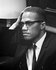
1964 Harlem Civil Rights Rally MALCOLM X 8x10 Photo Glossy Print Minister Poster $6.49
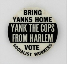
Black Civil Rights 1964 Harlem Race Riot NYC Vietnam War Protest NYPD Abuse P260 $129.00
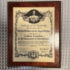
NAACP Harlem Welfare Center, life member plaque 1964 AFRICAN AMERICAN 8.5x10.5 $175.00
|
|
|
Shopping Cart  |

|
Recently Viewed |
|
Latest Items |
|
Facebook |
Secure Websites

|
