

|
Site Categories |
|
Featured Items |

Poodle, Spaghetti Trim, Ucagco


|
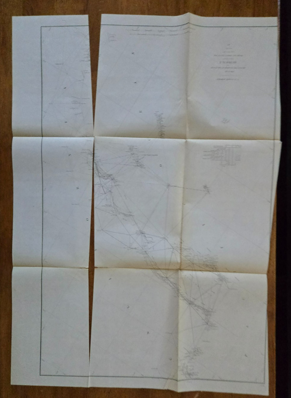
1877 US Coast Survey Progress Sketch Map California San Diego to Point Sal LA For Sale

When you click on links to various merchants on this site and make a purchase, this can result in this site earning a commission. Affiliate programs and affiliations include, but are not limited to, the eBay Partner Network.

1877 US Coast Survey Progress Sketch Map California San Diego to Point Sal LA:
$45.99
1877 US Coast Survey Progress Sketch Map California San Diego to Point Sal LAAn authentic, original 1877 antique coastal triangulation chart covering the crucial maritime paths of Southern and Central California. Formally designated as Section X (Lower Sheet), this survey maps the Pacific coastline from San Diego Bay northward past the Los Angeles Basin, Santa Barbara Channel, and up to Point Sal (just south of San Luis Obispo.the chart reveals the expansive network of primary and secondary geodesic triangulation webs used by 19th-century cartographers. It explicitly details offshore locations like San Clemente Island, Santa Catalina, Santa Cruz, and Santa Rosa Island, as well as early coastal geography.It measures 22\" by 31\".
|
|
Related Items:
Antique 1877 US Coast Survey Map Maryland to Georgia Primary Triangulation Chart $39.99
1877 US Dept Interior Pension Office Letter - Peter Gregg $15.00

1877 Sitting Bull & U.S. Commission, Kars Fortress, Nast — Dec 8 $76.54
|
|
|
Shopping Cart  |

|
Recently Viewed |
|
Latest Items |
|
Facebook |
Secure Websites

|
