When you click on links to various merchants on this site and make a purchase, this can result in this site earning a commission. Affiliate programs and affiliations include, but are not limited to, the eBay Partner Network.
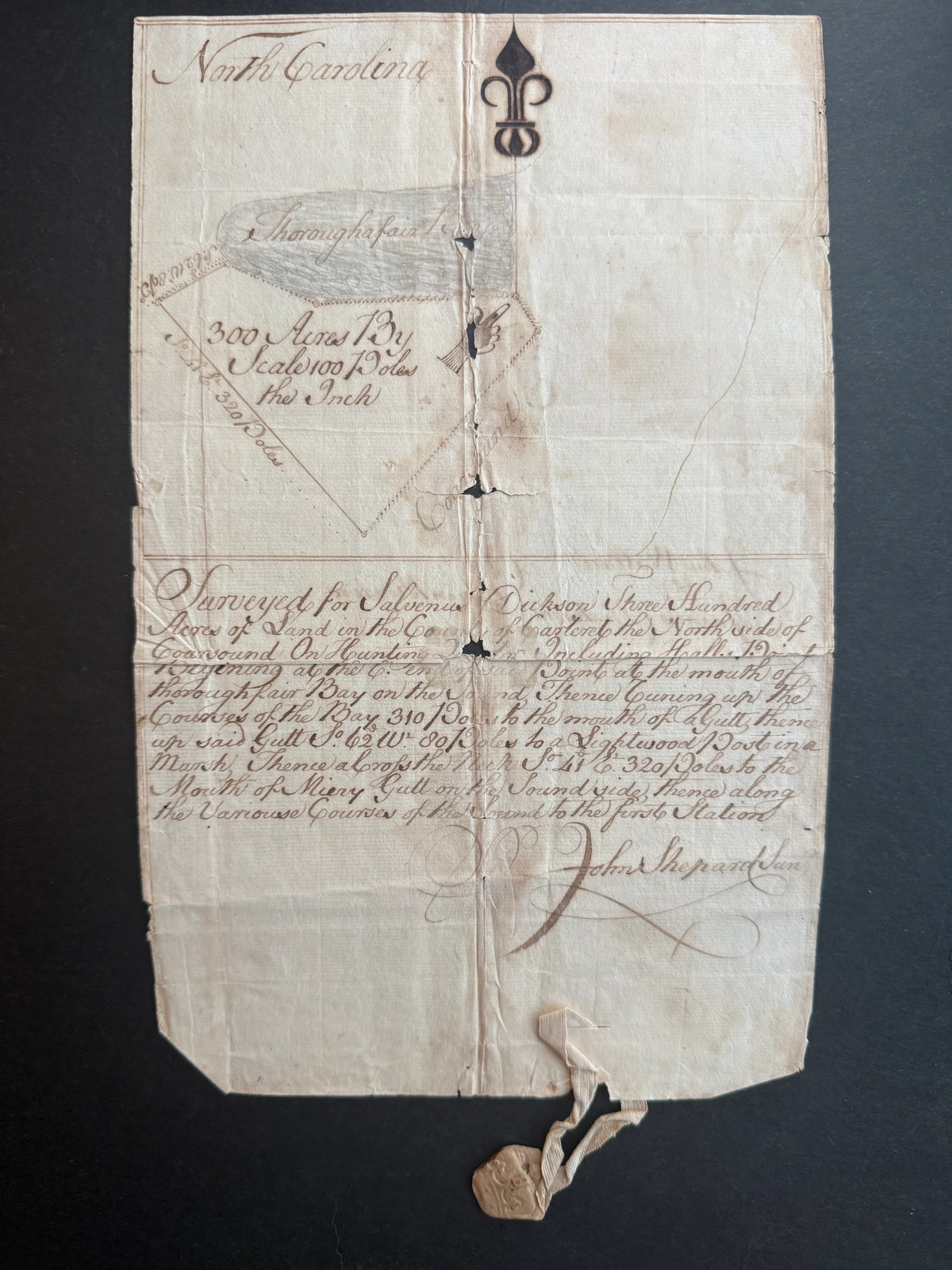
The tract was located on the north side of Core Sound in the area known as the Hunting Quarter and included Hall’s Point. The boundary description begins near the mouth of Thoroughfare Bay and follows the shoreline and surrounding marshes, including a geographical feature identified as Merry Gutt.
The upper portion contains a carefully drawn plat showing the irregular coastal tract, a shaded representation of Thoroughfare Bay and a scale of 100 poles to the inch. A distinctive fleur-de-lis-style device appears near the upper margin.
The survey is fully signed by John Shepard Jr. The reverse identifies John Wallace and James Dickson as chain bearers—the assistants who carried the measuring chain during the original field survey. A faint inscription on the plat appears to date the survey to approximately October 1772.
Most notably, the original ribbon and impressed pendant wax seal remain attached. The survival of both the seal and its textile attachment makes this a particularly appealing example of colonial surveying practice.
The document shows expected age toning, staining, fold wear, small holes and separations at fold intersections, minor edge losses and wear to the wax seal. The manuscript description, plat, geographic names, acreage and signatures remain substantially legible.
A visually impressive colonial coastal survey with strong North Carolina, Carteret County, cartographic and genealogical interest. It relates to another surviving Salvenus Dickson land grant but records a separate 300-acre tract.
North Carolina, apparently circa October 1772. Manuscript on laid paper, signed by John Shepard Jr., with hand-drawn plat and original pendant wax seal.