

|
Site Categories |
|
Featured Items |

Poodle, Spaghetti Trim, Ucagco


|
1950 US AIR FORCE Navigation Chart Map FIJI SAMOA TONGA Gilbert & Ellice Islands For Sale


When you click on links to various merchants on this site and make a purchase, this can result in this site earning a commission. Affiliate programs and affiliations include, but are not limited to, the eBay Partner Network.

1950 US AIR FORCE Navigation Chart Map FIJI SAMOA TONGA Gilbert & Ellice Islands:
$49.99
Large-formatfold-out 1950 U.S. Air Force Long Range Navigation Chart covering partof the South Pacific, on both sides of the International Date Line. - This map measures a verygenerous 102x 131 cm [40" x 51¾"] and is drawn on a scale of1:3,000,000.
- It is identified as the "Fiji" sheet (LR-41), 4thEdition,July 1950.
- The coverage area is bounded by longitude 170° E to 160°Wand latitude 20° S to 0° (the Equator), including numerous islandgroups,atolls, banks, reefs, and bays.
- Among the named places and features are the Gilbert andEllice Islands,Samoa, Aitutaki, the Union or Tokelau Group, Tonga, Bligh Water,Oneanta Passage, Phoenix Islands, Koro Sea, Nonouti Atoll, Disney Reef,Tutuila,Danger Island, Rose Bank, Exploring Isles, Suva, Natewa Bay, and Fiji.
- Condition: This map is in excellentcondition,bright and clean, with no rips,tears, or writing. It folds to 13½" x 8½" and is blank on theback, with no printing on the reverse side. Please see the scans andfeel free to ask any questions.
- Buy with confidence! We are always happy to combineshipping on the purchase of multiple items — just make sure to pay foreverythingat one time, not by SixBit's eCommerce Solution
|
|
Related Items: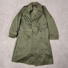
1950 US ARMY OD-7 OVERCOAT W/ BUTTON-IN WOOL LINER 1952 KOREAN WAR SIZE Reg Med $39.94
Vintage 1950 US Dept Of Geological Survey Savahia Peak CA Topographical Map $24.95
1950 AUGUST 10 NEW YORK TIMES - 3 MILE U. S. GAIN MENACES CHINJU - NT 5975 $45.00
|
|
|
Shopping Cart  |

|
Recently Viewed |
|
Latest Items |
|
Facebook |
Secure Websites

|
